Rudbaxton
| Rudbaxton | |
 St Michael's Church |
|
 Rudbaxton |
|
| Population | 768 (2011)[1] |
|---|---|
| OS grid reference | SM92SE20 |
| – Cardiff | 80.6 mi (129.7 km) |
| – London | 208.3 mi (335.2 km) |
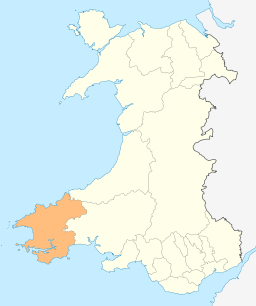
| Principal area | Pembrokeshire |
| Country | Wales |
| Sovereign state | United Kingdom |
| Post town | Hwlffordd |
| Police | Dyfed-Powys |
| Fire | Mid and West Wales |
| Ambulance | Welsh |
| EU Parliament | Wales |
|
|
Coordinates: 51°50′46″N 4°57′40″W / 51.846°N 4.961°W
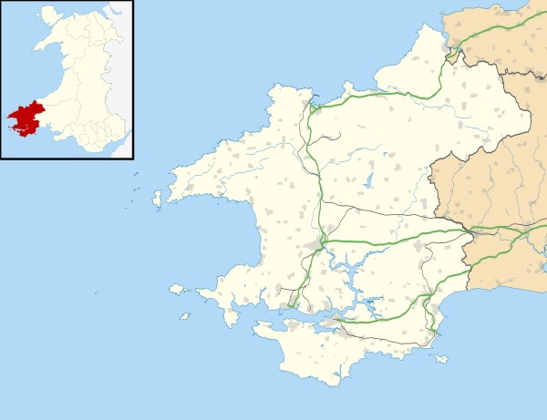
Rudbaxton is a parish and a local government community in the county of Pembrokeshire, Wales, and is 81 miles (130 km) from Cardiff and 208 miles (330 km) from London.[2][3] The community includes the village of Crundale and the hamlets of Poyston Cross and Bethlehem.
Description
The community includes the expanding village of Crundale, which houses the majority of the population, together with the settlements of Poyston Cross, Bethlehem and Rudbaxton Water.[4] In 2011 the population of Rudbaxton was 749 with 18.2% of them able to speak Welsh[5] and in 2015 the population is estimated at 850.[6]
History
Rudbaxton parish was in the hundred of Dungleddy, a corruption of the Welsh for two Cleddau, referring to the Eastern and Western Cleddau rivers, which form part of the parish boundary. The Haverfordwest to Fishguard turnpike (now the A40) ran through the western half of the parish.[7]
By 1708 efforts were being made by a "neighbouring Gentleman" to clothe and educate the poor children of the parish.[8] A school was established by the SPCK and the philanthropist Sir John Philipps.[9] In 1833 the population of the parish was 621, and the school educated 11 pupils, partly funded by the Baptist movement.[10] A National School was established in 1877[11] and the school's minutes and correspondence papers from 1877 to 1966 are held at Pembrokeshire Record Office.[12]
In 1831 about 75% of males over 20 years were occupied in agriculture.[13] The population in 1870 was 586, occupying 130 houses.[14] The population had expanded from 472 in 1801 to 669 in 1851, and then fell to 405 by 1961.[15]
In 1942 a large area of the parish was taken over to build RAF Haverfordwest, later becoming Withybush Airport.
Prehistoric remains

Rudbaxton Rath is a hillfort within the community: a subcircular banked, ditched enclosure measuring around 100m by 95m; inside the western ramparts is a second enclosure of 50m by 32m.[16]
Listed and other buildings
The parish church of St Michael was originally established in the early 13th century and is Grade I listed. It is built of rubble stone with slate roofing, and retains some late-15th or early-16th century features.[17] It was restored "from a state of ruin" by the rector in the 19th century.[7][18]
Grade II listed buildings in the parish include several houses and two bridges.[19]
There are 48 buildings and other structures of interest listed by the Royal Commission on the Ancient and Historical Monuments of Wales within the parish.[20]
Notable people
General Sir Thomas Picton was born in the parish, at Poyston Hall, in 1758. He died at the Battle of Waterloo.[4]
See also
References
- ↑ "Ward/Community population 2011". Retrieved 20 April 2015.
- ↑ Bangor University Placenames Unit (Canolfan Bedwyr); accessed 9 May 2014
- ↑ Google Maps (Map). Google.
- 1 2 "Pembrokeshire County Council: Town and Community Councils: Rudbaxton". Retrieved 5 April 2015.
- ↑ Welsh Government website; 2011 Census Returns and stats; accessed 9 May 2014
- ↑ "Pembrokeshire County Council: Town and Community Councils: Rudbaxton". Retrieved 5 April 2015.
- 1 2 "GENUKI: Rudbaxton". Retrieved 5 April 2015.
- ↑ An Account of Charity-schools Lately Erected in...England and Wales. Joseph Downing. 1708. p. 34. Retrieved 6 April 2015.
- ↑ Jones, M.G. (2013). The Charity School Movement. Cambridge University Press. p. 291. ISBN 9781107685857. Retrieved 5 April 2015.
- ↑ Parliamentary Papers: Abstract returns of education, 1833. HMSO. 1835. p. 1316. Retrieved 6 April 2015.
- ↑ "Dyfed FHS: Schools in Pembrokeshire". Retrieved 5 April 2015.
- ↑ "Pembrokeshire Record Office: School papers". Retrieved 5 April 2015.
- ↑ "A Vision of Britain through time: Rudbaxton CP/AC: Historical statistics". Retrieved 6 April 2015.
- ↑ History of Rudbaxton. GB Historical GIS / University of Portsmouth - A Vision of Britain through Time. Retrieved 6 April 2015.
- ↑ "A Vision of Britain through time". Retrieved 6 April 2015.
- ↑ "The Megalithic Portal: Rudbaxton Rath". Retrieved 6 April 2015.
- ↑ "British listed buildings: Church of St Michael". Retrieved 5 April 2015.
- ↑ "St Michael's Church, Rudbaxton". Retrieved 5 April 2015.
- ↑ "British listed buildings: Rudbaxton". Retrieved 5 April 2015.
- ↑ "Coflein: Rudbaxton". Retrieved 5 April 2015.