Brawdy
| Brawdy | |
 Brawdy Farm |
|
 Brawdy |
|
| Population | 1,012 (2011)[1] |
|---|---|
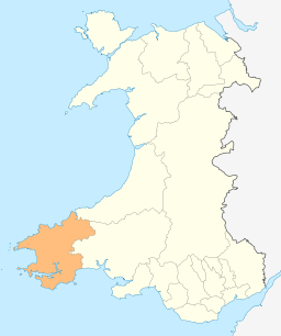
| Principal area | Pembrokeshire |
| Country | Wales |
| Sovereign state | United Kingdom |
| Post town | Haverfordwest |
| Postcode district | SA62 |
| Dialling code | 01437 |
| Police | Dyfed-Powys |
| Fire | Mid and West Wales |
| Ambulance | Welsh |
| EU Parliament | Wales |
| UK Parliament | Preseli Pembrokeshire |
|
|
Coordinates: 51°52′25″N 5°06′47″W / 51.873611°N 5.113056°W
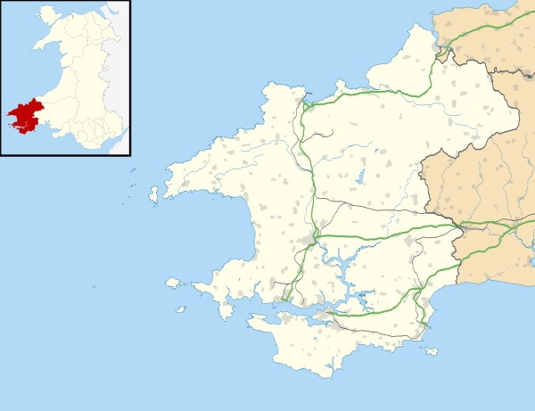
Brawdy (Welsh: Breudeth) is a village and parish and community in Pembrokeshire, Wales.
Etymology
The Welsh language name appears to be an archaic form of "Bridget" and the parish may originally have been Llanfreudeth. The English name is a corruption of the Welsh.[2]
Location
Brawdy is situated at the northeast corner of St Brides Bay. The southern half of the parish is in the Pembrokeshire Coast National Park. The parish has 4 km of coastline accessible throughout by the Pembrokeshire Coast Path.

The parish includes the villages of Penycwm 51°52′3″N 5°7′31″W / 51.86750°N 5.12528°W and Newgale (Welsh: Niwgwl) 51°51′29″N 5°7′35″W / 51.85806°N 5.12639°W, and the hamlets of Eweston (Welsh: Treŵen) 51°52′20″N 5°5′33″W / 51.87222°N 5.09250°W, Tancredston (Welsh: Trebwrnallt) 51°53′38″N 5°4′47″W / 51.89389°N 5.07972°W and Trefgarn Owen 51°53′14″N 5°5′55″W / 51.88722°N 5.09861°W. The parish church of St David is a Grade II* listed building.[3]
Together with the parishes of Llandeloy and Llanreithan, it constitutes the community of Brawdy, which had a census population of 611 in 2001, increasing to 1,012 at the 2011 census. With the community of Solva, it makes up the Pembrokeshire ward of Solva.
The parish had an area of 2240 Hectares. Its census populations were: 572 (1801): 753 (1851): 467 (1901): 425 (1951): 798 (1981, of which around 400 were military). The percentage of Welsh speakers was 88% (1891): 72% (1931): 36% (1971). The Pembrokeshire language frontier, known as the Landsker Line, corresponds roughly with the southern boundary of the parish, and it has historically been more Welsh-speaking (excluding military personnel from the Royal Signals Regiment who are based in the former RN and RAF Station). This is less so today, the 2011 census showed 19.1% of the population could speak Welsh, a fall from 32.2% in 2001.[4]
During the second half of the 20th century, it was home to a large Fleet Air Arm, later RAF Station and Army Barracks.
References
- ↑ "Community population 2011". Retrieved 21 April 2015.
- ↑ Charles, B. G., The Placenames of Pembrokeshire, National Library of Wales, Aberystwyth, 1992, ISBN 0-907158-58-7, p 198
- ↑ "Church of Saint David,, Brawdy". British Listed Buildings. Retrieved 21 December 2013.
- ↑ "2011 Census results by Community". Welsh Language Commissioner. 2015. Retrieved 15 August 2015.
External links
![]() Media related to Brawdy at Wikimedia Commons
Media related to Brawdy at Wikimedia Commons
- Historical information and sources on GENUKI
- Details of the men on the Brawdy War Memorial, inside St David's Church
- Military Burials at St David's Church, Brawdy