Llandissilio
| Llandissilio | |
 St Tysilio parish church |
|
 Llandissilio |
|
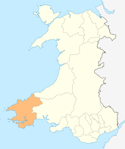
| Principal area | Pembrokeshire |
|---|---|
| Country | Wales |
| Sovereign state | United Kingdom |
| Post town | Clunderwen |
| Dialling code | 01437 |
| Police | Dyfed-Powys |
| Fire | Mid and West Wales |
| Ambulance | Welsh |
| EU Parliament | Wales |
| UK Parliament | Preseli Pembrokeshire |
| Welsh Assembly | Preseli Pembrokeshire |
|
|
Coordinates: 51°51′46″N 4°43′58″W / 51.86282°N 4.732757°W
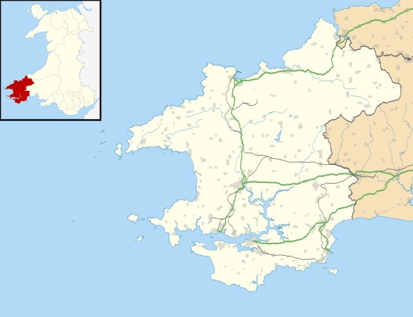
Llandissilio is a village and parish in east Pembrokeshire, Wales on the A478 road between Efailwen to the north and Clunderwen to the south. A largely ribbon development along the main road, the village is surrounded by farmland.
Name
The village takes its name from Tysilio, a 7th-century Welsh saint to whom the parish church is dedicated.[1]
History
Ancient remains indicate that the area that is now the village of Llandissilio has been occupied for many centuries.[2] For part of its history the parish of Llandissilio was in Carmarthenshire.[3]
The parish was originally part of the Hundred of Derllys in Carmarthenshire.[1][4]
A Visitation of the Archdeaconry of Carmarthen in 1710 found that of about 120 families in the parish, 40 attended church at Easter, 20 at Whitsuntide and 20 at Christmas and noted "the Minister suffers in his reputation for being addicted to drinking and swearing" and "the roof of the north side of the Chancell lies open to the wind & weather."[5]
The population of the parish of Llandissilio West in 1801 was 281. By 1981 the population had grown to 458. In 1891, 97% were Welsh-speaking, and 75% spoke only Welsh; 10 years later those speaking only Welsh had fallen to 29%. By 1981, 70% still spoke Welsh, but only 1% were not English-speaking.[6]

In 1831 nearly half of men over 20 years were agricultural labourers, and nearly a quarter were farmers employing them. The rest of the male population was engaged in retail or handicrafts.[7]
Slate quarrying and corn milling were carried out in the 19th century.[1]
Boys from Creek Road LCC School, Greenwich, London, were evacuated to Llandissilio during World War 2 (pictured). The War Memorial records the names of ten men of the parish who were killed in World War 1 and World War 2, and the memorial was Grade II listed in 2004.[8]
Environment
Llandissilio is situated on the Landsker Borderlands Trail, a circular waymarked long distance footpath running through Pembrokeshire and Carmarthenshire. The village is surrounded by farmland with deciduous trees.[1] Near the south of the village is the source of the River Conyn which then flows south-west to meet the Eastern Cleddau.
Worship
_NLW3361895.jpg)
St Tysilio Parish Church is in the Diocese of St David's. The church was Grade II listed in 1971 under the auspices of Cadw.[9]
Blaenconin Baptist Chapel is on the outskirts of the village.[10] Waldo Williams is buried there.
Education
Brynconin Community School (Welsh: Ysgol Brynconin) educates children from 3 to 11 years.[11] Teaching is in English and Welsh languages, and (in 2011) 40% of pupils spoke Welsh at home.[12]
Amenities
The village has a post office, two pubs (The Angel and The Bush), hotel, holiday park and retail premises.
Governance
The community of Llandissilio West, in which the village lies, is part of Maenclochog electoral division of Pembrokeshire County Council. The community of Llandissilio East is in Carmarthenshire.
References
- 1 2 3 4 "GENUKI - Llandissilio". Retrieved 30 May 2014.
- ↑ "Llandissilio (Lewis, 1833)". Retrieved 30 May 2014.
- ↑ "Vision of Britain - Llandissilio". Retrieved 30 May 2014.
- ↑ "History of Derllys". Retrieved 30 May 2014.
- ↑ Griffiths, G. Milwyn (1974). National Library of Wales Journal Vol XVIII/3 and XIX/3. Retrieved 31 May 2014.
- ↑ "Pembrokeshire History - Llandissilio West".
- ↑ "Llandissilio through time - Industry statistics". Retrieved 30 May 2014.
- ↑ "British Listed Buildings - Llandissilio War Memorial". Retrieved 30 May 2014.
- ↑ "British Listed Buildings - Saint Tysilio, Llandissilio". Retrieved 30 May 2014.
- ↑ "Peoples Collection Wales - Blaenconin Baptist Chapel". Retrieved 30 May 2014.
- ↑ "Pembrokeshire County Council - Brynconin Community School". Retrieved 30 May 2014.
- ↑ "Brynconin C.P. School - Estyn". Retrieved 30 May 2014.