Na-hpan
This article is about the village. For the capital, see Namphan.
| Na-hpan | |
|---|---|
| Village | |
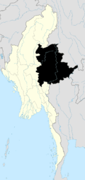
 Na-hpan Location in Burma | |
| Coordinates: 22°39′6″N 97°52′30″E / 22.65167°N 97.87500°E | |
| Country |
|
| Division | Shan State |
| District | Lashio District |
| Township | Mongyai Township |
| Elevation | 1,991 ft (607 m) |
| Population | |
| • Ethnicities | Shan |
| Time zone | MST (UTC+6.30) |
Na-hpan[1] is a village in Mongyai Township, Shan State.[2]
Geography
Na-hpan is located west of the Salween, 20 km to the west of Loi Leng mountain.[3]
References
- ↑ "Na-hpan". Mapcarta. Retrieved 20 May 2016.
- ↑ Shan State
- ↑ GoogleEarth
Capital: | |
|

This article is issued from Wikipedia - version of the 5/20/2016. The text is available under the Creative Commons Attribution/Share Alike but additional terms may apply for the media files.