Mawkmai Township
This article is about the present-day administrative division. For the former state of the Shan States, see Mawkmai State. For the town, see Mawkmai.
| Mawkmai Township | |
|---|---|
| Township | |
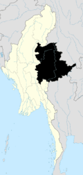
 Mawkmai Township Location in Burma | |
| Coordinates: 20°14′N 97°44′E / 20.233°N 97.733°ECoordinates: 20°14′N 97°44′E / 20.233°N 97.733°E | |
| Country |
|
| State | Shan State |
| District | Loilen District |
| Time zone | MST (UTC+6.30) |
Mawkmai Township is a township of Loilen District in the Shan State of Burma. The principal town is Mawkmai.[1][2]
The central portion of the township consists of a wide, well-watered plain on which rice is grown. The rest is chiefly mountainous with ranges running north and south. Rice is the chief crop, but much tobacco of good quality is grown in the Langko district on the Tang River. There is also a great deal of cattle-breeding.[3]
History
Mawkmai State was one of the former large states in the eastern division of the southern Shan States of Burma with an area of 7,215 km².
References
- ↑ Maps (Map). Google Maps.
- ↑ Bing Maps (Map). Microsoft and Harris Corporation Earthstar Geographics LLC.
- ↑
 This article incorporates text from a publication now in the public domain: Chisholm, Hugh, ed. (1911). "article name needed". Encyclopædia Britannica (11th ed.). Cambridge University Press.
Capital: Mawkmai | |
|

This article is issued from Wikipedia - version of the 5/23/2016. The text is available under the Creative Commons Attribution/Share Alike but additional terms may apply for the media files.