Namhkam (Shan State)
| Nampaka Mine Myint Aung | |
|---|---|
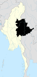
 Nampaka Location in Burma | |
| Coordinates: 23°50′00″N 97°41′00″E / 23.83333°N 97.68333°E | |
| Country | Burma |
| Division | Shan State |
| District | Mu Se District |
| TownshipKutkai | KutkaiTownship |
| Population (2005) | |
| • Ethnicities | , Palaung |
| • Religions | Buddhism |
| Time zone | MST (UTC+6.30) |
_(14761064231).jpg)
Namhkam (Shan: ၼမ်ႉၶမ်း), also spelt is the principal town of Namhkam Township in northern Shan State, Burma, situated on the southern bank of Shweli River near the border with Yunnan Province, China.
History
The region belonged to China but the British colonial administration built a road in 1894-1897 between this frontier town and Bhamo by the Ayeyarwady River in Kachin State, a distance of 56 miles, for Chinese muleteers in order to benefit from the border trade.[1] The town was rented to the British in 1897 by Qing Dynasty(similar to the New Territories of Hong Kong). The area became formally part of Burma in 1960 when China and Burma signed a border treaty, swapping some border land.
During the Second World War the Allies built the Ledo Road from Ledo in Assam, India to Kunming, China across northern Burma, and by the end of 1944, completed 439 miles to Namhkam, linking up with the old Burma Road at Bhamo.[2][3] Dr Gordon Seagrave of the Burma Surgeon fame ran the US missionary hospital overlooking Namhkam.[3][4] He was believed to have had intelligence duties as well as medical.[4] He wrote some articles on his experience in NamHkam.[5]
Since 2014 the governments of Myanmar and China are seeking to resolve a border dispute in the area of Namhkam and Muse.[6]
Education
There are 2 high school, 2 middle schools and 5 primary schools in 2005.[7]
Agriculture
Cultivation of the opium poppy in the area in British times had caused considerable deforestation noted in 1920 east of a line from Lashio to Namhkam.[8] A 2005 survey carried out by the Shan State Peace Council recorded 1,800 drug addicts in Namhkam alone, and community-run rehabilitation centers were set up to tackle the rising problem of addiction. The first of these started in 1998 were declared illegal and forced to close in 2000 by the authorities.[9]Buddhist monks and teachers are also involved in the amelioration of the HIV/AIDS problem among drug users.[10]
Hsinshweli high yield hybrid rice cultivation has been promoted in recent years by the authorities in the region.[11]
Development
Burma and China signed a contract in August 2003 for a hydroelectric project. The Shweli I Dam was constructed on the Shweli River near Namhkam aiming to supply electricity to Kyaukme, Hsipaw, Lashio and Namtu.[12] It was completed in 2009 and has a 600 MW installed capacity.[13]
Politics
In 2005, an attempt by the Shan State Army-South based near the Thai border to fill the vacuum left by the 1989 cease-fire agreement between their counterparts in the north and the Burmese military was thwarted.[14][15]
References
- ↑ Nisbet, John (1901). Burma Under British Rule and Before. Adamant Media Corporation, 2005. pp. 36–40. ISBN 978-1-4021-5293-1. Retrieved 2009-03-03.
- ↑ Carl Warren Weidenburner. "The Ledo Road- MILEPOSTS". University of Oklahoma Press. Retrieved 2009-03-02.
- 1 2 Win Nyunt Lwin. "Historic road links wilderness and culture". Myanmar Times October 4–10, 2004. Retrieved 2009-03-04.
- 1 2 "World War II Timeline:Chinese struggles to provide medical care". HowStuffWorks. Retrieved 2009-03-02.
- ↑ "SEAGRAVE GS". Ncbi.nlm.nih.gov. Retrieved 17 November 2014.
- ↑ Nyein Nyein Govt Working With China on Border Dispute in Shan State
- ↑ "Shan Herald Agency for News (S.H.A.N.)". Shanland.org. Retrieved 17 November 2014.
- ↑ "Replacing Opium in Kokang and Wa Special Regions, Shan State, Myanmar" (PDF). UNODC. 2003. p. 6. Retrieved 2009-03-02.
- ↑ "Community-run rehab centers in the north". Shan Herald Agency for News (S.H.A.N.). Retrieved 2009-03-04.
- ↑ The Sangha Metta Project (November 2000). "HIV/AIDS education and training in Yunnan, China and the Shan State, Burma". buddhanet.net. Retrieved 2009-03-04.
- ↑ "Lt-Gen Aung Htwe inspects harvesting, cultivation tasks in Namhkham". New Light of Myanmar. June 12, 2004. Retrieved 2009-03-02.
- ↑ "Shweli Hydel Power Project". Ministry of Foreign Affairs. September 1, 2003. Archived from the original on January 15, 2006. Retrieved 2009-03-03.
- ↑ "Myanmar to implement some six hydropower projects". People's Daily online, April 21, 2007. Retrieved 2009-03-03.
- ↑ "Curfew for northern township follows rout". S.H.A.N. 2005-12-29. Retrieved 2009-03-04.
- ↑ "The big chase". S.H.A.N. 2006-01-03. Retrieved 2009-03-04.
External links
- Satellite map GeoNames
- Taipei American Chamber of Commerce; Topics Magazine, Analysis, November 2012. Myanmar: Southeast Asia's Last Frontier for Investment, BY DAVID DUBYNE
- Oilseedcrops.org; Editor Article, Transit routes from western China through Myanmar. Myanmar: the Missing Link from Western China to India’s N.E. States
Coordinates: 23°50′00″N 97°41′00″E / 23.83333°N 97.68333°E
Capital: Kunhing | |
|