Keng Hkam
This article is about the town. For the former state, see Kenghkam.
| Keng Hkam | |
|---|---|
| Town | |
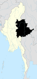
 Keng Hkam Location in Burma | |
| Coordinates: 21°52′N 97°22′E / 21.867°N 97.367°ECoordinates: 21°52′N 97°22′E / 21.867°N 97.367°E | |
| Country |
|
| State | Shan State |
| District | Loilem District |
| Township | Mong Kung Township |
| Time zone | MST (UTC+6.30) |
Keng Hkam is a town in Mong Kung Township in the Shan State of Burma. It is located by the Nam Pang River.
Keng Hkam will be one of the communities impacted by the Tasang Dam project. [1]
History
Main article: Kenghkam
Prior to the end of World War II, the town of Keng Hkam was the capital of Kenghkam State.[2]
References
Capital: Mong Kung | |
|

This article is issued from Wikipedia - version of the 5/25/2016. The text is available under the Creative Commons Attribution/Share Alike but additional terms may apply for the media files.