Haddiscoe
| Haddiscoe | |
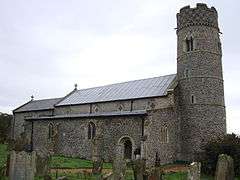 Parish Church of St Mary, Haddiscoe |
|
 Haddiscoe |
|
| Area | 19.88 km2 (7.68 sq mi) |
|---|---|
| Population | 487 |
| – density | 24/km2 (62/sq mi) |
| OS grid reference | TM444969 |
| Civil parish | Haddiscoe |
| District | South Norfolk |
| Shire county | Norfolk |
| Region | East |
| Country | England |
| Sovereign state | United Kingdom |
| Post town | NORWICH |
| Postcode district | NR14 |
| Dialling code | 01502 |
| Police | Norfolk |
| Fire | Norfolk |
| Ambulance | East of England |
| EU Parliament | East of England |
Coordinates: 52°30′55″N 1°36′02″E / 52.51514°N 1.60062°E
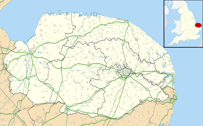
Haddiscoe is a village and civil parish in the English county of Norfolk. It is situated some 30 km south-east of the city of Norwich, but only 10 km west of the Suffolk town of Lowestoft.[1]
The civil parish has an area of 19.88 km2 (7.68 sq mi) and in the 2001 census had a population of 481 in 194 households,[2] increasing to 487 at the 2011 Census.[3] For the purposes of local government, the parish falls within the district of South Norfolk.[4]
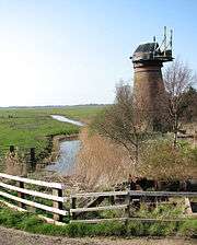
Haddiscoe railway station, on the Wherry Lines service between Norwich and Lowestoft, is within the parish although approximately 2.5 km from the centre of the village. The Haddiscoe Cut (New Cut), a canal which joins the River Waveney and the River Yare, joins the River Waveney within the parish and close to the railway station. Toft Monks mill is a disused drainage windpump which once drained the marshes into the River Waverney.[5]
Haddiscoe was the site of Norfolk's only Knights Templar Preceptory, dissolved in the 14th Century.
A stray V-1 rocket landed in Haddiscoe during the Second World War.
It was the home of the landscape painter Sir John Arnesby Brown, who is buried in the Church cemetery.
The 'Haddiscoe Hoard', the largest hoard of civil war coins found in Norfolk to date, was discovered on 17 July 2003 by a workman on a flood defence scheme. St Mary's Church at Haddiscoe is one of the 124 round-tower churches of Norfolk, believed - despite its round tower - to be of early Norman origin. Jan Pier Pier, a 16th-century Dutch immigrant and creator of some of the dykes surrounding the village, is buried in the Church nave. The Church also contains frescoes from the 14th century representing the Black Death of 1349.
See also
Notes
- ↑ Ordnance Survey (2005). OS Explorer Map OL40 - The Broads. ISBN 0-319-23769-9.
- ↑ "Haddiscoe parish information". South Norfolk Council. 4 January 2006. Retrieved 20 June 2009.
- ↑ "Civil Parish population 2011". Retrieved 10 September 2015.
- ↑ Office for National Statistics & Norfolk County Council (2001). Census population and household counts for unparished urban areas and all parishes. Retrieved December 2, 2005.
- ↑ "Name: TOFT MONKS (DETACHED) WINDPUMP List entry Number: 1050525". English Heritage. Retrieved 16 March 2014.
External links
| Wikimedia Commons has media related to Haddiscoe. |
- Map sources for Haddiscoe.
- Coin Hoard Article
- Information from Genuki Norfolk on Haddiscoe.
- Haddiscoe Village web site - The web site owned and run by the Haddiscoe Villagers.
| Boroughs or districts | |
|---|---|
| Major settlements |
|
| Topics | |
