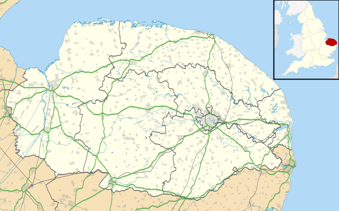
Great Moulton
| Great Moulton | |
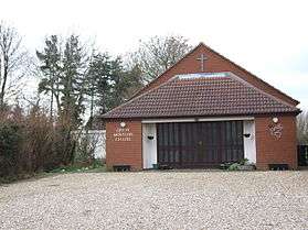 Great Moulton Chapel |
|
 Great Moulton |
|
| Area | 5.66 km2 (2.19 sq mi) |
|---|---|
| Population | 751 (2011) |
| – density | 133/km2 (340/sq mi) |
| OS grid reference | TM166901 |
| Civil parish | Great Moulton |
| District | South Norfolk |
| Shire county | Norfolk |
| Region | East |
| Country | England |
| Sovereign state | United Kingdom |
| Post town | NORWICH |
| Postcode district | NR15 |
| Police | Norfolk |
| Fire | Norfolk |
| Ambulance | East of England |
| EU Parliament | East of England |
Coordinates: 52°27′59″N 1°11′19″E / 52.46645°N 1.18862°E

Great Moulton (also known as Moulton St Michael)[1] is a civil parish in the English county of Norfolk. Until the 16th Century it also included the Little Moulton parish.[2]
It covers an area of 5.66 km2 (2.19 sq mi) and had a population of 699 in 289 households at the 2001 census,[3] increasing to 751 at the 2011 census.[4] For the purposes of local government, it falls within the district of South Norfolk. The parish is close to the nearby village of Aslacton.
History
In the 1870s, Great Moulton was described as:
... Adjacent to the Great Eastern railway, midway between Tivetshall and Forncett r. stations, and seven miles NW of Harleston; and has a post office, of the name of Moulton, under Long Stratton. The parish contains also the hamlet of Little Moulton, and comprises 1,347 acres. The church has a round tower, surmounted by an octagonal lantern[5]
Great Moulton was mentioned in the doomsday book five times, and was considered to have a very large population consisting of more than 70 households (in 2011 there were over 300)[6] as well as a church. The lord in 1086 was Count Alan of Brittany.[7]
Chapel
A chapel originally found in Great Moulton was donated to the Museum of East Anglican Life and is a 'tin tabernacle' which is common in the area.[8] It was built in the 1890s and cost the equivalent of £20,000 in today's money. The community built a new chapel in 1990s which is why the previous was donated.[9]
Local businesses
- Double Glazing Norfolk is a company that supplies and installs windows, doors and conservatories across Norfolk and Suffolk.[10]
- Designtec Ltd is a web design company that was established over 10 years ago to create user-friendly websites for businesses, as well as creating logos and online banners.[11]
- Serenity touch provides holistic treatment throughout the Norfolk area, providing massage and spa therapies as well as Reiki sessions and allergy testing.[12]
Transport
The village is served by the 1 bus route between Diss and Norwich, which has four stops within the parish.[13] The nearest train station is Spooner Row which is 7.42 miles away, and also has Norwich and Brundall train stations within 20 miles of the chapel.[14]
Car ownership is relatively high, as only 19 households in 2011 did not own 1 or more car or van, and there are 585 cars or vans in the area.[15]
Statistics
Occupations

In 1881 just over 60 men were involved with agriculture, which was the largest occupation at the time. Many of the workers were employed as an agricultural labourer, farm servant or cottager. The next most popular job for men was work in houses, furniture or decorations, with 8 male workers employed in this profession. Most of the women during 1881 were not in specific occupations, although 12 women were employed in domestic offices or services, with the next most popular job for females being work in professional occupations and their direct subordinates, with 3 women and one male employed.[16]
Comparatively in 2011 of the 402 residents employed in Great Moulton only 10 males were working in the agricultural sector, and 48 men were employed in construction, which had the highest number of male employees.[17] Over 50 women were employed in administrative and secretarial occupations, and 16 women were employed as managers, directors and senior officials.[18] Overall the most common job is work in wholesale and retail trade; repair of motor vehicles and motor cycles which had 65 employees.[19]

Population
The total population of Great Moulton was at its lowest in 1961 with a total of 247,[20] where there was then it showed an increase of 500 people in 50 years, leading to 751 people living in Great Moulton to date.[21] When the census began in 1801, the population was at 354 residents, where it gently increased to the highest population prior to 2001, which was 1851 with a total population of over 450 people.[22]
Age
208 residents are aged 45–59, making this the largest age range. 47 people are under the age of 10, with a further 55 under the age of 16, and the most common age range for children is 10-14. 163 residents of Great Moulton are over 65, 113 of which are under 75.[23]
Ethnicity
Of the 751 residents of Great Moulton, 730 are white British, 4 people are from multiplpe ethnic backgrounds, 1 person is Irish and a further 14 have an other white background,[24] which is relatively diverse for a civil parish.
External links
- Moulton St Micheal in the Doomsday book
Notes
- ↑ "The meaning of Moulton St Micheal". Key to English Place-Names. University of Nottingham. Retrieved 2016-03-07.
- ↑ "GENUKI Moulton St Micheal". GENUKI UK and Ireland Genealogy. GENUKI. Retrieved 2016-03-07.
- ↑ "Great Moulton parish information". South Norfolk Council. 7 October 2008. Retrieved 20 June 2009.
- ↑ "Civil Parish population 2011". Retrieved 6 September 2015.
- ↑ Wilson, John Marius (1870–72). Imperial Gazetteer of England and Wales. Edinburgh.
- ↑ "Great Moulton Parish Key figures for 2011 census". Neighbourhood Statistics. Office for National Statistics. Retrieved 2016-04-23.
- ↑ "Moulton (st Michael) Open Domesday". Open Domesday. University of Hull. Retrieved 2016-04-23.
- ↑ "Museum of East Anglian Life - Our buildings". eastanglianlife.org.uk. Retrieved 2016-03-19.
- ↑ "Great Moulton tin church, Stowmarket". www.suffolkchurches.co.uk. Retrieved 2016-03-19.
- ↑ Windows, Moulton. "Double Glazing Norfolk | Windows, Doors and Conservatories | Moulton Windows". www.moultonwindows.co.uk. Retrieved 2016-03-20.
- ↑ "Designtec Web Design". Designtec Ltd - Web Design Norwich. Retrieved 2016-03-20.
- ↑ "Serenity Touch - Massage Therapies, Reiki & Reiki Courses in Norfolk". www.serenitytouch.co.uk. Retrieved 2016-03-20.
- ↑ "List of Available Bus Services". www.carlberry.co.uk. Retrieved 2016-03-20.
- ↑ "Journey Planner - Trains Times and Fares - National Rail Enquiries". ojp.nationalrail.co.uk. Retrieved 2016-03-20.
- ↑ "Great Moulton (Parish) Car or Van Availability, 2011". Neighbourhood Statistics. Office for National Statistics. Retrieved 2016-04-24.
- ↑ "Occupations of Males and Females in the Division and its Registration Counties, Great Moulton". Vision of Britain. University of Britain. Retrieved 23 April 2016.
- ↑ "Great Moulton (Parish) Industry-Males, 2011". Neighbourhood Statistics. Office for National Statistics. Retrieved 2016-04-23.
- ↑ "Area: Great Moulton (Parish) Occupation - Females, 2011". Neighbourhood Statistics. Office for National Statistics. Retrieved 2016-04-24.
- ↑ "Great Moulton (Parish) Industry, 2011". Neighbourhood Statistics. Office for National Statistics. Retrieved 2016-04-24.
- ↑ "Moulton St Michael CP/AP Total Population". Vision of Britain. University of Portsmouth. Retrieved 2016-04-24.
- ↑ "Great Moulton (Parish) Key Figures for 2011 Census: Key Statistics". Neighbourhood Statistics. Office for National Statistics. Retrieved 2016-04-24.
- ↑ "Moulton St Michael Total Population through time". Vision of Britain. University of Portsmouth. Retrieved 2016-04-24.
- ↑ "Great Moulton (Parish) Age Structure, 2011". Neighbourhood Statistics. Office for National Statistics. Retrieved 2016-04-24.
- ↑ "Great Moulton (Parish) Ethnic Group, 2011". Neighbourhood Statistics. Office for National Statistics. Retrieved 2016-04-25.