Chamoli Gopeshwar
| Chamoli Gopeshwar Gopeshwar | |
|---|---|
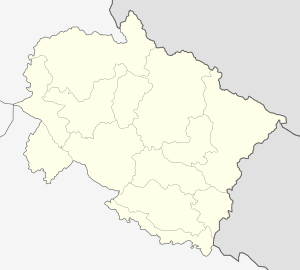 Location in Uttarakhand, India | |
| Coordinates: 30°25′N 79°20′E / 30.42°N 79.33°ECoordinates: 30°25′N 79°20′E / 30.42°N 79.33°E | |
| Country |
|
| State | Uttarakhand |
| District | Chamoli |
| Elevation | 1,550 m (5,090 ft) |
| Population | |
| • Total | 100,600population_as_of = 2,011 |
| Languages | |
| • Official | Hindi, English |
| Time zone | IST (UTC+5:30) |
| Vehicle registration | uk11 |
| Website |
uk |
Chamoli Gopeshwar is a township in garhwal hills and a municipal board in Chamoli district. It is the administrative headquarters of the Chamoli District of Uttarakhand in India. Located 1400 meters above sea level, it is famous for its weather (pleasant most of the year, but very cold in December and January) and its temples.It is largest town in chamoli district. Famous places at Gopeshwar are Pt. dindayal park, Kunds, Gopinath temple,telephone tower house. The only T.B. Hospital in chamoli district is situated here. A sports stadium in the form of the land forming part of police ground is also situated here. Major colonies are Pwd colony,Jal Nigam,Wireless colony,police colony,kund colony,post office,basant bihar,saraswati bihar,subhash nagar,haldapani,negwar,Mandir colony,teacher colony,hospital colony,polytechnic colony.
Educational Colleges are Govt. Institute of Engineering Gopeshwar for b.tech, Govt. P.G. college, Govt. Law college, Govt. Girls Polytechnic, Govt. Inter College, Govt. Girls inter college, Convent School, SGRR Public school, Saraswati Vidhya Mandir Inter College, Sharada Suman children Academy, Aadarsh vidhya Mandir Inter college, National Public School, Peace Public school, himalayan public school, Subodh Prem Vidhya Mandir, Gopinath children academy,Uttarakhand Public school,Nalanda Public School, Christ Academy.
Geography
Gopeshwar is located at 30°25′N 79°20′E / 30.42°N 79.33°E.[1] It has an average elevation of 1,550 m (5,090 ft). Gopeshwar is said to be able to captivate any visitor with its mystic charm and pristine beauty. There are many snow-capped hills and peaks that can be witnessed from Gopeshwar.
Climate
Classified by Köppen-Geiger system as humid subtropical climate (Cwa).
| Climate data for Chamoli Gopeshwar | |||||||||||||
|---|---|---|---|---|---|---|---|---|---|---|---|---|---|
| Month | Jan | Feb | Mar | Apr | May | Jun | Jul | Aug | Sep | Oct | Nov | Dec | Year |
| Average high °C (°F) | 13.4 (56.1) |
15.9 (60.6) |
20.5 (68.9) |
26 (79) |
29.3 (84.7) |
28.3 (82.9) |
25 (77) |
24.4 (75.9) |
24.2 (75.6) |
22.4 (72.3) |
18.3 (64.9) |
14.8 (58.6) |
21.88 (71.38) |
| Daily mean °C (°F) | 8.6 (47.5) |
10.4 (50.7) |
14.7 (58.5) |
19.1 (66.4) |
22.5 (72.5) |
22.8 (73) |
21.3 (70.3) |
20.9 (69.6) |
20.1 (68.2) |
17.1 (62.8) |
13 (55) |
9.8 (49.6) |
16.69 (62.01) |
| Average low °C (°F) | 3.8 (38.8) |
4.9 (40.8) |
9 (48) |
12.3 (54.1) |
15.7 (60.3) |
17.4 (63.3) |
17.6 (63.7) |
17.4 (63.3) |
16 (61) |
11.8 (53.2) |
7.8 (46) |
4.9 (40.8) |
11.55 (52.78) |
| Average precipitation mm (inches) | 74 (2.91) |
76 (2.99) |
77 (3.03) |
36 (1.42) |
48 (1.89) |
140 (5.51) |
322 (12.68) |
271 (10.67) |
150 (5.91) |
66 (2.6) |
12 (0.47) |
33 (1.3) |
1,305 (51.38) |
| Source: Climate-Data.org[2] | |||||||||||||
Demographics
As of 2011 India census,[3] Chamoli Gopeshwar had a population of 21,447. The total number of households are 5513.[4] Males constitute 56% of the population and females 44%. Chamoli Gopeshwar has an average literacy rate of 81%, higher than the national average of 59.5%; with male literacy of 85% and female literacy of 75%. 10% of the population is under 6 years of age.
Places of interest
Gopeshwar is surrounded by four famous temples: Tungnath, Anasuya Devi, Rudranath, and Badrinath. The holy town of Kedarnath is also nearby.
A famous temple of Lord Shiva, now known as Gopinath Mandir, is situated here. A story tells of a king named Sagar (for whom a nearby village is named) who was there in ancient times. His cow always came to this place and gave his milk to a Shivling; one day Sagar saw it and he constructed a temple there.
http://www.facebook.com/mygopeshwar
Media and communications
All India Radio has a local station in Gopeshwar which transmits various programs of mass interest.
References
- ↑ Falling Rain Genomics, Inc - Gopeshwar
- ↑ "Climate: Chamoli Gopeshwar - Climate graph, Temperature graph, Climate table". Climate-Data.org. Retrieved 27 August 2013.
- ↑ "Census of India 2001: Data from the 2001 Census, including cities, villages and towns (Provisional)". Census Commission of India. Archived from the original on 2004-06-16. Retrieved 2008-11-01.
- ↑ http://www.censusindia.gov.in/pca/SearchDetails.aspx?Id=46669