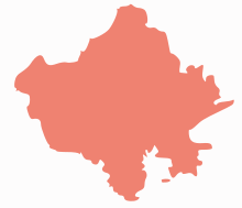
Jalore
| Jalore Jalor | |
|---|---|
| city | |
 Jalore  Jalore Location in Rajasthan, India | |
| Coordinates: 25°21′N 72°37′E / 25.35°N 72.62°ECoordinates: 25°21′N 72°37′E / 25.35°N 72.62°E | |
| Country |
|
| State | Rajasthan |
| District | Jalor |
| Elevation | 178 m (584 ft) |
| Population (2001) | |
| • Total | 44,828 |
| Languages | |
| • Official | Hindi |
| Time zone | IST (UTC+5:30) |
| PIN | 343001 |
| Telephone code | 912973 |
| Vehicle registration | RJ-16 ,RJ -46 |
| Website |
www |
Jalor, also known as Jalore (in Hindi जालोर), is a city in Rajasthan state of western India. It is the administrative headquarters of Jalor District.
Geography
Jalore is known as granite city.Jalore lies to south of Sukri river, a tributary of Luni river and is about 140 km south of Jodhpur. Jalore hasn't grown that much in terms of infrastructure.But City Center Shopping Mall is the example that it is growing. City center has many corporate offices like Axis Bank, Punjab National bank,Uco bank,Birla Sun Life Insurance Ltd, Shreeram Transport Finance co etc.
The major towns, villages and cities of the Jalor district are Bhadrajun, Sayla, Megalva, Siana, Ahore, Sanchore, Bishangarh, Hadecha, Ramsin, Daspan, Jaswantpura, Ummedabad, Raniwara, Bagra, Bhinmal, Jalor and Bagoda.
History
In ancient times Jalore was known as Jabalipura - named after a saint. The town was also known as Suvarngiri or Songir, the Golden Mount, on which the fort stands.
According to some historical sources, in 8th-9th centuries, one branch of the Gurjara Pratiharas was ruling at Jablipur (Jalore).[1]
It was a flourishing town in the 8th century. Jalore was ruled by the Paramaras in the 10th century. Kirtipala, the youngest son of Alhana, the Chahamana ruler of Nadol, was the founder of the Jalore line of Chauhans. He captured it from the Parmars in 1181 and took the clan name Songara, after the place. His son Samarasimha succeeded him in 1182. Udayasimha was the next ruler under whom Jalore had a golden period. He was a powerful and able ruler ruling over a large area. He recaptured Nadol and Mandor from the Muslims. In 1228, Iltutmish circled Jalore but Udayasimha offered stiff resistance. He was succeeded by Chachigadeva and Samantasimha. Samantasimha was succeeded by his son Kanhadadeva.
During the reign of Kanhadadeva, Jalor was attacked and destroyed in 1311 by Ala ud din Khilji, Sultan of Delhi. Kanhadadeva and his son Viramadeva died defending Jalore. The Muslim rulers of Palanpur State of Gujarat briefly ruled Jalor in the 16th century and it became part of the Mughal Empire. It was restored to Marwar in 1704, and remained part of the kingdom until shortly after Indian Independence in 1947.
Visitor attractions of Jalore
- Jalore Fort
- Topekhana
One of the most important structures within the town is the Topekhana or "the cannon foundry". The building is not in the best of conditions now, but its architecture indicates that this structure must have been awesome in the old days. It was built by "Ujjain King" Vkramditya as a "sansrut Pathshala" for education for his public.But at the time of Muslim Emperor Ala ud din Khilji converted into a Muslim monument. The structure is imposing, with a spacious forecourt and an intricate facade. The colonnade and the ceiling are tastefully carved.
- Mosque
- Malik Shah's mosque
- Hindu Temple
- Sire Mandir at Jalore
- Sundha Mata
- Kailashdham at Bishangarh with huge statue of lord Shiva.
- Dhabbawali Mata Temple at Khasravi
- Jain Temples
- Jain temples built in the 8th century, dedicated to the first Tirthankara of Jainism, Rishabha, the 16th Tirthankara, Shantinath, the 23rd Tirthankara, Parsva and the 24th Tirthankara, Mahavira,
- Derasars of Rishabha, Munisuvrata, Acharya Rajendrasuri and Neminath
Demographics
As of 2001 India census,[2] Jalor had a population of 44828. Males constitute 53% of the population and females 47%. Jalor has an average literacy rate of 60%, higher than the national average of 59.5%: male literacy is 72%, and female literacy is 46%. In Jalor, 16% of the population is under 6 years of age.
Special
Jalore was the hometown of Jeevant Kunwar, mother of Maharana Pratap (1572–1597). She was the daughter of Akhey Raj Songara. Rathore rulers of Jodhpur used the Jalore fort to safe-keep their treasure.
References
- ↑ Neelima Vashishtha (1989). Sculptural traditions of Rajasthan: ca. 800-1000 A.D. Publication Scheme. p. 6.
- ↑ "Census of India 2001: Data from the 2001 Census, including cities, villages and towns (Provisional)". Census Commission of India. Archived from the original on 2004-06-16. Retrieved 2008-11-01.
