Munger
| Munger मुंगेर | |
|---|---|
| Metropolitan City | |
| Nickname(s): Twin City,City of Yoga | |
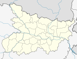 Munger Location in Bihar, India | |
| Coordinates: 25°22′52″N 86°27′54″E / 25.381°N 86.465°ECoordinates: 25°22′52″N 86°27′54″E / 25.381°N 86.465°E | |
| Country |
|
| State | Bihar |
| District | Munger |
| Founded by | Chandragupta Maurya |
| Government | |
| • Type | Mayor-council |
| • Body | Munger Municipal Corporation |
| • Mayor | Kumkum Devi |
| • Municipal Commissioner | Prabhat Kumar Sinha |
| Area | |
| • Total | 68 km2 (26 sq mi) |
| Elevation | 43 m (141 ft) |
| Population (2011)[1] | |
| • Total | 388,000 |
| • Rank | 5th in Bihar |
| • Density | 5,700/km2 (15,000/sq mi) |
| Time zone | IST (UTC+5:30) |
| PIN | 811201,811202,811211,811214 |
| Telephone code | +91-6344 |
| Vehicle registration | BR-08 |
| Website |
munger |
Munger (Angika and Hindi:मुंगेर) is a twin city and a Municipal Corporation situated in the Indian state of Bihar.[2] It is the administrative headquarters of Munger district and Munger Division. It is the fifth largest city of Bihar and second largest city in Eastern Bihar.
Historically, Munger is known for being an ancient seat of rule. The twin city comprises Munger and Jamalpur situated on the southern bank of the river Ganges.[3] It is situated 60 km west of Bhagalpur, and 180 km east of capital city Patna.
Climate
The climate of Munger is subtropical (warm in summer and cold during winter). The Köppen climate classification sub-type for this climate is humid subtropical.[4]
| Climate data for Munger, India | |||||||||||||
|---|---|---|---|---|---|---|---|---|---|---|---|---|---|
| Month | Jan | Feb | Mar | Apr | May | Jun | Jul | Aug | Sep | Oct | Nov | Dec | Year |
| Average high °C (°F) | 23.5 (74.3) |
26.4 (79.6) |
32.5 (90.5) |
37 (98.6) |
37.9 (100.3) |
35.5 (95.9) |
31.9 (89.4) |
31.2 (88.1) |
31.5 (88.7) |
30.8 (87.5) |
27.7 (81.9) |
24.2 (75.6) |
30.8 (87.5) |
| Average low °C (°F) | 9.4 (48.9) |
11.9 (53.4) |
16.9 (62.4) |
21.8 (71.3) |
24.6 (76.3) |
25.4 (77.7) |
24.9 (76.8) |
24.8 (76.6) |
24.2 (75.5) |
20.9 (69.7) |
14.4 (57.9) |
10 (50) |
19.1 (66.4) |
| Average precipitation mm (inches) | 15 (0.6) |
18 (0.7) |
13 (0.5) |
13 (0.5) |
41 (1.6) |
173 (6.8) |
297 (11.7) |
280 (11) |
226 (8.9) |
81 (3.2) |
5 (0.2) |
3 (0.1) |
1,161 (45.7) |
| Source: weatherbase[5] | |||||||||||||
Demographics
As per 2011 census, Munger Municipal Corporation had a total population of 3,88,000, out of which 2,00,000 were males and 1,88,000 were females. It had a sex ratio of 883. The population below 5 years was 42,260. The literacy rate of the 7+ population was 81.83 per cent.[6]
Places of interest
- Munger Fort, covers an area of around 222 acres
- Chandika Asthan, a sacred Shakti-Peeth
- Kastaharni Ghat on the Ganges
- Bhimbandh Wildlife Sanctuary
Sitakund
Transport
Rail
Munger has two railway stations: Jamalpur Junction and Munger Railway Station . The former is the main railhead for the city while the latter, which was earlier called Purabsarai Railway Station, acts as suburban facility.
The rail system provides connection to cities such as New Delhi, Mumbai, Kolkata, Banglore, Surat, Guwahati, Lucknow, Kanpur, Jammutawi, Vishakhapatnam, Bhagalpur, Patna, Gaya, Muzaffarpur, Ranchi, and Jamshedpur. The Munger Ganga Bridge, which takes both rail- and road-traffic, connects Munger to the nearby cities of Begusarai and Khagaria as well as various districts of North Bihar.[8] The bridge is the third-largest rail-cum-road bridge in India.[9]
Road
Munger is connected to major parts of India by various National and State Highways. The major cities of Bihar and Jharkhand - such as Patna, Ranchi, Bhagalpur, Muzaffarpur, Jamshedpur, Dhanbad, Gaya, Bokaro and Darbhanga - can be reached by NH 80, NH 333 and NH 333B and various state Highways. Regular bus service are provided by BSRTC for all the major cities and other destinations.
The Munger Ganga Bridge is under construction and will link Munger to various districts of North Bihar and north-eastern India by 2014.
Air
Munger has a small airport with no commercial service and used only for VIP movements. Nearest domestic airport with commercial service is Patna airport around 180 km away. Patna is served by all major airlines. Nearest international airport is Netaji Subhash Chandra Bose International Airport in Kolkata Which is around 480 km away from Munger.
Waterways
Munger is located on National Waterway No-1 running from Allahabad(U.P) to Haldia(W.B).it is well connected to major cities like Patna, Bhagalpur, Varanasi, Kolkata, and Allahabad through waterway.
Economy
Industry
Indian Railways operates of Asia's largest and oldest railway workshops at Jamalpur. This was set up by the British Raj in 1862.[10] The city also has India's oldest tobacco manufacturing unit. Initially a Raj enterprise founded in 1905, it was later taken over by ITC Limited.
Munger is also famous for the manufacture of guns, which has taken place there for over 200 years.
Education
Schools
- Dav Public School, Purabsarai.
- Kendriya Vidyalaya, Jamalpur
- Notre Dame Academy, Jamalpur
- Notre Dame Academy, Jamalpur,Munger
- Saraswati vidya mandir
Munger Municipal Corporation operates many primary and secondary schools.
Colleges
- Balmiki Rajniti Mahila College
- Jamalpur College
- JRS college, Jamalpur
- RD&DJ College
- RSS Evening College, Munger
- Indian Railways Institute of Mechanical and Electrical Engineering, Jamalpur
University
Bihar School of Yoga
Media
Aside from national radio and television broadcasters, the city has twolocal TV channels: NK and MCN.
Notable people
- Niranjanananda Saraswati, yoga Guru
- Satyananda Saraswati, founder of Bihar School of Yoga
- Nandalal Bose, sculptor and painter
- Krishna Singh, first Chief Minister of Bihar and a freedom fighter
- Kumar Suresh Singh, Director-General of Anthropological Survey of India
- Ramdhari Singh Dinkar, poet
References
- ↑ "Census of India Search details". censusindia.gov.in. Retrieved 10 May 2015.
- ↑ "CDP Munger" (PDF). Urban department, Government of Bihar. Retrieved 21 March 2014
- ↑ "CDP Jamalpur" (PDF). Urban Department, Government of Bihar.Retrieved on 21 January 2014
- ↑ "Climate Data for Munger, India". weatherbase.Retrieved on April 8, 2014
- ↑ "weatherbase.com". weatherbase. 2014. Retrieved on April 8, 2014.
- ↑ "Cities having population 1 lakh and above" (PDF). Provisional Population Totals, Census of India 2011. Retrieved 2012-04-16.
- ↑ "census of india:Socio-cultural aspects". Government of India, Ministry of Home Affairs.Retrieved on 9 March 2014
- ↑ "Munger bridge likely to be operational by 2014 year end". The Times of India. 15 Apr 2013.Retrieved on 14 May 2014
- ↑ "top ten rail road bridges in india". walkthroughindia.Retrieved on 10 May 2014
- ↑ "Minister releases stamp on Jamalpur railway workshop". Times of India. 28 Nov 2013.Reterived on April 18, 2014