Droop, West Virginia
| Droop | |
|---|---|
| Unincorporated community | |
 Droop  Droop Location within the state of West Virginia | |
| Coordinates: 38°5′6″N 80°17′5″W / 38.08500°N 80.28472°WCoordinates: 38°5′6″N 80°17′5″W / 38.08500°N 80.28472°W | |
| Country | United States |
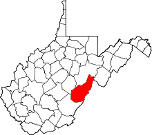
| State | West Virginia |
| County | Pocahontas |
| Time zone | Eastern (EST) (UTC-5) |
| • Summer (DST) | EDT (UTC-4) |
| ZIP codes | 24933 |
Droop is an unincorporated community in Pocahontas County, West Virginia, in the Greenbrier River Valley.
The community takes its name from nearby Droop Mountain.[1] The area is most famous for Droop Mountain Battlefield State Park, site of West Virginia's last significant Civil War battle. The Civilian Conservation Corps (CCC) constructed the park's trails and buildings in the 1930s, as part of Franklin D. Roosevelt's New Deal legislation. Today, a small museum on the park grounds houses Civil War artifacts and discusses the park's CCC history.[2] Bi-annually, the West Virginia Reenactors Association reenacts the Droop Mountain battle.[3]
-

Snowy Day at Droop Mountain
-

Overlook at the Park
Places of interest
- Droop Mountain Battlefield State Park
- The Civilian Conservation Corps Museum, Civil War History
- Beartown State Park
- Hiking Trails at Both State Parks
- The nearby town of Hillsboro, West Virginia
- The Pearl S. Buck Birthplace
References
- ↑ Kenny, Hamill (1945). West Virginia Place Names: Their Origin and Meaning, Including the Nomenclature of the Streams and Mountains. Piedmont, WV: The Place Name Press. p. 214.
- ↑ http://www.droopmountainbattlefield.com
- ↑ http://www.wvra.org
External links
This article is issued from Wikipedia - version of the 7/28/2016. The text is available under the Creative Commons Attribution/Share Alike but additional terms may apply for the media files.