Marlinton, West Virginia
| Marlinton, West Virginia | |
|---|---|
| Town | |
|
Visitors Center and Trailhead in Marlinton. | |
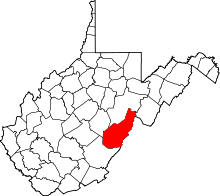
 Location of Marlinton, West Virginia | |
| Coordinates: 38°13′29″N 80°5′41″W / 38.22472°N 80.09472°WCoordinates: 38°13′29″N 80°5′41″W / 38.22472°N 80.09472°W | |
| Country | United States |
| State | West Virginia |
| County | Pocahontas |
| Area[1] | |
| • Total | 2.53 sq mi (6.55 km2) |
| • Land | 2.44 sq mi (6.32 km2) |
| • Water | 0.09 sq mi (0.23 km2) |
| Elevation | 2,126 ft (648 m) |
| Population (2010)[2] | |
| • Total | 1,054 |
| • Estimate (2012[3]) | 1,051 |
| • Density | 432.0/sq mi (166.8/km2) |
| Time zone | Eastern (EST) (UTC-5) |
| • Summer (DST) | EDT (UTC-4) |
| ZIP code | 24954 |
| Area code(s) | 304 |
| FIPS code | 54-51676[4] |
| GNIS feature ID | 1552003[5] |

Marlinton is a town in Pocahontas County, West Virginia, United States. The population was 1,054 at the 2010 census. It is the county seat of Pocahontas County.[6]
History
Marlinton is named for Jacob Marlin, who, along with Stephen Sewell, became the first non-native settlers west of the Allegheny Mountains, in the Greenbriar Valley in 1749. New Englanders Marlin and Sewell built a cabin in what would become Marlinton, but after various religious disputes, Sewell moved into a nearby hollowed-out Sycamore tree. In 1751, surveyor John Lewis discovered the pair. Sewell eventually settled on the eastern side of Sewell Mountain, near present-day Rainelle, WV.[7]
Located at Marlinton and listed on the National Register of Historic Places are the Frank and Anna Hunter House, IOOF Lodge Building, Marlinton Chesapeake and Ohio Railroad Station, Marlinton Opera House, Pocahontas County Courthouse and Jail, and Pocahontas Times Print Shop.[8] Located near Marlinton are Droop Mountain Battlefield and New Deal Resources in Watoga State Park Historic District.[8]
Geography
According to the United States Census Bureau, the town has a total area of 2.53 square miles (6.55 km2), of which, 2.44 square miles (6.32 km2) is land and 0.09 square miles (0.23 km2) is water.[1]
Climate
The climate in this area has mild differences between highs and lows, and there is adequate rainfall year round. According to the Köppen Climate Classification system, Marlinton has a marine west coast climate, abbreviated "Cfb" on climate maps.[9]
Demographics
| Historical population | |||
|---|---|---|---|
| Census | Pop. | %± | |
| 1890 | 5 | — | |
| 1900 | 171 | 3,320.0% | |
| 1910 | 1,045 | 511.1% | |
| 1920 | 1,177 | 12.6% | |
| 1930 | 1,586 | 34.7% | |
| 1940 | 1,644 | 3.7% | |
| 1950 | 1,645 | 0.1% | |
| 1960 | 1,586 | −3.6% | |
| 1970 | 1,286 | −18.9% | |
| 1980 | 1,352 | 5.1% | |
| 1990 | 1,148 | −15.1% | |
| 2000 | 1,204 | 4.9% | |
| 2010 | 1,054 | −12.5% | |
| Est. 2015 | 1,029 | [10] | −2.4% |
2010 census
As of the census[2] of 2010, there were 1,054 people, 467 households, and 247 families residing in the town. The population density was 432.0 inhabitants per square mile (166.8/km2). There were 658 housing units at an average density of 269.7 per square mile (104.1/km2). The racial makeup of the town was 97.8% White, 1.4% African American, 0.3% Native American, 0.1% from other races, and 0.4% from two or more races. Hispanic or Latino of any race were 0.5% of the population.
There were 467 households of which 24.4% had children under the age of 18 living with them, 31.7% were married couples living together, 16.5% had a female householder with no husband present, 4.7% had a male householder with no wife present, and 47.1% were non-families. 40.3% of all households were made up of individuals and 18.2% had someone living alone who was 65 years of age or older. The average household size was 2.12 and the average family size was 2.80.
The median age in the town was 47.4 years. 18.2% of residents were under the age of 18; 7.7% were between the ages of 18 and 24; 20.9% were from 25 to 44; 32% were from 45 to 64; and 21.2% were 65 years of age or older. The gender makeup of the town was 45.6% male and 54.4% female.
2000 census
As of the census[4] of 2000, there were 1,204 people, 552 households, and 290 families residing in the town. The population density was 539.8 inhabitants per square mile (208.5/km²). There were 653 housing units at an average density of 292.8 per square mile (113.1/km²). The racial makeup of the town was 97.92% White, 1.16% African American, 0.08% Native American, 0.08% Asian, 0.08% from other races, and 0.66% from two or more races. Hispanic or Latino of any race were 0.17% of the population.
There were 552 households out of which 22.5% had children under the age of 18 living with them, 37.9% were married couples living together, 12.7% had a female householder with no husband present, and 47.3% were non-families. 42.4% of all households were made up of individuals and 21.4% had someone living alone who was 65 years of age or older. The average household size was 2.04 and the average family size was 2.80.
In the town the population was spread out with 19.6% under the age of 18, 7.5% from 18 to 24, 22.8% from 25 to 44, 24.8% from 45 to 64, and 25.2% who were 65 years of age or older. The median age was 45 years. For every 100 females there were 83.5 males. For every 100 females age 18 and over, there were 76.6 males.
The median income for a household in the town was $21,293, and the median income for a family was $33,125. Males had a median income of $26,500 versus $16,477 for females. The per capita income for the town was $14,957. About 17.5% of families and 24.0% of the population were below the poverty line, including 29.0% of those under age 18 and 16.2% of those age 65 or over.
Gallery
 The Greenbrier River in Marlinton
References
- 1 2 "US Gazetteer files 2010". United States Census Bureau. Retrieved 2013-01-24.
- 1 2 "American FactFinder". United States Census Bureau. Retrieved 2013-01-24.
- ↑ "Population Estimates". United States Census Bureau. Retrieved 2013-06-26.
- 1 2 "American FactFinder". United States Census Bureau. Retrieved 2008-01-31.
- ↑ "US Board on Geographic Names". United States Geological Survey. 2007-10-25. Retrieved 2008-01-31.
- ↑ "Find a County". National Association of Counties. Retrieved 2011-06-07.
- ↑ http://www.wvencyclopedia.org/articles/1508
- 1 2 National Park Service (2010-07-09). "National Register Information System". National Register of Historic Places. National Park Service.
- ↑ Climate Summary for Marlinton, West Virginia
- ↑ "Annual Estimates of the Resident Population for Incorporated Places: April 1, 2010 to July 1, 2015". Retrieved July 2, 2016.
- ↑ "Census of Population and Housing". Census.gov. Retrieved June 4, 2015.
External links
-
 Marlinton travel guide from Wikivoyage
 - Traveling 219: Marlinton History