Sunset, West Virginia
| Sunset, West Virginia | |
|---|---|
| Ghost town | |
 Sunset, West Virginia | |
| Coordinates: 38°12′00″N 79°56′39″W / 38.20000°N 79.94417°WCoordinates: 38°12′00″N 79°56′39″W / 38.20000°N 79.94417°W | |
| Country | United States |
| State | West Virginia |
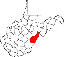
| County | Pocahontas |
| Elevation | 2,375 ft (724 m) |
| GNIS feature ID | 1728170[1] |
Sunset is a ghost town in Pocahontas County, West Virginia. Sunset was 3.5 miles (5.6 km) northeast of Minnehaha Springs. Sunset appeared on USGS maps as late as 1901.
The community lies west of Sunrise, Virginia, hence the name.[2]
References
- ↑ U.S. Geological Survey Geographic Names Information System: Sunset, West Virginia
- ↑ Kenny, Hamill (1945). West Virginia Place Names: Their Origin and Meaning, Including the Nomenclature of the Streams and Mountains. Piedmont, WV: The Place Name Press. p. 613.
This article is issued from Wikipedia - version of the 9/4/2016. The text is available under the Creative Commons Attribution/Share Alike but additional terms may apply for the media files.