Downe Township, New Jersey
| Downe Township, New Jersey | |
|---|---|
| Township | |
| Township of Downe | |
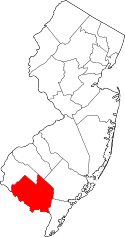
 Downe Township highlighted in Cumberland County. Inset map: Cumberland County highlighted in the State of New Jersey. | |
 Census Bureau map of Downe Township, New Jersey | |
| Coordinates: 39°16′10″N 75°08′00″W / 39.269497°N 75.133318°WCoordinates: 39°16′10″N 75°08′00″W / 39.269497°N 75.133318°W[1][2] | |
| Country |
|
| State |
|
| County | Cumberland |
| Royal charter | January 19, 1748 |
| Incorporated | February 21, 1798 |
| Government[3] | |
| • Type | Township |
| • Body | Township Committee |
| • Mayor | Robert G. Campbell (R, term ends December 31, 2016)[4][5] |
| • Clerk | Constance S. Garton[6] |
| Area[1] | |
| • Total | 54.268 sq mi (140.552 km2) |
| • Land | 48.606 sq mi (125.888 km2) |
| • Water | 5.662 sq mi (14.664 km2) 10.43% |
| Area rank |
31st of 566 in state 3rd of 14 in county[1] |
| Elevation[7] | 0 ft (0 m) |
| Population (2010 Census)[8][9][10] | |
| • Total | 1,585 |
| • Estimate (2015)[11] | 1,519 |
| • Rank |
510th of 566 in state 11th of 14 in county[12] |
| • Density | 32.6/sq mi (12.6/km2) |
| • Density rank |
559th of 566 in state 14th of 14 in county[12] |
| Time zone | Eastern (EST) (UTC-5) |
| • Summer (DST) | Eastern (EDT) (UTC-4) |
| ZIP code |
08315 - Dividing Creek 08321 - Fortescue 08345 - Newport 08349 - Port Norris, New Jersey[13] |
| Area code(s) | 856 exchange: 785[14] |
| FIPS code | 3401118220[1][15][16] |
| GNIS feature ID | 0882061[17] |
| Website |
www |
Downe Township is a township in Cumberland County, New Jersey, United States. It is part of the Vineland-Millville-Bridgeton Primary Metropolitan Statistical Area for statistical purposes. As of the 2010 United States Census, the township's population was 1,585,[8][9][10] reflecting a decline of 46 (-2.8%) from the 1,631 counted in the 2000 Census, which had in turn declined by 71 (-4.2%) from the 1,702 counted in the 1990 Census.[18]
What is now Downe Township was formed by Royal charter on January 19, 1748, as Downes Township, from portions of Fairfield Township. Downe Township was incorporated as one of New Jersey's initial 104 townships by an act of the New Jersey Legislature on February 21, 1798. Portions of the township were taken to form Commercial Township on February 27, 1874.[19] Downe Township is a dry township where alcohol cannot be sold.[20][21]
Geography
According to the United States Census Bureau, the township had a total area of 54.268 square miles (140.552 km2), including 48.606 square miles (125.888 km2) of land and 5.662 square miles (14.664 km2) of water (10.43%).[1][2]
Unincorporated communities, localities and place names located partially or completely within the township include Beadons Point, Beaver Dam, Dividing Creek, Dragston, Egg Island Point, False Egg Island Point, Fortescue, Gandys Beach, Little Neck, Money Island (surrounded by the Gandy's Beach nature preserve[22]), Nantuxent Point, Newport, Newport Landing, Newport Neck, Newport Station, Shaws Mill, The Glades and Turkey Point.[23]
Fortescue is known as the "weakfish capital of the world".[24]
The township borders Lawrence Township, Millville, Commercial Township, and the Delaware Bay.
Demographics
| Historical population | |||
|---|---|---|---|
| Census | Pop. | %± | |
| 1810 | 1,501 | — | |
| 1820 | 1,749 | 16.5% | |
| 1830 | 1,923 | 9.9% | |
| 1840 | 1,920 | −0.2% | |
| 1850 | 2,341 | 21.9% | |
| 1860 | 3,114 | 33.0% | |
| 1870 | 3,385 | 8.7% | |
| 1880 | 1,687 | * | −50.2% |
| 1890 | 1,793 | 6.3% | |
| 1900 | 1,833 | 2.2% | |
| 1910 | 1,519 | −17.1% | |
| 1920 | 1,322 | −13.0% | |
| 1930 | 1,574 | 19.1% | |
| 1940 | 1,546 | −1.8% | |
| 1950 | 1,786 | 15.5% | |
| 1960 | 1,870 | 4.7% | |
| 1970 | 1,777 | −5.0% | |
| 1980 | 1,803 | 1.5% | |
| 1990 | 1,702 | −5.6% | |
| 2000 | 1,631 | −4.2% | |
| 2010 | 1,585 | −2.8% | |
| Est. 2015 | 1,519 | [11][25] | −4.2% |
| Population sources: 1810-2000[26] 1810-1920[27] 1840[28] 1850-1870[29] 1850[30] 1870[31] 1880-1890[32] 1890-1910[33] 1910-1930[34] 1930-1990[35] 2000[36][37] 2010[8][9][10] * = Lost territory in previous decade[19] | |||
Census 2010
At the 2010 United States Census, there were 1,585 people, 646 households, and 434.8 families residing in the township. The population density was 32.6 per square mile (12.6/km2). There were 996 housing units at an average density of 20.5 per square mile (7.9/km2). The racial makeup of the township was 92.62% (1,468) White, 2.59% (41) Black or African American, 0.50% (8) Native American, 0.25% (4) Asian, 0.00% (0) Pacific Islander, 1.64% (26) from other races, and 2.40% (38) from two or more races. Hispanics or Latinos of any race were 3.85% (61) of the population.[8]
There were 646 households, of which 21.8% had children under the age of 18 living with them, 52.0% were married couples living together, 8.5% had a female householder with no husband present, and 32.7% were non-families. 24.9% of all households were made up of individuals, and 13.3% had someone living alone who was 65 years of age or older. The average household size was 2.45 and the average family size was 2.93.[8]
In the township, 19.6% of the population were under the age of 18, 6.5% from 18 to 24, 20.3% from 25 to 44, 33.2% from 45 to 64, and 20.4% who were 65 years of age or older. The median age was 47.6 years. For every 100 females there were 97.9 males. For every 100 females age 18 and over, there were 98.6 males.[8]
The Census Bureau's 2006-2010 American Community Survey showed that (in 2010 inflation-adjusted dollars) median household income was $45,250 (with a margin of error of +/- $5,437) and the median family income was $49,471 (+/- $9,499). Males had a median income of $36,739 (+/- $5,543) versus $32,841 (+/- $8,768) for females. The per capita income for the borough was $20,428 (+/- $2,019). About 6.7% of families and 14.9% of the population were below the poverty line, including 16.5% of those under age 18 and 13.0% of those age 65 or over.[38]
Census 2000
As of the 2000 United States Census[15] there were 1,631 people, 658 households, and 438 families residing in the township. The population density was 32.1 people per square mile (12.4/km²). There were 1,134 housing units at an average density of 22.3 per square mile (8.6/km²). The racial makeup of the township was 91.05% White, 4.84% African American, 1.47% Native American, 0.18% Asian, 0.98% from other races, and 1.47% from two or more races. Hispanic or Latino of any race were 3.37% of the population.[36][37]
There were 658 households out of which 26.6% had children under the age of 18 living with them, 51.1% were married couples living together, 10.3% had a female householder with no husband present, and 33.3% were non-families. 27.4% of all households were made up of individuals and 14.3% had someone living alone who was 65 years of age or older. The average household size was 2.48 and the average family size was 3.03.[36][37]
In the township the population was spread out with 23.5% under the age of 18, 6.3% from 18 to 24, 24.2% from 25 to 44, 27.0% from 45 to 64, and 18.9% who were 65 years of age or older. The median age was 42 years. For every 100 females there were 107.8 males. For every 100 females age 18 and over, there were 96.7 males.[36][37]
The median income for a household in the township was $34,667, and the median income for a family was $39,375. Males had a median income of $35,000 versus $26,397 for females. The per capita income for the township was $17,366. About 11.5% of families and 13.1% of the population were below the poverty line, including 21.1% of those under age 18 and 14.4% of those age 65 or over.[36][37]
Government
Local government
Downe Township is governed under the Township form of government. The five-member Township Committee is elected directly by the voters at-large in partisan elections to serve three-year terms of office on a staggered basis, with either one or two seats coming up for election each year as part of the November general election in a three-year cycle.[3][39] At an annual reorganization meeting, the Township Committee selects one of its members to serve as Mayor and another to serve as Deputy Mayor.
As of 2016, members of the Downe Township Committee are Mayor Robert Campbell (R, term on the committee ends December 31, 2018; term as mayor ends 2016), Deputy Mayor Dennis M. Cook (D, term on committee and as deputy mayor ends 2016), Edward Bart (R, 2017), Stephen Byrne (R, 2017) and Larry M. Jordan, Sr. (R, 2016).[4][40][41][42][43][44]
Federal, state and county representation
Downe Township is located in the 2nd Congressional District[45] and is part of New Jersey's 1st state legislative district.[9][46][47] Prior to the 2011 reapportionment following the 2010 Census, Downe Township had been in the 3rd state legislative district.[48]
New Jersey's Second Congressional District is represented by Frank LoBiondo (R, Ventnor City).[49] New Jersey is represented in the United States Senate by Cory Booker (D, Newark, term ends 2021)[50] and Bob Menendez (D, Paramus, 2019).[51][52]
For the 2016–2017 session (Senate, General Assembly), the 1st Legislative District of the New Jersey Legislature is represented in the State Senate by Jeff Van Drew (D, Dennis Township) and in the General Assembly by Bob Andrzejczak (D, Middle Township) and R. Bruce Land (D, Vineland).[53] The Governor of New Jersey is Chris Christie (R, Mendham Township).[54] The Lieutenant Governor of New Jersey is Kim Guadagno (R, Monmouth Beach).[55]
Cumberland County is governed by a seven-member Board of Chosen Freeholders, who are elected at-large in partisan elections to serve staggered three-year terms in office, with two or three seats coming up for election each year. At an annual reorganization meeting held each January, the freeholders select one member to serve as Freeholder Director and another as Deputy Director.[56][57] As of 2014, Cumberland County's Freeholders (with committee liaison assignments, political party, residence and term-end dates listed in parentheses) are Freeholder Director Joseph Derella (Administration / Public Safety; D, Millville, term ends December 31, 2015),[58] Freeholder Deputy Director Douglas M. Long (NA; D, Upper Deerfield Township, 2015),[59] Darlene Barber (Education; D, 2016, Upper Deerfield Township),[60] Carol Musso (Community Services; D, Deerfield Township, 2014),[61] James Sauro (Agriculture; R, Vineland, 2014),[62] Thomas Sheppard (Health; R, Lawrence Township, 2016)[63] and Tony Surace (Public Works; D, Millville, 2014).[64][65][66][67] The county's constitutional officers are County Clerk Gloria Noto (Vineland, 2014),[68] Sheriff Robert A. Austino (Vineland, 2014)[69] and Surrogate Douglas M. Rainear (Bridgeton, 2018).[70]
Politics
As of March 23, 2011, there were a total of 1,128 registered voters in Downe Township, of which 249 (22.1%) were registered as Democrats, 484 (42.9%) were registered as Republicans and 394 (34.9%) were registered as Unaffiliated. There was one voter registered to another party.[71]
In the 2012 presidential election, Republican Mitt Romney received 58.8% of the vote (415 cast), ahead of Democrat Barack Obama with 39.1% (276 votes), and other candidates with 2.1% (15 votes), among the 715 ballots cast by the township's 1,172 registered voters (9 ballots were spoiled), for a turnout of 61.0%.[72][73] In the 2008 presidential election, Republican John McCain received 56.7% of the vote (447 cast), ahead of Democrat Barack Obama, who received 38.1% (300 votes), with 788 ballots cast among the township's 1,127 registered voters, for a turnout of 69.9%.[74] In the 2004 presidential election, Republican George W. Bush received 59.1% of the vote (445 ballots cast), outpolling Democrat John Kerry, who received 38.9% (293 votes), with 753 ballots cast among the township's 1,071 registered voters, for a turnout percentage of 70.3.[75]
In the 2013 gubernatorial election, Republican Chris Christie received 73.4% of the vote (353 cast), ahead of Democrat Barbara Buono with 23.5% (113 votes), and other candidates with 3.1% (15 votes), among the 502 ballots cast by the township's 1,072 registered voters (21 ballots were spoiled), for a turnout of 46.8%.[76][77] In the 2009 gubernatorial election, Republican Chris Christie received 51.7% of the vote (306 ballots cast), ahead of both Democrat Jon Corzine with 31.9% (189 votes) and Independent Chris Daggett with 9.8% (58 votes), with 592 ballots cast among the township's 1,127 registered voters, yielding a 52.5% turnout.[78]
Education
The Downe Township School District serves public school students in pre-Kindergarten through eighth grade at Downe Township School. As of the 2012-13 school year, the district's one school had an enrollment of 189 students and 17.2 classroom teachers (on an FTE basis), for a student–teacher ratio of 10.99:1.[79]
Public school students in ninth through twelfth grades attend Bridgeton High School in Bridgeton, as part of a sending/receiving relationship with the Bridgeton Public Schools.[80]
Transportation
As of May 2010, the township had a total of 54.68 miles (88.00 km) of roadways, of which 21.99 miles (35.39 km) were maintained by the municipality and 32.69 miles (52.61 km) by Cumberland County.[81]
References
- 1 2 3 4 5 2010 Census Gazetteer Files: New Jersey County Subdivisions, United States Census Bureau. Accessed May 21, 2015.
- 1 2 US Gazetteer files: 2010, 2000, and 1990, United States Census Bureau. Accessed September 4, 2014.
- 1 2 2012 New Jersey Legislative District Data Book, Rutgers University Edward J. Bloustein School of Planning and Public Policy, March 2013, p. 19.
- 1 2 Township Committee, Downe Township. Accessed June 30, 2016.
- ↑ 2016 New Jersey Mayors Directory, New Jersey Department of Community Affairs. Accessed June 14, 2016.
- ↑ Clerk / Chief Financial Officer, Downe Township. Accessed June 30, 2016.
- ↑ U.S. Geological Survey Geographic Names Information System: Township of Downe, Geographic Names Information System. Accessed March 5, 2013.
- 1 2 3 4 5 6 DP-1 - Profile of General Population and Housing Characteristics: 2010 for Downe township, Cumberland County, New Jersey, United States Census Bureau. Accessed October 22, 2012.
- 1 2 3 4 Municipalities Grouped by 2011-2020 Legislative Districts, New Jersey Department of State, p. 1. Accessed January 6, 2013.
- 1 2 3 Profile of General Demographic Characteristics: 2010 for Downe township, New Jersey Department of Labor and Workforce Development. Accessed October 22, 2012.
- 1 2 PEPANNRES - Annual Estimates of the Resident Population: April 1, 2010 to July 1, 2015 - 2015 Population Estimates for New Jersey municipalities, United States Census Bureau. Accessed May 22, 2016.
- 1 2 GCT-PH1 Population, Housing Units, Area, and Density: 2010 - State -- County Subdivision from the 2010 Census Summary File 1 for New Jersey, United States Census Bureau. Accessed October 22, 2012.
- ↑ Zip Codes, State of New Jersey. Accessed September 3, 2013.
- ↑ Area Code Lookup - NPA NXX for Port Norris, NJ, Area-Codes.com. Accessed March 15, 2015.
- 1 2 American FactFinder, United States Census Bureau. Accessed September 4, 2014.
- ↑ A Cure for the Common Codes: New Jersey, Missouri Census Data Center. Accessed October 22, 2012.
- ↑ US Board on Geographic Names, United States Geological Survey. Accessed September 4, 2014.
- ↑ Table 7. Population for the Counties and Municipalities in New Jersey: 1990, 2000 and 2010, New Jersey Department of Labor and Workforce Development, February 2011. Accessed October 22, 2012.
- 1 2 Snyder, John P. The Story of New Jersey's Civil Boundaries: 1606-1968, Bureau of Geology and Topography; Trenton, New Jersey; 1969. p. 120. Accessed October 22, 2012.
- ↑ New Jersey Division of Alcoholic Beverage Control. New Jersey ABC list of dry towns (May 1, 2013)
- ↑ Giordano, Rita. "More towns catching liquor-license buzz; Moorestown considers ending its dry spell", The Philadelphia Inquirer, June 24, 2007. Accessed February 16, 2014.
- ↑ "About Money Island NJ".
- ↑ Locality Search, State of New Jersey. Accessed May 21, 2015.
- ↑ Natural, Undisturbed Beauty of Nature, Right Here in the Northeast Corridor, accessed April 5, 2007. "Fortescue is also host to one of the East Coast's most popular fishing tournaments, the Fortescue Weakfish Tournament. Fortescue is known as the weakfish capital of the world."
- ↑ Census Estimates for New Jersey April 1, 2010 to July 1, 2015, United States Census Bureau. Accessed May 22, 2016.
- ↑ Barnett, Bob. Population Data for Cumberland County Municipalities, 1810 - 2010, WestJersey.org. January 6, 2011. Accessed October 22, 2012.
- ↑ Compendium of censuses 1726-1905: together with the tabulated returns of 1905, New Jersey Department of State, 1906. Accessed September 3, 2013.
- ↑ Bowen, Francis. American Almanac and Repository of Useful Knowledge for the Year 1843, p. 231, David H. Williams, 1842. Accessed September 3, 2013.
- ↑ Raum, John O. The History of New Jersey: From Its Earliest Settlement to the Present Time, Volume 1, p. 269, J. E. Potter and company, 1877. Accessed September 3, 2013. "Downe is in the southern part of the county, on Maurice river cove, and contained in 1850, 2,341 inhabitants; in 1860, 3,114; and in 1870, 3,385. Mauricetown (on Maurice river), Dividing Creek, and Newport, are the principal towns "
- ↑ Debow, James Dunwoody Brownson. The Seventh Census of the United States: 1850, p. 138. R. Armstrong, 1853. Accessed September 3, 2013.
- ↑ Staff. A compendium of the ninth census, 1870, p. 258. United States Census Bureau, 1872. Accessed September 3, 2013.
- ↑ Porter, Robert Percival. Preliminary Results as Contained in the Eleventh Census Bulletins: Volume III - 51 to 75, p. 97. United States Census Bureau, 1890. Accessed September 3, 2013.
- ↑ Thirteenth Census of the United States, 1910: Population by Counties and Minor Civil Divisions, 1910, 1900, 1890, United States Census Bureau, p. 336. Accessed October 22, 2012.
- ↑ Fifteenth Census of the United States : 1930 - Population Volume I, United States Census Bureau, p. 715. Accessed October 22, 2012.
- ↑ New Jersey Resident Population by Municipality: 1930 - 1990, Workforce New Jersey Public Information Network. Accessed June 28, 2015.
- 1 2 3 4 5 Census 2000 Profiles of Demographic / Social / Economic / Housing Characteristics for Downe township, Cumberland County, New Jersey, United States Census Bureau. Accessed October 22, 2012.
- 1 2 3 4 5 DP-1: Profile of General Demographic Characteristics: 2000 - Census 2000 Summary File 1 (SF 1) 100-Percent Data for Downe township, Cumberland County, New Jersey, United States Census Bureau. Accessed October 22, 2012.
- ↑ DP03: Selected Economic Characteristics from the 2006-2010 American Community Survey 5-Year Estimates for Downe township, Cumberland County, New Jersey, United States Census Bureau. Accessed October 22, 2012.
- ↑ "Forms of Municipal Government in New Jersey", p. 7. Rutgers University Center for Government Studies. Accessed June 3, 2015.
- ↑ 2014 Municipal Data Sheet, Downe Township. Accessed June 21, 2015.
- ↑ 2016 Directory of Cumberland County, New Jersey, Cumberland County, New Jersey. Accessed June 30, 2016.
- ↑ Cumberland County GENERAL - November 3rd, 2015 Official Results, Cumberland County, New Jersey, updated November 3, 2015. Accessed June 30, 2016.
- ↑ Cumberland County General - November 4, 2014 Official Results, Cumberland County, New Jersey, updated March 17, 2015. Accessed June 30, 2016.
- ↑ Cumberland County General - November 5, 2013 Unofficial Results, Cumberland County, New Jersey, updated November 6, 2013. Accessed June 30, 2016.
- ↑ Plan Components Report, New Jersey Redistricting Commission, December 23, 2011. Accessed January 6, 2013.
- ↑ 2016 New Jersey Citizen's Guide to Government, p. 56, New Jersey League of Women Voters. Accessed July 20, 2016.
- ↑ Districts by Number for 2011-2020, New Jersey Legislature. Accessed January 6, 2013.
- ↑ 2011 New Jersey Citizen's Guide to Government, p. 56, New Jersey League of Women Voters. Accessed May 22, 2015.
- ↑ Directory of Representatives: New Jersey, United States House of Representatives. Accessed January 5, 2012.
- ↑ About Cory Booker, United States Senate. Accessed January 26, 2015. "He now owns a home and lives in Newark's Central Ward community."
- ↑ Biography of Bob Menendez, United States Senate, January 26, 2015. "He currently lives in Paramus and has two children, Alicia and Robert."
- ↑ Senators of the 114th Congress from New Jersey. United States Senate. Accessed January 26, 2015. "Booker, Cory A. - (D - NJ) Class II; Menendez, Robert - (D - NJ) Class I"
- ↑ Legislative Roster 2016-2017 Session, New Jersey Legislature. Accessed January 17, 2016.
- ↑ "About the Governor". State of New Jersey. Retrieved 2010-01-21.
- ↑ "About the Lieutenant Governor". State of New Jersey. Retrieved 2010-01-21.
- ↑ What is a County Freeholder?, Cumberland County, New Jersey. Accessed July 28, 2014. "Freeholders are elected at-large and serve three year staggered terms. Each January, the Board reorganizes and selects its leadership."
- ↑ About Cumberland County Government, Cumberland County, New Jersey. Accessed July 28, 2014. "By law, Cumberland County is allowed 7 freeholders, who serve staggered, overlapping three year terms. Two are elected in two successive years, three in the third year, elected from the county at-large. A Director of the Board is selected by his colleagues for a one year term."
- ↑ Joseph Derella, Cumberland County, New Jersey. Accessed July 28, 2014.
- ↑ Douglas Long, Cumberland County, New Jersey. Accessed July 28, 2014.
- ↑ Darlene Barber, Cumberland County, New Jersey. Accessed July 28, 2014.
- ↑ Carol Musso, Cumberland County, New Jersey. Accessed July 28, 2014.
- ↑ James R. Sauro, Cumberland County, New Jersey. Accessed July 28, 2014.
- ↑ Thomas Sheppard, Cumberland County, New Jersey. Accessed July 28, 2014.
- ↑ Tony Surace, Cumberland County, New Jersey. Accessed July 28, 2014.
- ↑ County Freeholders, Cumberland County, New Jersey. Accessed July 28, 2014.
- ↑ 2014 County Data Sheet, Cumberland County, New Jersey. Accessed July 28, 2014.
- ↑ Marko, Deborah M.; and Kov, Daniel. "GOP keeps two seats on freeholder boardRainear re-elected as surrogate; Mercado ousted", The Daily Journal (New Jersey), November 6, 2013. Accessed July 28, 2014. "GOP candidate Tom Sheppard wins a three-year seat. His running mate, James Sauro, wins a one-year seat. The pair will be the only GOP representatives on the seven-member freeholder board. Darlene Barber, a Democrat in her first race, won the other three-year freeholder seat that was available.... In the surrogate race, incumbent Democrat Douglas Rainear defeated Republican newcomer Timothy Codispoti."
- ↑ Cumberland County Clerk's Office, Cumberland County, New Jersey. Accessed July 28, 2014.
- ↑ Cumberland County Sheriff's Department, Cumberland County, New Jersey. Accessed July 28, 2014.
- ↑ Cumberland County Surrogate Office, Cumberland County, New Jersey. Accessed July 28, 2014. As of date accessed, a 2013 term-end year is listed incorrectly.
- ↑ Voter Registration Summary - Cumberland, New Jersey Department of State Division of Elections, March 23, 2011. Accessed October 23, 2012.
- ↑ "Presidential General Election Results - November 6, 2012 - Cumberland County" (PDF). New Jersey Department of Elections. March 15, 2013. Retrieved December 24, 2014.
- ↑ "Number of Registered Voters and Ballots Cast - November 6, 2012 - General Election Results - Cumberland County" (PDF). New Jersey Department of Elections. March 15, 2013. Retrieved December 24, 2014.
- ↑ 2008 Presidential General Election Results: Cumberland County, New Jersey Department of State Division of Elections, December 23, 2008. Accessed October 23, 2012.
- ↑ 2004 Presidential Election: Cumberland County, New Jersey Department of State Division of Elections, December 13, 2004. Accessed October 23, 2012.
- ↑ "Governor - Cumberland County" (PDF). New Jersey Department of Elections. January 29, 2014. Retrieved December 24, 2014.
- ↑ "Number of Registered Voters and Ballots Cast - November 5, 2013 - General Election Results - Cumberland County" (PDF). New Jersey Department of Elections. January 29, 2014. Retrieved December 24, 2014.
- ↑ 2009 Governor: Cumberland County, New Jersey Department of State Division of Elections, December 31, 2009. Accessed October 23, 2012.
- ↑ District information for Downe Township School District, National Center for Education Statistics. Accessed March 15, 2015.
- ↑ Western/Southern Cumberland Region Strategic Plan, Cumberland Development Corporation, January 2003. Accessed September 3, 2013. "Students in Bridgeton, Downe and a portion of Lawrence Township attend Bridgeton High School. There are over 10,000 students enrolled in public schools in the study area (Table 26, Enrollment)."
- ↑ Cumberland County Mileage by Municipality and Jurisdiction, New Jersey Department of Transportation, May 2010. Accessed July 18, 2014.
External links
- Downe Township web site
- Downe Township School District
- Downe Township School District's 2014–15 School Report Card from the New Jersey Department of Education
- School Data for the Downe Township School District, National Center for Education Statistics