Cedarville, New Jersey
| Cedarville, New Jersey | |
|---|---|
| Census-designated place | |
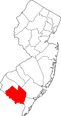
 Map of Cedarville, highlighted within Cumberland County. Right: Location of Cumberland County in New Jersey. | |
| Coordinates: 39°20′19″N 75°12′52″W / 39.338571°N 75.214506°WCoordinates: 39°20′19″N 75°12′52″W / 39.338571°N 75.214506°W | |
| Country |
|
| State |
|
| County | Cumberland |
| Township | Lawrence |
| Area[1] | |
| • Total | 2.277 sq mi (5.897 km2) |
| • Land | 2.236 sq mi (5.791 km2) |
| • Water | 0.041 sq mi (0.107 km2) 1.81% |
| Elevation[2] | 30 ft (9 m) |
| Population (2010 Census)[3] | |
| • Total | 776 |
| • Density | 347.1/sq mi (134.0/km2) |
| Time zone | Eastern (EST) (UTC-5) |
| • Summer (DST) | EDT (UTC-4) |
| ZIP code | 08311[4] |
| Area code(s) | 856 |
| FIPS code | 3411410[5] |
| GNIS feature ID | 02389294[6] |
Cedarville is an unincorporated community and census-designated place (CDP) located within Lawrence Township, in Cumberland County, New Jersey, United States.[7] It is part of the Vineland-Millville-Bridgeton Primary Metropolitan Statistical Area for statistical purposes. As of the 2010 United States Census, the CDP's population was 776.[3]
Geography
According to the United States Census Bureau, the CDP had a total area of 2.277 square miles (5.897 km2), including 2.236 square miles (5.791 km2) of land and 0.041 square miles (0.107 km2) of water (1.81%).[1][8]
Demographics
| Historical population | |||
|---|---|---|---|
| Census | Pop. | %± | |
| 2000 | 776 | — | |
| 2010 | 793 | 2.2% | |
| Population sources: 2000[9] 2010[3] | |||
Census 2010
At the 2010 United States Census, there were 776 people, 275 households, and 188.9 families residing in the CDP. The population density was 347.1 per square mile (134.0/km2). There were 300 housing units at an average density of 134.2 per square mile (51.8/km2). The racial makeup of the CDP was 79.77% (619) White, 10.05% (78) Black or African American, 1.29% (10) Native American, 0.39% (3) Asian, 0.00% (0) Pacific Islander, 5.67% (44) from other races, and 2.84% (22) from two or more races. Hispanics or Latinos of any race were 10.05% (78) of the population.[3]
There were 275 households, of which 29.8% had children under the age of 18 living with them, 52.0% were married couples living together, 9.8% had a female householder with no husband present, and 31.3% were non-families. 24.7% of all households were made up of individuals, and 13.1% had someone living alone who was 65 years of age or older. The average household size was 2.80 and the average family size was 3.30.[3]
In the CDP, 25.1% of the population were under the age of 18, 9.3% from 18 to 24, 24.4% from 25 to 44, 25.6% from 45 to 64, and 15.6% who were 65 years of age or older. The median age was 39.0 years. For every 100 females there were 97.0 males. For every 100 females age 18 and over, there were 95.6 males.[3]
Census 2000
As of the 2000 United States Census[5] there were 793 people, 276 households, and 208 families residing in the CDP. The population density was 134.9/km2 (349.8/mi2). There were 306 housing units at an average density of 52.0/km2 (135.0/mi2). The racial makeup of the CDP was 85.75% White, 8.83% African American, 1.77% Native American, 0.38% Asian, 2.52% from other races, and 0.76% from two or more races. Hispanic or Latino of any race were 4.04% of the population.[9]
There were 276 households out of which 34.1% had children under the age of 18 living with them, 58.3% were married couples living together, 11.2% had a female householder with no husband present, and 24.3% were non-families. 19.9% of all households were made up of individuals, and 12.3% had someone living alone who was 65 years of age or older. The average household size was 2.87, and the average family size was 3.26.[9]
In the CDP the population was spread out with 26.9% under the age of 18, 7.7% from 18 to 24, 28.9% from 25 to 44, 23.0% from 45 to 64, and 13.6% who were 65 years of age or older. The median age was 37 years. For every 100 females there were 99.7 males. For every 100 females age 18 and over, there were 94.6 males.[9]
The median income for a household in the CDP was $46,500, and the median income for a family was $48,021. Males had a median income of $35,833 versus $25,962 for females. The per capita income for the CDP was $15,446. About 2.6% of families and 3.8% of the population were below the poverty line, including 4.6% of those under age 18 and 3.9% of those age 65 or over.[9]
Notable people
People who were born in, residents of, or otherwise closely associated with Cedarville include:
- Ephraim Bateman (1780-1829) represented New Jersey in the United States Senate from 1826 to 1829 and in the United States House of Representatives from 1815-1823.[10]
- Benjamin Franklin Howell (1844-1933) represented New Jersey's 3rd congressional district from 1895 to 1911.[11]
References
- 1 2 Gazetteer of New Jersey Places, United States Census Bureau. Accessed July 21, 2016.
- ↑ U.S. Geological Survey Geographic Names Information System: Cedarville Census Designated Place, Geographic Names Information System. Accessed November 3, 2012.
- 1 2 3 4 5 6 DP-1 - Profile of General Population and Housing Characteristics: 2010 Demographic Profile Data for Cedarville CDP, New Jersey, United States Census Bureau. Accessed November 3, 2012.
- ↑ Look Up a ZIP Code for Cedarville, NJ, United States Postal Service. Accessed November 3, 2012.
- 1 2 American FactFinder, United States Census Bureau. Accessed September 4, 2014.
- ↑ US Board on Geographic Names, United States Geological Survey. Accessed September 4, 2014.
- ↑ New Jersey: 2010 - Population and Housing Unit Counts - 2010 Census of Population and Housing (CPH-2-32), United States Census Bureau, August 2012. Accessed November 3, 2012.
- ↑ US Gazetteer files: 2010, 2000, and 1990, United States Census Bureau. Accessed September 4, 2014.
- 1 2 3 4 5 DP-1 - Profile of General Demographic Characteristics: 2000 from the Census 2000 Summary File 1 (SF 1) 100-Percent Data for Cedarville CDP, New Jersey, United States Census Bureau. Accessed November 3, 2012.
- ↑ Ephraim Bateman, Biographical Directory of the United States Congress. Accessed August 21, 2007.
- ↑ Benjamin Franklin Howell, Biographical Directory of the United States Congress. Accessed August 29, 2007.