Alberta Highway 1A
Alberta Provincial Highway No. 1A[1] is the designation of three alternate routes off the Alberta portion of the Trans-Canada Highway. However, it is not the only name used for spurs off Highway 1 - Highway 1X is another such designation. These highways, however, are not part of the Trans-Canada Highway network, and only have Alberta's provincial primary highway shields instead of the ones used for the Trans-Canada Highway.
Bow Valley Parkway
| ||||
|---|---|---|---|---|
| Bow Valley Parkway | ||||
| Route information | ||||
| Maintained by Parks Canada | ||||
| Length: | 51 km (32 mi) | |||
| Major junctions | ||||
| West end: |
| |||
| East end: |
| |||
| Location | ||||
| Specialized and rural municipalities: | I.D. No. 9 | |||
| Highway system | ||||
|
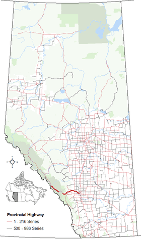
Provincial highways in Alberta
| ||||

The Lake Louise to Banff section of the Banff National Park 1A route is also known as the Bow Valley Parkway.[2] It begins at Highway 1 at Lake Louise, generally paralleling it until it meets Highway 1 again approximately 6 km (3.7 mi) west of Banff. It provides more immediate access to attractions in Banff National Park such as Castle Mountain and Johnston Canyon. This spur has a reduced speed limit of 60 km/h (37 mph), and provides opportunity to view wildlife at various times of the year.
Parks Canada introduced planned and marked pullovers along the route to enhance and educate visitors about the region. The Bow Valley Parkway is one of only two parkways between Lake Louise and Banff, and the only one that allows views of the mountain scenery, waterfalls, and various view points of the nearby rivers and creeks. It was the original highway that connected the valley and holds heritage appeal to many locals.
A former section of Highway 1A precedes the Bow Valley Parkway. Known as Lake Louise Drive, the former route begins at Highway 1 in British Columbia, 2.9 km (1.8 mi) into Yoho National Park. It meanders eastward to Lake Louise, generally paralleling the main Highway 1 and CPR rail line to the south.
Major intersections
Starting from the west end of Highway 1A:[3]
Bow Valley Trail
| ||||
|---|---|---|---|---|
| Bow Valley Trail | ||||
| Route information | ||||
| Maintained by Alberta Transportation, City of Calgary | ||||
| Length: | 103 km (64 mi) | |||
| Major junctions | ||||
| West end: |
| |||
|
| ||||
| East end: |
| |||
| Location | ||||
| Specialized and rural municipalities: | Bighorn No. 8 M.D., Rocky View County | |||
| Major cities: | Calgary | |||
| Towns: | Canmore, Cochrane | |||
| Highway system | ||||
|
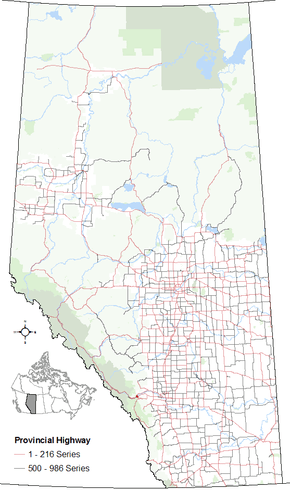
Provincial highways in Alberta
| ||||
.svg.png)
The second of the 1A routes, known as the Bow Valley Trail, begins in Canmore, off of the Trans-Canada Highway at exit 91. It extends west into Canmore, carrying "Bow Valley Trail" as the name of the street, while it is not a highway itself. This extension through Canmore rejoins the Trans-Canada Highway at exit 86.
From exit 91, it heads eastbound, along the Canadian Pacific Railway tracks, until it reaches the Hamlet of Exshaw. From Exshaw, Bow Valley Trail heads to the northeast, past Highway 1X.
Just east of Highway 1X, Bow Valley Trail narrows and the speed limit is reduced to 80 km/h (50 mph) for approximately thirty kilometres as it passes through the Stoney Indian Reserve, where warning signs that there may be livestock and/or pedestrians on the road are posted. Highway 1A passes Morley approximately eight kilometres from the reserve's eastern boundary; the community is situated just south of the highway. As the highway leaves the reserve, it widens and the speed limit increases back to 100 km/h (62 mph). Shortly after leaving the reserve, the highway skirts the north shore of Ghost Lake, a manmade glacier lake that is a popular spot for Calgary's boating and sailing enthusiasts in the summer, as well as ice sailing in the winter. The lake also supplies most of the water power for Calgary through TransAlta Utilities. Highway 1A meets northbound Highway 40 3 km (1.9 mi) after passing Ghost Lake.

From Highway 40, Bow Valley Trail proceeds towards the east, and then slightly to the southeast, before reaching the Town of Cochrane, where it intersects with Highway 22. There, the highway proceeds a short distance to the southeast. The highway widens to 4 lanes just west of Highway 766 until it reaches Calgary, where it continues as Crowchild Trail, a major north-south expressway, (although it travels in a southeasterly direction from the city limits to 24 Avenue NW) through the northwest and southwest parts of the city. While within the Calgary city limits, it crosses Stoney Trail (Highway 201) as well as a number of major streets, before reuniting with the Trans-Canada Highway (known as 16 Avenue North in Calgary) near McMahon Stadium and the University of Calgary. The section along Crowchild Trail is maintained by the City of Calgary rather than Alberta Transportation.
Major intersections
Starting from the west end of Highway 1A:[3]
Calgary to Chestermere
| ||||
|---|---|---|---|---|
| Route information | ||||
| Length: | 14.2 km (8.8 mi) | |||
| Existed: | 1949 – 2013 | |||
| Major junctions | ||||
| West end: |
| |||
|
| ||||
| East end: |
| |||
| Location | ||||
| Major cities: | Calgary, Chestermere | |||
| Highway system | ||||
|
Provincial highways in Alberta
| ||||
The third segment is a former segment of Highway 1A located within the City of Calgary and City of Chestermere, paralleling Highway 1. Prior to 2013,[4] It began at Highway 2 (Deerfoot Trail, at exit 254) and followed 17 Avenue SE (International Avenue) where it passed through the former town of Forest Lawn. It crossed 116 Street SE and entered Chestermere, terminating at Highway 1.[3]
Major intersections
Starting from the west end of Highway 1A:[3][5]
| Rural/specialized municipality | Location | km | mi | Destinations | Notes |
|---|---|---|---|---|---|
| City of Calgary | 0 | 0.0 | Continues as Blackfoot Trail Grade separated 51°2′13″N 114°0′17″W / 51.03694°N 114.00472°W | ||
| 5.9 | 3.7 | Grade separated 51°2′16″N 113°55′16″W / 51.03778°N 113.92111°W | |||
| 9.8 | 6.1 | 100 Street SE, Range Road 284, Conrich Road | City / town limits 51°2′16″N 113°51′55″W / 51.03778°N 113.86528°W | ||
| City of Chestermere | 13.3 | 8.3 | Chestermere Drive | Chestermere Traffic lights 51°2′59″N 113°49′23″W / 51.04972°N 113.82306°W | |
| 14.2 | 8.8 | East to Strathmore Grade separated 51°3′9″N 113°48′45″W / 51.05250°N 113.81250°W | |||
| |||||
Highway 1X
| ||||
|---|---|---|---|---|
 | ||||
| Route information | ||||
| Maintained by Alberta Transportation | ||||
| Length: | 4.5 km (2.8 mi) | |||
| Major junctions | ||||
| South end: |
| |||
| North end: |
| |||
| Location | ||||
| Specialized and rural municipalities: | Kananaskis I.D., Bighorn No. 8 M.D. | |||
| Highway system | ||||
|
Provincial highways in Alberta
| ||||

Alberta Provincial Highway No. 1X[1] is a spur highway between Highway 1 and Highway 1A approximately 7 km (4.3 mi) east of Exshaw near the western edge of the Stoney Indian Reserve. It serves as the only Bow River crossing between Canmore to the west and Morley to the east, providing access to First Nations lands and communities in the area. At 4.5 km (2.8 mi) in length, it is one of Alberta's shortest provincial highways.[3]
Major intersections
| Rural/specialized municipality | Location | km[3] | mi | Destinations | Notes |
|---|---|---|---|---|---|
| Kananaskis Improvement District | | 0.0 | 0.0 | Grade separated Highway 1X begins 51°4′41″N 115°3′27″W / 51.07806°N 115.05750°W | |
| M.D. of Bighorn No. 8 | | 2.2 | 1.4 | Crosses Bow River | 51°5′48″N 115°3′51″W / 51.09667°N 115.06417°W |
| | 3.0 | 1.9 | Seebe | ||
| | 4.5 | 2.8 | Highway 1X ends 51°6′9″N 115°5′14″W / 51.10250°N 115.08722°W |
References
- 1 2 Provincial Highways Designation Order, Alberta Transportation, p. 1
- ↑ Lake Louise Road & Trail Map
- 1 2 3 4 5 6 2010 Provincial Highways 1 - 216 Progress Chart (map, 8 MB) by Alberta Transportation.
- ↑ "Highway 1A Becomes Chestermere Boulevard". Town of Chestermere. June 17, 2013. Retrieved June 24, 2013.
- ↑ Alberta Transportation (2010-01-01). Provincial Highway Designation – Highway 1A.
External links
- 2010 Provincial Highways 1 - 216 Series Progress Chart (map, 8 MB) by Alberta Transportation.