Rocky View County
| Rocky View County Municipal District of Rocky View No. 44 (1956–2009) Municipal District of Calgary No. 44 (1955–1956) | |||
|---|---|---|---|
| Municipal district | |||
|
View of the Rockies and Foothills | |||
| |||
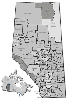 Location of Rocky View County in Alberta | |||
| Coordinates: 51°02′42″N 114°03′26″W / 51.04500°N 114.05722°WCoordinates: 51°02′42″N 114°03′26″W / 51.04500°N 114.05722°W | |||
| Country |
| ||
| Province |
| ||
| Region | Calgary Region | ||
| Census division | No. 6 | ||
| Incorporated[1] | January 1, 1955 | ||
| Name changed[1] |
January 9, 1956 June 24, 2009 | ||
| Government[2] | |||
| • Reeve | Greg Boehlke | ||
| • Governing body |
Rocky View County Council
| ||
| • Manager | Kevin Greig | ||
| • Office location | Calgary | ||
| Area (2011)[3] | |||
| • Total | 3,885.41 km2 (1,500.17 sq mi) | ||
| Population (2011)[3] | |||
| • Total | 36,461 | ||
| • Density | 9.4/km2 (24/sq mi) | ||
| • Dwellings | 11,604 | ||
| Time zone | MST (UTC−7) | ||
| • Summer (DST) | MDT (UTC−6) | ||
| Website |
rockyview | ||


Rocky View County is a municipal district in southern Alberta, Canada that is named for its views of the nearby Rocky Mountains to the west. It surrounds most of Calgary, forming the city's northern boundary and most of the city's western and eastern boundaries. At a population of 38,055 in 2013, Rocky View County is the most populous municipal district in Alberta. Though predominantly rural in nature, Rocky View County is home to 14 hamlets, including Langdon, one of Alberta's most populous hamlets. Its rural areas are home to numerous country residential subdivisions.
History
The Municipal District (MD) of Calgary No. 44 was originally formed on January 1, 1955 from part of Improvement District No. 46 and parts of five municipal districts – the MD of Serviceberry No. 43, the MD of Conrich No. 44, the MD of Springbank No. 45, the MD of Kneehill No. 48, and the MD of Mountain View No. 49.[1] The MD of Calgary No. 44 was renamed the MD of Rocky View No. 44 on January 9, 1956.[1]
"Rocky View" was the successful entry selected in December 1955 in a local competition to rename the newly formed municipal district.[4] The entry was submitted by Leslie Burwash of Balzac.[4] "Bow View" and "Chinook" placed second and third respectively in the competition.[4] The name "Rocky View" was successful due to its descriptive nature as most areas within the MD of Rocky View No. 44 have views of the Rocky Mountains to the west.
The MD of Rocky View No. 44 had its name changed to the Rocky View County on June 24, 2009.[1]
Geography
Rocky View County is located within the Calgary Region and forms part of the Calgary census metropolitan area. Being located along Highway 2, it is also located within the Calgary–Edmonton Corridor.
Communities and localities
The following localities are located within Rocky View County.[8]
- Localities
|
|
|
|
- Other places
|
|
|
Demographics
Rocky View County's 2013 municipal census counted a population of 38,055,[9] a 6.4% increase over its adjusted 2011 federal census population of 35,754.[10] Its previous 2006 municipal census counted a population of 34,597.[11]
In the 2011 Census, Rocky View County had a population of 36,461 living in 12,077 of its 12,810 total dwellings, a 9.9% change from its 2006 adjusted population of 33,173. With a land area of 3,885.41 km2 (1,500.17 sq mi), it had a population density of 9.4/km2 (24.3/sq mi) in 2011.[3] Following Airdrie’s 2011 annexation, Statistics Canada adjusted Rocky View County's 2011 population downward by 707 people to 35,754.[10]
According to the 2006 federal census, Rocky View County had a population of 34,171 living in 11,604 dwellings, a 14.2% increase from 2001. It had a land area of 4,014.89 km2 (1,550.16 sq mi) and a population density of 8.5/km2 (22/sq mi).[12]
Attractions
- Big Hill Springs Provincial Park
- Bragg Creek Community Centre and historic downtown
- Bragg Creek Provincial Park
- Calaway Park
- CrossIron Mills
- Glenbow Ranch Provincial Park
- Pioneer Acres Museum
Government
Municipal
Rocky View County has a council consisting of elected officials representing nine electoral divisions. Municipal elections, organized by Alberta Municipal Affairs, are held every four years, the last being October 21, 2013.
Each October, the councillors elect the reeve. The position of deputy reeve is also an elected position, voted on by the councillors every year in October.
The Rocky View Council consists of:[13]
- Reeve Greg Boehlke - Division 6
- Councillor Liz Breakey - Division 1
- Councillor Jerry Arshinoff - Division 2
- Councillor Margaret Bahcheli - Division 3
- Councillor Rolly Ashdown - Division 4
- Councillor Earl Solberg - Division 5
- Councillor Lois Habberfield - Division 7
- Councillor Eric Lowther - Division 8
- Councillor Bruce Kendall - Division 9
Provincial
Rocky View County is served by the Provincial Electoral Divisions of Airdrie, Chestermere-Rocky View and Olds-Didsbury-Three Hills.
Rocky View is currently represented in the Alberta Legislature by MLA Rob Anderson in the riding of Airdrie, Bruce McAllister in Chestermere-Rocky View and Bruce Rowe in Olds-Didsbury-Three Hills.
Federal
Rocky View is served by three Federal Electoral Divisions: Crowfoot, Macleod and Wild Rose.
Rocky View's northeast and southeast (east of Calgary, north of the Bow River) is part of the Federal Electoral district (also known as a riding) of Crowfoot. This riding has been represented by Kevin Sorenson, who was originally elected as a member of the Reform Party then again as a member of the Canadian Alliance and currently of the Conservative Party.
Rocky View's southwest (south of the Bow River and west of Calgary) is part of the Federal Electoral district (also known as a riding) of Macleod. This riding has been represented by Ted Menzies, who was originally elected as a member of the Canadian Alliance and currently of the Conservative Party.
Rocky View's northwest is part of the Federal Electoral district (also known as a riding) of Wild Rose. This riding is represented by Blake Richards, who was elected as a member of the Conservative Party on October 14, 2008.
Rocky View and the Calgary Region are also represented by two Federal Senators:
Senator Bert Brown was appointed to the Senate of Canada (the Upper House) by Prime Minister Stephen Harper on July 10, 2007.
Senator Elaine McCoy was appointed to the Senate of Canada (the Upper House) by Prime Minister Paul Martin on March 24, 2005.
Infrastructure
Transportation
- Highways
Rocky View County is bisected by the Trans-Canada Highway (Highway 1) and Highway 2. Highway 9, a major transportation route between Calgary and Saskatoon, Saskatchewan, also bisects the eastern portion of Rocky View County.
- Railways
The main lines of the Canadian Pacific Railway (CPR) and the Canadian National Railway (CNR) between Calgary and Edmonton travel through Rocky View County. The CPR main line is routed through the City of Airdrie and the Town of Crossfield, while the CNR main line is routed through the Town of Irricana and the Village of Beiseker.
- Airports
Two airports are located within Rocky View County – Beiseker Airport and Springbank Airport.
See also
References
- 1 2 3 4 5 "Location and History Profile: Rocky View County". Alberta Municipal Affairs. August 28, 2015. Retrieved August 28, 2015.
- ↑ "Municipal Officials Search". Alberta Municipal Affairs. November 18, 2016. Retrieved November 21, 2016.
- 1 2 3 "Population and dwelling counts, for Canada, provinces and territories, and census subdivisions (municipalities), 2011 and 2006 censuses (Alberta)". Statistics Canada. 2012-02-08. Retrieved 2012-02-08.
- 1 2 3 "Municipal District of Rocky View, Alberta, Canada: Community Profile" (PDF). Municipal District of Rocky View No. 44. April 2004. p. 7. Retrieved September 26, 2015.
- ↑ "Airdrie, City (Census Subdivision), Alberta". Statistics Canada. 2012-06-20. Retrieved 2012-08-13.
- 1 2 "Specialized and Rural Municipalities and Their Communities" (PDF). Alberta Municipal Affairs. 2012-03-01. Retrieved 2012-08-12.
- ↑ "O.C. 499/2014". Government of Alberta. December 19, 2014. Retrieved January 1, 2015.
- ↑ "Standard Geographical Classification (SGC) 2006, Economic Regions: 4806014 - Rocky View No. 44, geographical codes and localities, 2006". Statistics Canada. 2010-03-05. Retrieved 2012-08-12.
- ↑ "Rocky View's Total Population Results are In". Rocky View County. August 30, 2013. Retrieved August 31, 2013.
- 1 2 "Interim List of Changes to Municipal Boundaries, Status, and Names From January 2, 2011 to January 1, 2012 (Table 1 – Changes to census subdivisions in alphabetical order by province and territory)" (XLSX). Statistics Canada. November 14, 2012. Retrieved August 17, 2013.
- ↑ "Alberta 2009 Official Population List" (PDF). Alberta Municipal Affairs. September 15, 2009. Retrieved August 31, 2013.
- ↑ Statistics Canada (2006). "Rocky View No. 44 - Community Profile". Retrieved 2007-06-11.
- ↑ "Councillors". Rocky View County. Retrieved January 8, 2016.
External links

| Subdivisions | |||||||||||
|---|---|---|---|---|---|---|---|---|---|---|---|
| Communities | |||||||||||
| Cities and urban service areas | |||||||||||
| Rural municipalities |
| ||||||||||
| Specialized municipalities | |||||||||||
| |||||||||||