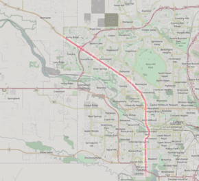
Crowchild Trail
| |
|---|---|
| Alberta Highway 1A | |
 | |
| Route information | |
| Maintained by City of Calgary | |
| Length: | 22.3 km (13.9 mi) |
| Major junctions | |
| South end: | Linden Drive SW |
|
Glenmore Trail Bow Trail Memorial Drive Shaganappi Trail | |
| North end: | Twelve Mile Coulee Road |
| Location | |
| Major cities: | Calgary |
| Highway system | |
| Provincial highways in Alberta | |

Crowchild Trail is a major expressway on the west side of Calgary, Alberta, Canada. The segment from 12 Mile Coulee Road to 16 Avenue NE (Trans-Canada Highway) is designated as Highway 1A by Alberta Transportation.
Part of this road was the Morley Trail when it was an actual trail. It was first paved in the 1930s. It then became the main highway to Banff and was the home of Eamon's Bungalow Camp and service station. When the Trans-Canada Highway was created it dropped in importance.[1]
The road was originally signed as 24th Street SW from North Glenmore Park to the Bow River, 24th Street NW from the Bow to the intersection with 16th Avenue NW (the Trans-Canada Highway, Highway 1), and Highway 1A from 16th Ave NW to the city limits. It was renamed Crowchild Trail in March, 1971 in honour of David Crowchild, Chief of the Tsuu T'ina Nation from 1946 to 1953.
Crowchild Trail's south terminus is located at North Glenmore Park as a minor arterial road. Exiting northbound from the park the road intersects several residential streets within the communities of Lakeview and North Glenmore Park, and several residential dwellings are located on the Trail itself. Continuing northward, its first major intersection is with Glenmore Trail at an interchange that was built in 1981, which is the point at which Crowchild becomes an freeway. After an interchange was completed at 50th Avenue SW in 2003, Crowchild Trail became a true freeway from Glenmore Trail to Kensington Road NW, with overpasses at Flanders Avenue SW, 33 Avenue SW and 17 Avenue SW and interchange intersections with 10 Avenue SW, Bow Trail and Memorial Drive. The speed limit on the freeway sections are 80 km/h (50 mph).
Traffic slows immediately north of the Bow River (dropping to a principal arterial with a 60 km/h (37 mph) limit), with signal-controlled intersections at Kensington Road NW and 5th Avenue NW, and heavy use by football fans and transit users at McMahon Stadium and students of the University of Calgary. After 24th Avenue NW the road veers northwest, and once again becomes an uninterrupted freeway until the Stoney Trail ring road. As of 2012, the interchange was completed at Stoney Trail, which makes Crowchild Trail a freeway nearly to the city limits, at which point (following a signalized intersection with Twelve Mile Coulee Road), Crowchild Trail continues as Bow Valley Trail, eventually linking to the towns of Cochrane and Canmore.
Major intersections
From south to north, the following intersections are observed along Crowchild Trail.[2] The entire route is in Calgary. All exits are unnumbered.
| km[3] | mi | Destinations | Notes | ||||
|---|---|---|---|---|---|---|---|
| 0.0 | 0.0 | Linden Drive / North Glenmore Park | Starts north of Glenmore Reservoir as a minor arterial road | ||||
| 0.4 | 0.25 | 66 Avenue SW | At grade; four-way stop | ||||
| 0.7 | 0.43 | 63 Avenue SW | At grade; traffic signals | ||||
| 1.0 | 0.62 | Glenmore Trail (Unsigned Hwy 8) | Diamond interchange with signalized intersections on Crowchild Trail. Southbound to eastbound flyover. | ||||
| Freeway begins | |||||||
| 1.6 | 0.99 | 54 Avenue SW | Northbound right-in/right-out | ||||
| 2.1 | 1.3 | 50 Avenue SW / Mount Royal Gate – Mount Royal University | Partial cloverleaf interchange | ||||
| 3.0 | 1.9 | Flanders Avenue / Richard Road | Dogbone interchange under construction[4] | ||||
| 3.9 | 2.4 | 33 Avenue SW | Diamond interchange | ||||
| 4.6 | 2.9 | 17 Avenue SW | Partial cloverleaf interchange | ||||
| 6.2 | 3.9 | Bow Trail – City Centre | Interchange No access from Bow Trail eastbound to Crowchild Trail southbound No access from Crowchild Trail northbound to Bow Trail westbound. | ||||
| 6.4 | 4.0 | 12 Avenue SW (via 10 Avenue SW) | Southbound exit, northbound entrance | ||||
| 6.9 | 4.3 | Crowchild Trail Bridge across Bow River | |||||
| 4.6 | 2.9 | Memorial Drive | Interchange | ||||
| 7.3 | 4.5 | Freeway ends, expressway begins | |||||
| Kensington Road | At grade; traffic signals | ||||||
| 7.5 | 4.7 | 2 Avenue SW | Northbound right-in/right-out | ||||
| 7.9 | 4.9 | 5 Avenue NW | Traffic signals | ||||
| 8.5 | 5.3 | University Drive – University of Calgary | Northbound exit, southbound entrance | ||||
| 8.8 | 5.5 | 13 Avenue NW (To University Drive) | Southbound exit only | ||||
| 9.0 | 5.6 | Northbound exit, southbound entrance | |||||
| 9.5 | 5.9 | 23 Avenue NW (To Banff Trail) – McMahon Stadium | At grade; traffic signals | ||||
| 9.6 | 6.0 | Banff Trail | At grade No access to southbound Banff Trail (business access only) Connects 16 Avenue NW to northbound Crowchild Trail | ||||
| 9.5 | 5.9 | 24 Avenue NW – University of Calgary | At grade; traffic signals Crowchild Trail turns northwest. | ||||
| Freeway begins | |||||||
| 10.2 | 6.3 | No access from Crowchild Trail | |||||
| 11.0 | 6.8 | Charleswood Drive / 32 Avenue NW – University of Calgary | Folded diamond interchange | ||||
| 9.6 | 6.0 | Brentwood Road | Westbound exit only | ||||
| 10.2 | 6.3 | Brisebois Drive / 40 Avenue NW | Folded diamond interchange | ||||
| 12.6 | 7.8 | Northland Drive | Diamond interchange | ||||
| 13.3 | 8.3 | Shaganappi Trail | Split diamond interchange | ||||
| 14.6 | 9.1 | 53 Street NW | Diamond interchange | ||||
| 15.7 | 9.8 | Sarcee Trail / Silver Springs Gate | Folded diamond interchange | ||||
| 17.7 | 11.0 | Nose Hill Drive | Diamond interchange | ||||
| 18.0 | 11.2 | Crowfoot Parade | Diamond interchange Use Nose Hill Drive exit ramp. | ||||
| 18.2 | 11.3 | Crowfoot Rise | Westbound right-in/right out Use Nose Hill Drive exit ramp. | ||||
| 19.7 | 12.2 | Cloverstack interchange | |||||
| 20.3 | 12.6 | No access from Crowchild Trail | |||||
| 22.3 | 13.9 | Freeway ends | |||||
| 12 Mile Coulee Road | Traffic signals | ||||||
| Continues as | |||||||
| |||||||
Gallery
-
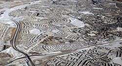
Crowchild Trail at the interchange with Stoney Trail
-
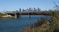
Bridge over Bow River
-

C-Train tracks along Crowchild Trail
-
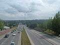
Looking south just north of 5 Ave NW
See also
References
- ↑ "Historic Eamon's gas station to be saved". May 7, 2012. Archived from the original on March 21, 2013. Retrieved October 23, 2016.
- ↑ Sherlock's Map of Calgary (16th ed.). Langdon, Alberta: Sherlock Publishing Ltd. 2014. pp. 7, 8, 17, 18, 26, 34, 40. ISBN 1-895229-80-4.
- ↑ "Google Maps". Google Maps. Retrieved 19 April 2016.
- ↑ "New Crowchild Trail / Flanders Avenue Interchange" (PDF). The City of Calgary. Retrieved 21 April 2016.