Macleod Trail
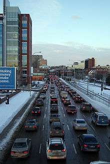 Macleod Trail in downtown Calgary, 2011 | |
| Part of |
|
|---|---|
| Maintained by | City of Calgary, Alberta Transportation |
| Length | 27.7 km[1] (17.2 mi) |
| Location | Calgary, Alberta |
| North end | Riverfront Avenue |
| Major junctions |
Glenmore Trail Anderson Road |
| South end |
|
Macleod Trail is a major road in Calgary, Alberta, Canada. It is a six- to eight-lane principal arterial road extending from downtown Calgary to the south of the city, where it merges into Highway 2. South of Anderson Road, Macleod Trail is an expressway and is slated to be upgraded to a freeway in the future. It is named for its destination to the south, Fort Macleod.
The road effectively divides the south-west and the south-east quadrants of the city, and many communities (inner city as well as suburban) were developed along its course.[2] Macleod Trail (along with Crowchild Trail-Glenmore Trail-14 Street S and Anderson Road) constitutes one of the four major north-south corridors of the city.[3]
In the downtown section, the road passes by Calgary City Hall, Olympic Plaza, the Calgary Public Library, and the EPCOR Centre for the Performing Arts. South of downtown, it defines the western edge of the Calgary Stampede grounds, as it passes through the Beltline district, then provides access to Talisman Centre as it runs between the historic inner city communities of Mission and Ramsay. South of Elbow River, Macleod Trail becomes a two-way road and has various motels established on its sides, and Chinook Centre faces the road as it passes between the communities of Meadowlark Park, Kingsland and Fairview. Macleod Trail is lined with commercial developments on both sides for its entire length between Erlton and Lake Bonavista, including strip malls, auto malls, big-box stores and shopping centres such as Southcentre Mall, and Calgary's largest suburban office complex at Southland Park. The southern leg of the C-Train LRT system (Route 201) is also developed along Macleod Trail.
In November 2007, Calgary City Council approved a functional planning study for the portion of Macleod Trail that extends from Anderson Road north to Downtown. Expected recommendations include interchanges at Heritage Drive and Southland Drive, as well as possible traffic signal refinements.[4] In addition, three other interchange locations are planned to be constructed within ten years. They are at the intersection with Lake Fraser Gate, at the intersection with 162 Avenue, and at the intersection with 194 Avenue.[5][6] This would make Macleod Trail a freeway from Anderson Road to the city limits.
Major intersections
From north to south:[7]
| Location | km[1] | mi | Destinations | Notes | |||
|---|---|---|---|---|---|---|---|
| Calgary | 0.0 | 0.0 | Riverfront Avenue | At grade; one-way couplets. Northbound traffic follows Macleod Trail, southbound traffic follows 1 Street SE. | |||
| 0.2 | 0.12 | 4 Avenue SE | At grade; traffic signals. Westbound one-way. | ||||
| 0.3 | 0.19 | 5 Avenue SE | At grade; traffic signals. Eastbound one-way. Connects to Memorial Drive and Edmonton Trail. | ||||
| 0.4 | 0.25 | 6 Avenue SE | At grade; traffic signals. Westbound one-way west of Macleod Trail. | ||||
| 0.5 | 0.31 | Transit mall; traffic signals. Passes the historic Calgary City Hall and Calgary Public Library. | |||||
| 0.6 | 0.37 | 8 Avenue SE (Stephen Avenue) | Pedestrian mall; traffic signals. Passes the Calgary Municipal Building and Olympic Plaza. | ||||
| 0.7 | 0.43 | 9 Avenue SE | At grade; traffic signals. Eastbound one-way. | ||||
| Exits Downtown Calgary. | |||||||
| 0.8 | 0.50 | 10 Avenue SE | At grade; traffic signals. | ||||
| 0.9 | 0.56 | 11 Avenue SE | At grade; traffic signals. Westbound one-way. | ||||
| 1.1 | 0.68 | 12 Avenue SE – Stampede Park, Scotiabank Saddledome | At grade; traffic signals. Eastbound one-way. | ||||
| 1.4 | 0.87 | At grade; traffic signals. | |||||
| 1.8 | 1.1 | Crosses the Elbow River Victoria Bridge (northbound) and Pattison Bridge (southbound) | |||||
| 1.9 | 1.2 | 1 Street SE | One-way transition; becomes two-way divided arterial road. South-to-north U-turn ramp. | ||||
| 2.3 | 1.4 | At grade; traffic signals. Interchange proposed.[8] | |||||
| 3.1 | 1.9 | Spiller Road | Northbound right in/right out. Original alignment of Macleod Trail (pre-1967).[9] | ||||
| 3.3 | 2.1 | 36 Avenue SE / Mission Road | At grade; traffic signals. | ||||
| 3.6 | 2.2 | At grade; traffic signals. | |||||
| 3.9 | 2.4 | 42 Avenue S | At grade; traffic signals. | ||||
| 4.3 | 2.7 | 45 Avenue SW | At grade; traffic signals. | ||||
| 4.8 | 3.0 | 50 Avenue SW | At grade; traffic signals. | ||||
| 5.2 | 3.2 | 53 Avenue SW | At grade; traffic signals. | ||||
| 5.7 | 3.5 | 58 Avenue SW | At grade; traffic signals. | ||||
| 5.9 | 3.7 | Access road – Chinook Centre | At grade; traffic signals. No northbound entrance. | ||||
| 6.1 | 3.8 | At grade; traffic signals. | |||||
| 6.4 | 4.0 | Single-point urban interchange; traffic signals. | |||||
| 7.0 | 4.3 | 71 Avenue S | At grade; traffic signals. | ||||
| 7.4 | 4.6 | 75 Avenue SW | At grade; traffic signals. | ||||
| 7.7 | 4.8 | 78 Avenue SW | Grade separated. | ||||
| 8.1 | 5.0 | At grade; traffic signals. | |||||
| 8.5 | 5.3 | 86 Avenue SE / Hull Avenue | At grade; traffic signals. | ||||
| 8.9 | 5.5 | 90 Avenue SE | At grade; traffic signals. | ||||
| 9.3 | 5.8 | 94 Avenue SE | At grade; traffic signals. | ||||
| 9.7 | 6.0 | At grade; traffic signals. | |||||
| 10.2 | 6.3 | 99 Avenue S | At grade; traffic signals. | ||||
| 10.5 | 6.5 | At grade; traffic signals. | |||||
| 10.8 | 6.7 | At grade; traffic signals. Becomes an expressway. | |||||
| 10.9 | 6.8 | Access road – Southcentre Mall | Northbound right in/right out. | ||||
| 11.3 | 7.0 | Anderson Road – To | Partial cloverleaf interchange. | ||||
| Lake Fraser Drive | Northbound exit only. | ||||||
| 12.1 | 7.5 | Lake Fraser Drive | Northbound right in/right out. | ||||
| 12.5 | 7.8 | Lake Fraser Gate | At grade; traffic signals. Northbound right in/right out weekdays from 6 a.m. - 8:30 a.m.[10] | ||||
| 13.5 | 8.4 | Partial cloverleaf interchange. Also accesses Lake Fraser Drive. | |||||
| 13.7 | 8.5 | Crosses Fish Creek | |||||
| 14.1 | 8.8 | Bannister Road / Shawnee Gate – Fish Creek Provincial Park | Southbound exit; northbound entrance. | ||||
| 14.6 | 9.1 | Southbound right in/right out. | |||||
| 14.9 | 9.3 | 149 Avenue SE to Bannister Road – Fish Creek Provincial Park | Northbound right in/right out. Northbound access to James McKevitt Road. | ||||
| 15.5 | 9.6 | Partial cloverleaf interchange. Also accesses Shawville Boulevard and Bannister Road. | |||||
| 16.6 | 10.3 | Diverging diamond interchange under construction.[11] | |||||
| 17.2 | 10.7 | Shawville Boulevard | Southbound exit only. | ||||
| 18.0 | 11.2 | Partial cloverleaf interchange. Future cloverstack interchange. | |||||
| 20.0 | 12.4 | 194 Avenue SE | At grade; traffic signals. | ||||
| 21.2 | 13.2 | 210 Avenue SE | At grade; traffic signals. Intersections are offset by 70 m (230 ft). | ||||
| ↑ / ↓ | 23.3 | 14.5 | Southbound right in/right out. | ||||
| M.D. of Foothills No. 31 | 25.4 | 15.8 | Dunbow Road – De Winton, Heritage Pointe | At grade; traffic signals. Northbound access to Hwy 552. | |||
| 27.7 | 17.2 | Y interchange. Northbound exit, southbound entrance. | |||||
| Continues as | |||||||
1.000 mi = 1.609 km; 1.000 km = 0.621 mi
| |||||||
See also
References
- 1 2 "Macleod Trail". Google Maps. Google. Retrieved December 3, 2016.
- ↑ City of Calgary (February 2005). "The Calgary Transportation Plan". Archived from the original on 2007-09-30. Retrieved 2007-05-25.
- ↑ City of Calgary (July 2002). "Transportation System Map". Archived from the original on 2007-09-30. Retrieved 2007-05-25.
- ↑ Calgary Herald (November 2007). "Alderman Urging Macleod Trail Study". Retrieved 2007-12-03.
- ↑ City Of Calgary (April 2007). "Calgary Regional Transportation Model Anticipated Projects List 2001-2015" (PDF). Retrieved 2007-12-03.
- ↑ City Of Calgary (April 2007). "Calgary Regional Transportation Model Anticipated Projects List 2020-2035" (PDF). Retrieved 2007-12-03.
- ↑ Sherlock's Map of Calgary (16th ed.). Langdon, Alberta: Sherlock Publishing Ltd. 2014. pp. 28, 35, 41, 47, 53, 57, 78. ISBN 1-895229-80-4.
- ↑ "25 Avenue S.E. Connector". Transportation Planning. City of Calgary. March 11, 2011. Retrieved December 3, 2016.
- ↑ Carter, Beth (April 2011). "Old North Trail" (PDF). Ramsay News. Ramsay Community Association. p. 10. Retrieved December 3, 2016.
- ↑ "Lake Fraser Gate traffic improvements". City of Calgary. October 10, 2012. Retrieved December 3, 2016.
- ↑ "Macleod Trail / 162 Avenue S Interchange". Transportation Infrastructure. City of Calgary. October 1, 2014. Retrieved December 4, 2016.
