Alberta Highway 9
| ||||
|---|---|---|---|---|
 | ||||
| Route information | ||||
| Length: | 325 km (202 mi) | |||
| Major junctions | ||||
| West end: |
| |||
|
| ||||
| East end: |
Saskatchewan border near Alsask continues east as | |||
| Location | ||||
| Specialized and rural municipalities: | Rocky View County, Wheatland County, Kneehill County, Starland County, Special Area No. 2, Special Area No. 3 | |||
| Towns: | Irricana, Drumheller, Hanna | |||
| Villages: | Beiseker, Munson, Youngstown, Cereal | |||
| Highway system | ||||
|
Provincial highways in Alberta
| ||||

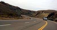
Alberta Provincial Highway No. 9[1] is an east-west highway through south-central Alberta, Canada. It is designated a core route in Canada's National Highway System, connecting the Calgary Region with Saskatoon, Saskatchewan.[2] Highway 9 spans approximately 325 km (202 mi) from the Trans-Canada Highway (Highway 1) east of Calgary to Alberta's border with Saskatchewan.[3][4]
Route description
Highway 9 begins at its interchange with Highway 1 approximately 10 km (6.2 mi) east of Chestermere and 20 km (12 mi) west of Strathmore, and approximately 6 km (3.7 mi) north of Langdon via Highway 797. For its first 45 km (28 mi), Highway 9 generally runs in a north/south direction to Beiseker. At Beiseker, Highway 9 runs in an east-west direction for 64 km (40 mi) to Drumheller. It then runs north/south for 22 km (14 mi) from Drumheller to its intersection with Highway 27 east of Morrin. The highway then runs east/west for the balance of route to the Saskatchewan border, providing connections to Hanna and Oyen as well as numerous smaller communities, and generally running parallel to Highway 12 to the north. The highway continues as Saskatchewan Highway 7 in a northeast direction toward Saskatoon.[2][3][4]
History
Over the past few years, the province of Alberta has executed a number of upgrades to the highway, widening shoulders and realigning the road (most recently just west of Drumheller, although the new alignment now bypasses the Horseshoe Canyon landmark as a result). As of 2007, however, the province has yet to twin any stretch of the busy highway, and there have been calls for interchanges to be built at its junctions with Highway 21 and the Trans-Canada due to the number of fatal automobile accidents that have happened at these locations.
A full scale interchange was constructed in 2007 where Highway 9 crosses the Trans-Canada Highway. As well, the junction with Highway 21 was changed to a four-way stop in early 2011.
Major intersections
The following is a list of major intersections along Alberta Highway 9 from west to east.[3][4]
| Rural/specialized municipality | Location | km | mi | Destinations | Notes | ||
|---|---|---|---|---|---|---|---|
| Rocky View County | | 0 | 0.0 | Hwy 9 begins and travels north. Grade separated. | |||
| | 13 | 8.1 | |||||
| | 19 | 12 | |||||
| | 33 | 21 | |||||
| Irricana | 35 | 22 | UAR 144 west | ||||
| Beiseker | 43 | 27 | UAR 141 west | ||||
| 44 | 27 | Hwy 9 branches east. | |||||
| Wheatland County / Kneehill County | | 64 | 40 | ||||
| | 70 | 43 | |||||
| | 83 | 52 | |||||
| Kneehill County | | 99 | 62 | ||||
| Town of Drumheller | 107 | 66 | 5 Street SE | Hwy 9 branches northwest Hwy 56 concurrency begins | |||
| 108 | 67 | 2 Street SW | Hwy 9/56 branches north | ||||
| 108.5 | 67.4 | Crosses Red Deer River | |||||
| 109 | 68 | ||||||
| 110 | 68 | ||||||
| Starland County | Munson | 119 | 74 | Township Road 302 | |||
| | 129 | 80 | Hwy 9 branches east. Hwy 56 concurrency ends. | ||||
| | 142 | 88 | |||||
| | 152 | 94 | |||||
| | 162 | 101 | UAR 122 north – Craigmyle | ||||
| Special Area No. 2 | | 173 | 107 | ||||
| | 175 | 109 | |||||
| Hanna | 182 | 113 | Range Road 144 | ||||
| | 190 | 120 | Hwy 36 concurrency begins. | ||||
| | 193 | 120 | Hwy 36 concurrency ends. | ||||
| Special Area No. 3 | Youngstown | 238 | 148 | Hwy 884 concurrency begins. | |||
| | 245 | 152 | Hwy 884 concurrency ends. | ||||
| Cereal | 268 | 167 | |||||
| Oyen | 292 | 181 | |||||
| | 310 | 190 | Hwy 899 concurrency begins. | ||||
| | 311 | 193 | Hwy 899 concurrency ends. | ||||
| Sibbald | 314 | 195 | Range Road 20 | ||||
| | 325 | 202 | Alberta – Saskatchewan border | ||||
| Continues as | |||||||
| |||||||
References
- ↑ Provincial Highways Designation Order, Alberta Transportation, p. 3
- 1 2 "National Highway System". Transport Canada. 2009-12-13. Retrieved 2011-03-14.
- 1 2 3 "2010 Provincial Highways 1 - 216 Series Progress Chart" (PDF). Alberta Transportation. March 2010. Retrieved 2011-03-14.
- 1 2 3 Alberta Official Road Map (Map) (2010 ed.). Alberta Tourism, Parks and Recreation. § L–6, L-7, L–8.
External links
- 2010 Provincial Highways 1 - 216 Series Progress Chart (map, 8 MB) by Alberta Transportation.
- Mile by Mile. Alberta Highway # 9