Şanlıurfa Province
| Şanlıurfa Province Şanlıurfa ili | |
|---|---|
| Province of Turkey | |
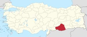 Location of Şanlıurfa Province in Turkey | |
| Country | Turkey |
| Region | Southeastern Anatolia |
| Subregion | Şanlıurfa |
| Government | |
| • Electoral district | Şanlıurfa |
| Area | |
| • Total | 18,584 km2 (7,175 sq mi) |
| Population (2010-12-31)[1] | |
| • Total | 1,663,371 |
| • Density | 90/km2 (230/sq mi) |
| Area code(s) | 00414 |
| Vehicle registration | 63 |
Şanlıurfa Province (Turkish: Şanlıurfa ili) or simply Urfa Province is a province in southeastern Turkey. The city of Şanlıurfa is the capital of the province which bears its name. The population is 1,845,667 (2014).
The province is famous for its Abrahamic sites such as Balıklıgöl, where Prophet Abraham was cast by Nimrod into fire that is believed to have turned to water, and Mevlid-i Halil Mosque where Abraham was born in the cave next to the mosque. Also lying within the district, approximately 12 km (7 mi) northeast of the city of Şanlıurfa, is the pre-historic site of Göbekli Tepe, where continuing excavations have unearthed 12,000-year-old sancturies dating from the early Neolithic period, considered to be the oldest temples in the world, predating Stonehenge by 6,000 years.
Population in 1990 was 1,001,455; 551,124 in the district centers, 450,331 in rural villages. By 2000, the population of Şanlıurfa province had grown to 1,436,956 and that of Şanlıurfa city, 829,000. Its provincial capital is the city of Şanlıurfa, the traffic code is 63.
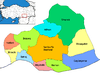
Districts
Şanlıurfa province is divided into 13 districts (capital district in bold):
- Şanlıurfa (Central district. In 2014 it was split into three districts: Eyyübiye, Haliliye and Karaköprü)
- Akçakale
- Birecik
- Bozova
- Ceylanpınar
- Halfeti
- Harran
- Hilvan
- Siverek
- Suruç
- Viranşehir
Geography
Area 18,584 km² (7,173 sq. miles), the largest province of Southeast Anatolia with:
- Adıyaman to the north;
- Syria to the south;
- Mardin and Diyarbakır to the east;
- Gaziantep to the west;
Şanlıurfa includes several major components of the Southeastern Anatolia Project (in Turkish Güneydogu Anadolu Projesi (GAP)) designed to:
- exploit the hydropower potential of the Tigris and Euphrates Rivers;
- dramatically expand irrigation for agriculture; and
- develop the economy of the region.
This very large-scale, state-sponsored development project involved the damming, redirecting, hydroelectric tapping and other utilization of rivers in this broad, semi-arid region. (The rivers then flow into Syria and Iraq). The GAP project includes 22 dams, hundreds of miles of irrigation works.
Even before GAP, Şanlıurfa Province had the largest share of cultivated and cultivable land in the GAP region, due to its flatness and highly fertile, agricultural land. The Şanlıurfa and Harran Plains extend over an area of about 1,500 km² (579 sq. miles). Irrigating these plains is one of the most important components of GAP.
According to the 1990 census, Şanlıurfa Province contained 148,521 households, and the average household size was 6.74 persons. 71% of household heads described their occupation as farming. In 1992, Şanlıurfa had the highest concentration of land ownership in Turkey, with a landless rate of 48%. While 5% of the families in the province owned 65% of the land, the vast majority (70%) owned only 10%.
Şanlıurfa’s average annual growth rate between 1985 and 1990 was 4.6%, considerably higher than both the national and regional averages.
Demographics
The province has a diverse population, including Kurds, Arabs,Turks and Yazidis. According to political scientist Nicole Watts, 35% of the province's population are Kurds.[2]
History
See Şanlıurfa and Edessa, Mesopotamia.
Politics
The politics of Şanlıurfa Province are still widely shaped by the electoral adherence of a number of Zaza clans (aşiret). In particular, the districts along the Euphrates river have long been a power base for the traditional center-right Democratic Party (DYP), formerly under Süleyman Demirel and Tansu Çiller, and now under ex-chief of police Mehmet Ağar.
Turkey's ruling Justice and Development Party (AKP) did come first in 2004 local elections with a comfortable 43.04%, but the DYP, currently out of parliament, seems to be recovering under the new leadership of Ağar, who is known for his intimacy with the local feudal structures.
Much effort is deployed by the Democratic People's Party (DEHAP), campaigning on Kurdish-identity consciousness arguments, to attract clan votes, but this is complicated by polemics of the definitions of a Kurdish and a distinct Zaza identity. Several clans opposed the Kurdistan Workers' Party (PKK) in the 1980s and the 1990s. Still, DEHAP registered so much of me success in the 2004 local elections, coming second in the province with 1 6.95%, rising from 12,06% in 1 9, with a faithful electorate in the two districts bordering Diyarbakır Province. DEHAP traditionally avoids the districts bordering Syria and populated by ethnic Arabs, where they did not even name candidates for the 2004 elections.
The Nationalist Movement Party (MHP), campaigning on Turkish-identity consciousness arguments, after having scored an exceptional 7,18% in 1999, has in 2004 ebbed back to a more usual 2,97%.
The center-left Republican People's Party (CHP) usually obtains a modest share, slightly below 10%.
The current mayor of Şanlıurfa is Ahmet Eşref Fakibaba, a former general surgeon who has helped renovate the city and bring it up to a cleaner and structured level. He is known for his strong position against clan governance.
Places of interest
The following tombs and sacred spots are located within the province:[3]
- Prophet Ibrahim (Abraham)'s birthplace
- Prophet Ayyub (Job)'s cave and tomb
- Prophet Alyasa (Elisha)'s Tomb
- Imam Bakir's Tomb
- Shaykh Hayat al-Harrani's Tomb
- The first burial place of Said Nursi
- Rahma Hatun's Tomb
- Neolithic Temple at Göbekli Tepe
- Neolithic Settlement at Nevali Çori
Gallery
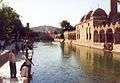
Balıklı Göl and Ridwaniya Mosque 
Balıklı Göl (Fish Pond) and people 
Mevlid-i Halil (Birth of Abraham) Mosque 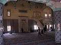
Salahaddin Mosque 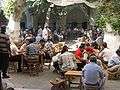
Urfa's central market 
Traditional Narrow Streets 
Urfa's retailers 
Harran District
See also
References
- ↑ Turkish Statistical Institute, MS Excel document – Population of province/district centers and towns/villages and population growth rate by provinces
- ↑ Watts, Nicole F. (2010). Activists in Office: Kurdish Politics and Protest in Turkey (Studies in Modernity and National Identity). Seattle: University of Washington Press. p. 167. ISBN 978-0-295-99050-7.
- ↑ TÜRBELER