Bilecik Province
| Bilecik Province Bilecik ili | |
|---|---|
| Province of Turkey | |
 Location of Bilecik Province in Turkey | |
| Country | Turkey |
| Region | East Marmara |
| Subregion | Bursa |
| Government | |
| • Electoral district | Bilecik |
| Area | |
| • Total | 4,307 km2 (1,663 sq mi) |
| Population (2010-12-31)[1] | |
| • Total | 225,381 |
| • Density | 52/km2 (140/sq mi) |
| Area code(s) | 0228 |
| Vehicle registration | 11 |
Bilecik Province (Turkish: Bilecik ili) is a province in midwest Turkey, neighboring Bursa to the west, Kocaeli and Sakarya to the north, Bolu to the east, Eskişehir to the southeast and Kütahya to the south, spanning an area of 4,307 km². Population is 225,381. Most of the province laid down in Marmara Region but eastern parts of Gölpazarı and Söğüt district and districts of İnhisar and Yenipazar remained in Black Sea Region, smaller southeastern parts of Bozüyük and Söğüt remained in Central Anatolian Region and smaller southwestern part of Bozüyük remained in Aegean Region.
Districts
Bilecik province is divided into 8 districts (capital district in bold):
History
The region was inhabited as early as 3000 BC, and was part of the territory controlled by such notable civilizations as the Hittites (1400–1200 BC), the Phrygians (1200–676 BC), Lydians (595–546 BC), Persians (546–334 BC), Romans (74–395 AD) and Byzantians (395 AD to late 13th century, with two brief occupations by Ummayads in between).
The region also contains Söğüt, the small town where the Ottoman Empire was founded in 1299, and is the source of important archeological as well as cultural artifacts.
Sites of interest
In Söğüt a site of interest is the Ethnographical Museum.
The town Bilecik is famous for its numerous restored Turkish houses.
Some other sites of interest in the province are: Osman Gazi and Orhan Gazi mosques, Seyh Edebali and Mal Hatun mausoleums, Köprülü Mehmet Pasha mosque, Köprülü Caravanserai, Kaplikaya tombs, Rüstem Pasha mosque, and Gülalan Pavilion.
Gallery
-
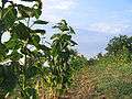
A view from Çengeller village in Gölpazarı
-

Çelebi Mehmet Mosque in Söğüt
-

The türbe of Dursun Fakih in Söğüt

See also
References
- ↑ Turkish Statistical Institute, MS Excel document – Population of province/district centers and towns/villages and population growth rate by provinces
External links
| Wikimedia Commons has media related to Bilecik Province. |
- (Turkish) Bilecik governor's official website
- (Turkish) Bilecik municipality's official website
- Bilecik weather forecast information
- (Turkish) Yerel Yöneylem Kalkınma Derneği - Gölpazarı
- (Turkish) Bayırköy's local website
- (Turkish) Virtual platform of Bilecik
- (Turkish) Virtual platform of Bilecik

| ||
Metropolitan municipalities are bolded. | ||
Coordinates: 40°06′24″N 30°07′33″E / 40.10667°N 30.12583°E