Weed, California
| Weed, California | |
|---|---|
| City | |
| City of Weed | |
|
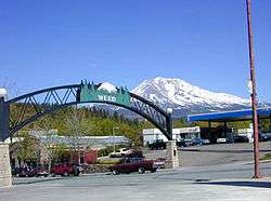
Entrance to Weed, California with Mount Shasta in the background. | |
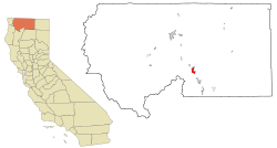 Location in Siskiyou County and the state of California | |
 Weed, California Location in the United States | |
| Coordinates: 41°25′27″N 122°23′4″W / 41.42417°N 122.38444°WCoordinates: 41°25′27″N 122°23′4″W / 41.42417°N 122.38444°W | |
| Country |
|
| State |
|
| County |
|
| Incorporated | January 25, 1961[1] |
| Area[2] | |
| • Total | 4.795 sq mi (12.417 km2) |
| • Land | 4.790 sq mi (12.405 km2) |
| • Water | 0.005 sq mi (0.012 km2) 0.10% |
| Elevation | 3,425 ft (1,044 m) |
| Population (2010) | |
| • Total | 2,967 |
| • Density | 620/sq mi (240/km2) |
| Time zone | Pacific (PST) (UTC-8) |
| • Summer (DST) | PDT (UTC-7) |
| ZIP code | 96094 |
| Area code(s) | 530 |
| FIPS code | 06-83850 |
| GNIS feature ID | 1652650 |
| Website | http://www.ci.weed.ca.us/ |
Weed is a city located in Siskiyou County, California, United States. As of the 2010 Census, the town had a total population of 2,967, down from 2,979 in 2000. There are several unincorporated communities adjacent to, or just outside Weed proper. These include Edgewood, Carrick, and Lake Shastina. These communities generally have mailing addresses that use Weed, or its ZIP code. The total population of this area in 2007 was 6,318.[3] Weed is about 10 miles (16 km) west-northwest of Mount Shasta, a prominent northern California landmark, and the second-tallest volcano in the Cascade Range.
Weed's city motto is "Weed like to welcome you".[4] It has frequently been noted on lists of unusual place names.[5][6]
History
The town of Weed gets its name from the founder of the local lumber mill and pioneer Abner Weed, who discovered that the area's strong winds were helpful in drying lumber. In 1897, Abner Weed bought the Siskiyou Lumber and Mercantile Mill and 280 acres (1.1 km2) of land in what is now the City of Weed, for the sum of $400.[7] By the 1940s Weed boasted the world's largest sawmill.
Boles Fire
On September 15, 2014, a fast moving wildfire called the "Boles Fire" spread through the town with massive force fueled by 40-mph winds. The fire started behind the Boles Creek Apartments in the central part of Weed at approximately 1:30pm and within 4 hours quickly spread to over 200 acres. Evacuations were immediately ordered and a shelter was first set up at College of the Siskiyous, but as fire headed towards the college, the evacuation center was relocated to the Siskiyou Golden Fairgrounds in Yreka, then Yreka and Mount Shasta High Schools, then the Armory in Mt. Shasta.
Over 200 structures were damaged or destroyed, including the high school, elementary school and Roseburg mill, many homes, and businesses. The schools and mill only sustained minimal damage to outbuildings. About 7,678 Pacific Power customers in both Weed and Mt. Shasta lost power as a result of the fire.[8][9][10][11]
Beaughan Spring
The town of Weed gets its only source of public water from the Beaughan Spring. The pristine water is piped directly to homes.
In September 2016, the New York Times reported French billionaire Pierre Papillaud is demanding that Weed give up its Beaughan Spring spring water source so that Papillaud's bottle water company could have more water to sell. Disconnecting from Beaughan Spring would leave Weed without public water. [12]
Geography
Weed is located at 41°25'27" north, 122°23'4" west (41.424298, -122.384417).[13] It is located off Interstate 5, 49 miles (79 km) south of the California–Oregon border. The next large town to the north on I-5 is Yreka; to the south is the City of Mount Shasta. U.S. Route 97 runs to the northeast and Klamath Falls, Oregon.
According to the United States Census Bureau, the city has a total area of 4.8 square miles (12 km2), of which 0.10% of is covered by water. The closest cities to Weed, with a population greater than 50,000, are: Redding, California (69 miles south); and Medford, Oregon (91 miles north).
Climate
Weed has a warm-summer Mediterranean climate (Csb according to the Köppen climate classification system), with cool, wet winters and warm, dry summers.[14] Its average annual precipitation is 23.64 in (600 mm).[15] Its USDA hardiness zone is 7b.[16]
| Weed (1971-2000 normals) | ||||||||||||||||||||||||||||||||||||||||||||||||||||||||||||
|---|---|---|---|---|---|---|---|---|---|---|---|---|---|---|---|---|---|---|---|---|---|---|---|---|---|---|---|---|---|---|---|---|---|---|---|---|---|---|---|---|---|---|---|---|---|---|---|---|---|---|---|---|---|---|---|---|---|---|---|---|
| Climate chart (explanation) | ||||||||||||||||||||||||||||||||||||||||||||||||||||||||||||
| ||||||||||||||||||||||||||||||||||||||||||||||||||||||||||||
| ||||||||||||||||||||||||||||||||||||||||||||||||||||||||||||
Transportation
Weed is located at the intersection of Interstate 5 and U.S. Route 97. Interstate 5 is the primary north-south transportation corridor for the west coast of the United States running from the Mexico–US border to the Canada–US border. U.S. Route 97 is a major north-south U.S. highway continuing from Weed in a northeasterly direction toward Klamath Falls, Oregon, thence through Oregon and Washington to the Canada–US border. California State Route 265 also runs through the town of Weed, locally known as North Weed Boulevard. Only two blocks long, it is the shortest state highway in California.

Weed is served by Siskiyou County's public transportation bus lines, Siskiyou Transit and General Express, commonly called "The STAGE".[17]
The closest airports for commercial air travel are Rogue Valley International-Medford Airport and Redding Municipal Airport. The Weed Airport serves general aviation, and as a base of operations for search and rescue operations on Mount Shasta. Corporate visitors or geological researchers typically use this facility.
Amtrak trains pass through Weed, but do not stop there. The Amtrak bus/shuttle has one stop in North Weed. The nearest depot for Amtrak train travel is in Dunsmuir, approximately 15 miles (24 km) to the south.
Greyhound Bus Lines has a bus station, with both north and southbound buses making stops.
Industry, commerce, and education
Historic forestry-based industry
From its founding in 1901, to as late as the 1980s, Weed was home to a thriving lumber industry. Roseburg Forest Products (Plywood Production), International Paper Company, Morgan Products Ltd. (Wooden Door Manufacturing), and J.H. Baxter (Wood Treatment) were all located in Weed. The historic industrial area at the northeast corner of town has been plagued with environmental concerns and clean-up efforts as a result of chemicals used for wood treatment, as well as chemical residue from glue used in the door factory.[18]
Economy
Although historically reliant on logging, wood processing and forest-related products, Weed's economy has become more reliant on tourism as a source of economic activity. Weed's microbrewery, Mt. Shasta Brewing Company, relies on tourists for 92% of its business, according to co-owner Vaune Dillman.[19]
Today, most of the wood-product-related industry has been scaled back or ceased altogether, and new retail and light industrial activity is concentrated in the south-east corner of Weed. Retail at the south end of town, in the form of restaurants and hotels, caters primarily to tourist travel on the Interstate 5 corridor. Light manufacturing of bottled water from Crystal Geyser Water Company has also added economic stability to the area.
Weed is part of the Shasta Valley Enterprise Zone which provides tax breaks, fee reductions, and permit fast-tracking for employers locating in the area.[20]
As of 2007, the largest employers in Weed were:
- College of the Siskiyous (100–249 employees)
- Roseburg Forest Products (100–249 employees)
- Crystal Geyser CG Roxane (25-99 employees)
- Weed Union Elementary School District (25-99 employees)
As a small community with few retail outlets, taxable sales within the city are somewhat limited, totaling $89 million in 2012.[21]
In the November 2014 General Election, the voters of Weed passed Measure J which raised the city's sales and use tax rate by 0.25%.[22]
Education
Primary education in Weed is conducted at Weed Elementary School (K-8th Grade). Butteville Elementary School (K-8th) is just outside the City of Weed, in the hamlet of Edgewood, CA, and has an enrollment similar to Weed Elementary.
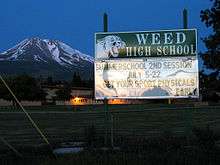
Secondary level students are educated at Weed High School (Grades 9-12) part of the Siskiyou Union High School District. Weed High School is known for its picturesque campus and diverse student body.[23] The College of the Siskiyous, located in Weed, provides a steady source of employment for faculty and staff, a source of visitors for the local economy, and offers a two-year junior college education with various associate degree and vocational certificate programs.
Recreation and tourism
Visitors use Weed as a base to engage in trout fishing in the nearby Klamath,[24] Sacramento[24][25][26] and McCloud[24][25] Rivers, or come to see and climb Mount Shasta, Castle Crags or the Trinity Alps.[27] Visitors also engage in nearby skiing (both alpine and cross-country) and biking, or hike to the waterfalls, streams and lakes in the area, including nearby Mossbrae Falls, Lake Siskiyou, Castle Lake and Shasta Lake.[27]
Recreation facilities and parks
Weed is centrally located to Castle Crags State Park, Lava Beds National Monument, and Lower Klamath National Wildlife Refuge. In addition to these state and federally designated parks, there are numerous local recreation opportunities.
- The Lake Shastina Golf Resort[28] offers an 18-hole championship golf course, and a 9-hole Scottish links course in a scenic setting.
- Local parks managed by the Weed Parks and Recreation District include: Lincoln Park (renamed Charles Byrd Community Park in 2004)[29] which is an 11-acre (4.5 ha) park with restrooms, a playground, basketball courts, and is the home to the Weed Skatepark;[30] as well as Bel Air Park, adjacent to College of the Siskiyous and home to the community swimming pool.
- Weed is located on the Volcanic Legacy Scenic Byway, and is a short distance from the Pacific Crest Trail.
- Nearby Mount Shasta Ski Park offers alpine and Nordic skiing in winter, as well as summertime mountain biking, rock climbing, and a concert series.
- The same wind that prompted the founding of Weed, as it was used to dry wood products, makes nearby Lake Shastina a popular destination for short-board windsurfing.[31]
- The Deer Mountain Snowmobile Park, is located 18 miles (29 km) north-east of Weed on US Highway 97 and offers 250 miles (400 km) of groommed trails.
Historic sites and museums
- The Weed Historic Lumber Town Museum is a small, seasonal, local museum in the heart of Weed. It features sawmill machinery and artifacts from the town's early days
- The Veterans' Living Memorial Sculpture Garden is 13 miles (21 km) north-east of Weed on US Highway 97, and consists of steel sculptures and other memorials honoring the service of U.S. Veterans.
Demographics
| Historical population | |||
|---|---|---|---|
| Census | Pop. | %± | |
| 1950 | 2,739 | — | |
| 1960 | 3,223 | 17.7% | |
| 1970 | 2,983 | −7.4% | |
| 1980 | 2,879 | −3.5% | |
| 1990 | 3,062 | 6.4% | |
| 2000 | 2,978 | −2.7% | |
| 2010 | 2,967 | −0.4% | |
| Est. 2015 | 2,556 | [32] | −13.9% |
2010
The 2010 United States Census[34] reported that Weed had a population of 2,967. The population density was 618.9 people per square mile (238.9/km²). The racial makeup of Weed was 2,221 (74.9%) White, 206 (6.9%) African American, 70 (2.4%) Native American, 121 (4.1%) Asian, 27 (0.9%) Pacific Islander, 132 (4.4%) from other races, and 190 (6.4%) from two or more races. Hispanic or Latino of any race were 475 persons (16.0%).
The Census reported that 2,820 people (95.0% of the population) lived in households, 101 (3.4%) lived in non-institutionalized group quarters, and 46 (1.6%) were institutionalized.
There were 1,131 households, out of which 385 (34.0%) had children under the age of 18 living in them, 447 (39.5%) were opposite-sex married couples living together, 188 (16.6%) had a female householder with no husband present, 81 (7.2%) had a male householder with no wife present. There were 103 (9.1%) unmarried opposite-sex partnerships, and 2 (0.2%) same-sex married couples or partnerships. 311 households (27.5%) were made up of individuals and 125 (11.1%) had someone living alone who was 65 years of age or older. The average household size was 2.49. There were 716 families (63.3% of all households); the average family size was 3.02.
The population was spread out with 735 people (24.8%) under the age of 18, 460 people (15.5%) aged 18 to 24, 660 people (22.2%) aged 25 to 44, 698 people (23.5%) aged 45 to 64, and 414 people (14.0%) who were 65 years of age or older. The median age was 32.7 years. For every 100 females there were 100.7 males. For every 100 females age 18 and over, there were 100.0 males.
There were 1,273 housing units at an average density of 265.5 per square mile (102.5/km²), of which 543 (48.0%) were owner-occupied, and 588 (52.0%) were occupied by renters. The homeowner vacancy rate was 3.3%; the rental vacancy rate was 8.8%. 1,275 people (43.0% of the population) lived in owner-occupied housing units and 1,545 people (52.1%) lived in rental housing units.
2000
As of the census of 2000, there were 2,978 people, 1,184 households, and 747 families residing in the city. The population density was 613.4 people per square mile (237.1/km²). There were 1,293 housing units at an average density of 266.3 per square mile (102.9/km²). The racial makeup of the city was 73.27% White, 9.27% Black or African American, 1.95% Native American, 4.57% Asian, 0.47% Pacific Islander, 5.51% from other races, and 4.97% from two or more races. 12.76% of the population were Hispanic or Latino of any race.
The number of violent crimes recorded by the FBI in 2003 was 25. The number of murders and homicides was 1. The violent crime rate was 8.5 per 1,000 people.
In the city the population is spread out with 25.6% under the age of 18, 14.4% from 18 to 24, 22.6% from 25 to 44, 20.2% from 45 to 64, and 17.2% who are 65 years of age or older. The median age is 35 years. For every 100 females there are 94.8 males. For every 100 females age 18 and over, there are 93.3 males.
The median income for a household in the city is $23,333, and the median income for a family is $32,197. Males have a median income of $29,052 versus $21,894 for females. The per capita income for the city is $12,434. 23.9% of the population and 17.2% of families are below the poverty line. Out of the total population, 30.9% of those under the age of 18 and 4.9% of those 65 and older are living below the poverty line.
Traffic: The average commute time for Weed workers is 12 minutes, compared with 26 minutes nationwide.
Housing: Median rent in Weed, at the time of the 2000 Census, was $348. Monthly homeowner costs, for people with mortgages, were $676.
Education: 7% of Weed residents age 25 and older have a bachelor's or advanced college degree.
84.97% spoke English as their primary language, while 15.02% did not, of those 9.87% speak Spanish, 2.90 speak Italian, and 2.23% speak Laotian.100% of the population speaks English.[35]
Ethnic migration
Weed's historic lumber industry and manufacturing facilities made it a magnet for ethnic minority migration, that may not have otherwise been the case in this region of the country. A large number of Italian immigrants migrated to Weed, and other towns in southern Siskiyou County at the turn of the 20th century. While immigrants were a source of labor for the region, they were not always well treated, in fact in 1909 complaints from workers in the lumber industry reached the Italian consular.[36] However, in time the Italian population came to be a cornerstone of Weed civic life. Many streets in the early Italian neighborhood bear names of Italian cities, such as Rome, Genoa, Como, and Venice. Annually since 1954, the town has held the Weed Italian Carnevale in June or July, although recently dropping "Italian" from its name while maintaining the Italian spelling of carnival and the traditional bocce ball tournaments.[37]
A large number of black-Americans migrated to Weed as well, to work in Long-Bell Lumber Company's Weed facility after the company closed two mills in Louisiana in 1922. The company promised to advance travel expenses and provide housing for workers relocating to Weed.[38] Immigrants locating in Weed since the 1980s have come primarily from Mexico and Laos. As a result of these migrations, Weed has a much more ethnically diverse population than Siskiyou County as a whole. Netting the Hispanic or Latino population out of Census figures for White Race, Weed's white population is 60.6% compared to Siskiyou County at 79.5% under the same method.[39]
Politics
In the state legislature Weed is in the 1st Senate District, represented by Republican Ted Gaines,[40] and the 1st Assembly District, represented by Republican Brian Dahle.[41]
Federally, Weed is in California's 1st congressional district, represented by Republican Doug LaMalfa.[42]
In Siskiyou County Supervisoral District 3, in which Weed is the core community, voter registration is 39.6% Democrat, 39.1% Republican, 16.2% Decline to State, with remainder split amongst other political parties such as Green, and Libertarian as of 2006.[43]
Notable people
- Mario Pastega (1916-2012), businessman and philanthropist, born in Weed.[44]
- Pamela Courson (1946-1974), long-term companion of Jim Morrison, vocalist of The Doors, born in Weed.
- Aaron Thomas (1937–present), NFL player, tight end for San Francisco 49ers and New York Giants, grew up in Weed, and graduated from Weed High School.
Local media
- KSIZ 99.3 Mount Shasta, 101.7 Yreka and 102.3 Weed
- KZRO-FM 100.1 "z100 FM" Mount Shasta
- KKLC 107.9 K-LOVE Fall River Mills
- Northland Communications
- MCTV 15 Mountain Community Television (located at College of the Siskiyous)
- Weed Press is the official newspaper of Weed.
In popular culture
Weed is mentioned in John Steinbeck's novel Of Mice and Men (first published 1937) as being the town from which George Milton and Lennie Small are fleeing at the beginning of the book.
In the WWDC 2014 Keynote, Apple Inc. engineering executive Craig Federighi displayed a map of locations in California that Apple could name its OS X desktop after, and Weed was joked as a location.[45]
Footnotes
- ↑ "California Cities by Incorporation Date" (Word). California Association of Local Agency Formation Commissions. Retrieved August 25, 2014.
- ↑ "U.S. Census". Archived from the original on 2012-01-24. Retrieved 2012-12-16.
- ↑ Sperling's Best Places, "Weed (Zip 49455)" http://www.bestplaces.net/zip-code/Weed-California-96094.aspx
- ↑ Griffin, Pete (May 26, 2011). "What's In a Name? Slogans Can Make or Break a City, Experts Say". Fox News. Retrieved March 19, 2014.
- ↑ Thompson, George E. (2009). You Live Where?: Interesting and Unusual Facts about where We Live. iUniverse. p. 12.
- ↑ Parker, Quentin (2010). Welcome to Horneytown, North Carolina, Population: 15: An insider's guide to 201 of the world's weirdest and wildest places. Adams Media. p. 189.
- ↑ "Weed Now and Then" http://www.snowcrest.net/whm/Weed1.html
- ↑
- ↑ 75 Structures Damaged by Boles Fire, Shanda Hurst, KDRV NewsWatch 12 website, September 15, 2014
- ↑ Boles Fire threatening over 1,000 homes, Nate Houser, KRCR-TV website, September 15, 2014
- ↑ Megerian, Chris (September 16, 2014). "Wildfire razes homes, other buildings in Weed, Calif.". Los Angeles Times.
- ↑ Fuller, Thomas (1 October 2016). "Timber Company Tells California Town, Go Find Your Own Water". The New York Times Company. Retrieved 2 October 2016.
- ↑ "US Gazetteer files: 2010, 2000, and 1990". United States Census Bureau. 2011-02-12. Retrieved 2011-04-23.
- ↑ Climate Summary for Weed, California
- 1 2 Western Regional Climate Center: NCDC 1971-2000 monthly normals for Weed Fire Department, California
- ↑ ZipDataMaps: 96094 Weed, CA
- ↑ "Siskiyou Transit and General Express". Co.siskiyou.ca.us. 2011-08-01. Retrieved 2012-12-16.
- ↑
- ↑ McManis, Sam (October 20, 2011). "Town's name is joke fodder, but Weed rolls with it". Sacramento Bee. ChicoER.com.
- ↑ Shasta Valley Enterprise Zone
- ↑ "Taxable Sales in California by City, 2012" State Board of Equalization. http://www.boe.ca.gov/news/tsalescont12.htm
- ↑ "City of Weed Sales Tax Increase,Measure J (November 2014) http://ballotpedia.org/City_of_Weed_Sales_Tax_Increase,_Measure_J_(November_2014)
- ↑ "Siskiyou Union High School District". Siskiyou.schoolwisepress.com. Retrieved 2012-12-16.
- 1 2 3 Siskiyou County information site accessed 2008-02-21.
- 1 2 Ross, John (2005). Trout Unlimited's Guide to America's 100 Best Trout Streams, Updated and Revised. Guilford, CT: The Lyons Press. ISBN 1-59228-585-6.
- ↑ Brooks, Wade (2006). Fly fishing and the meaning of life. St. Paul, MN: Voyageur Press. ISBN 0-7603-2575-8., p. 92. Excerpts of the text of this book are available here courtesy of Google Books.
- 1 2 Outdoor recreational activities in area accessed 2008-02-24.
- ↑ "Home : Lake Shastina Golf Resort". Lakeshastinagolf.com. Retrieved 2012-12-16.
- ↑ Weed Revitalization Coalition http://www.weedrc.org/page21.html
- ↑ "Weed Skatepark, California". Northwestskater.com. Retrieved 2012-12-16.
- ↑ Trip Advisor, "In the Shadow of Shasta" http://www.tripadvisor.com/GoListDetail-i3009-In_the_Shadow_of_Shasta.html
- ↑ "Annual Estimates of the Resident Population for Incorporated Places: April 1, 2010 to July 1, 2015". Retrieved July 2, 2016.
- ↑ "Census of Population and Housing". Census.gov. Archived from the original on May 11, 2015. Retrieved June 4, 2015.
- ↑ "2010 Census Interactive Population Search: CA - Weed city". U.S. Census Bureau. Retrieved July 12, 2014.
- ↑ Census 2005, Weed, California, 01-15-09
- ↑ Roediger, David R. "Working Toward Whiteness" p. 47
- ↑ Archived September 6, 2008, at the Wayback Machine.
- ↑ Five Views: A History of Black Americans in California http://www.nps.gov/history/history/online_books/5views/5views2h83.htm
- ↑ U.S. Census Bureau FactFinder for 2002 Census http://factfinder.census.gov/servlet/QTTable?_bm=y&-geo_id=05000US06093&-qr_name=DEC_2000_SF1_U_QTP3&-ds_name=D&-_lang=en&-redoLog=false
- ↑ "Senators". State of California. Retrieved March 10, 2013.
- ↑ "Members Assembly". State of California. Retrieved March 2, 2013.
- ↑ "California's 1st Congressional District - Representatives & District Map". Civic Impulse, LLC. Retrieved March 1, 2013.
- ↑ Siskiyou County Clerk's Office "Registration by Political Party by Supervisorial District 2006.http://www.co.siskiyou.ca.us/clerk/elections/elections.htm
- ↑ Ed Langlois, "Going Like a House on Fire," The Catholic Sentinel, www.catholicsentinel.org/ August 19, 2011.
- ↑ Goldman, David (June 3, 2014). "Craig Federighi is Apple's new Steve Jobs". CNN. Retrieved June 6, 2014.
External links
- The Rotary Club of Weed
- Weed Historic Lumbertown Museum
- Museum of the Siskiyou Trail
- Images of Weed from the Eastman’s Originals Collection, Special Collections Dept., University of California, Davis.
- Weed Recreation and Parks District
| Mountains | 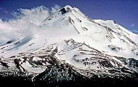 | |
|---|---|---|
| Bodies of Water | ||
| Rivers | ||
| Incorporated Cities | ||
| Counties | ||
| Parks |
| |
Municipalities and communities of Siskiyou County, California, United States | ||
|---|---|---|
| Cities | 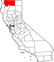 | |
| CDPs | ||
| Unincorporated communities | ||
| Indian reservation | ||
| Ghost towns | ||
| Footnotes | ‡This populated place also has portions in an adjacent county or counties | |
