Virginiatown, California
| Virginiatown | |
|---|---|
| Unincorporated community | |
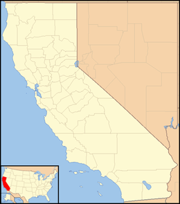 Virginiatown  Virginiatown Location in California | |
| Coordinates: 38°54′02″N 121°12′53″W / 38.90056°N 121.21472°WCoordinates: 38°54′02″N 121°12′53″W / 38.90056°N 121.21472°W | |
| Country |
|
| State |
|
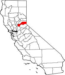
| County | Placer County |
| Elevation[1] | 322 ft (98 m) |
| Reference no. | 400 |
Virginiatown (formerly, Virginia)[2] is an unincorporated community in Placer County, California.[1] Virginiatown is located on Auburn Ravine, 7.5 miles (12.1 km) west of Auburn.[2] It lies at an elevation of 322 feet (98 m).[1]
Virginiatown is California Historical Landmark #400.[3]

The new plaque rededicated 2013-09-20[4]
References
- 1 2 3 U.S. Geological Survey Geographic Names Information System: Virginiatown, California
- 1 2 Durham, David L. (1998). California's Geographic Names: A Gazetteer of Historic and Modern Names of the State. Clovis, Calif.: Word Dancer Press. p. 572. ISBN 1-884995-14-4.
- ↑ "Virginatown". Office of Historic Preservation, California State Parks. Retrieved 2012-10-11.
- ↑ Otten, Michael (2013). "Relive History circa 1852, 1952 and 2013". Placer County Historical Society. Retrieved 2013-09-20.
This article is issued from Wikipedia - version of the 7/5/2016. The text is available under the Creative Commons Attribution/Share Alike but additional terms may apply for the media files.