Secret Canyon, California
| Secret Canyon | |
|---|---|
| Former settlement | |
 Secret Canyon Location in California | |
| Coordinates: 39°11′15″N 120°35′09″W / 39.18750°N 120.58583°WCoordinates: 39°11′15″N 120°35′09″W / 39.18750°N 120.58583°W | |
| Country |
|
| State |
|
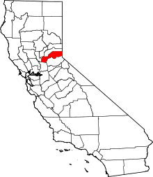
| County | Placer County |
| Elevation[1] | 5,410 ft (1,649 m) |
Secret Canyon (also, Secret House)[2] is a former settlement in Placer County, California.[1] Secret Canyon is located northwest of the stream that drains Little Secret Canyon, 4.5 miles (7.2 km) west-northwest of Duncan Peak.[2] It lay at an elevation of 5410 feet (1649 m).[1] It still appeared on maps as of 1898.[2]
References
This article is issued from Wikipedia - version of the 7/10/2011. The text is available under the Creative Commons Attribution/Share Alike but additional terms may apply for the media files.