Newcastle, California
| Newcastle | |
|---|---|
| census-designated place & unincorporated community | |
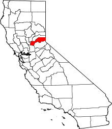
 Newcastle Position in California. | |
| Coordinates: 38°52′27″N 121°08′00″W / 38.87417°N 121.13333°WCoordinates: 38°52′27″N 121°08′00″W / 38.87417°N 121.13333°W | |
| Country |
|
| State |
|
| County | Placer |
| Area[1] | |
| • Total | 2.396 sq mi (6.206 km2) |
| • Land | 2.392 sq mi (6.195 km2) |
| • Water | 0.004 sq mi (0.011 km2) 0.18% |
| Elevation[2] | 945 ft (288 m) |
| Population (2010) | |
| • Total | 1,224 |
| • Density | 510/sq mi (200/km2) |
| Time zone | Pacific (PST) (UTC-8) |
| • Summer (DST) | PDT (UTC-7) |
| ZIP Code | 95658 |
| Area code(s) | 916 |
| GNIS feature IDs | 1659218; 2583089 |
| U.S. Geological Survey Geographic Names Information System: Newcastle, California; U.S. Geological Survey Geographic Names Information System: Newcastle, California | |
Newcastle is an unincorporated community and census-designated place (CDP) in Placer County, California.[3] Newcastle is located 8 miles (12.9 km) northeast of Rocklin.[4]
It is nestled in the Sierra Nevada foothills, 31 miles northeast of Sacramento. Newcastle generally has moderate winters and warm summers.
The latitude of Newcastle is 38.874N, the longitude is -121.132W, and an elevation of 945 ft. The town's zip code is 95658 and area code 916.
The population of the CDP as of the 2010 U.S. Census is 1,224.
History
Newcastle was founded in the 19th century. According to Transcontinental Railroad Landmarks the "Regular freight and passenger trains began operating over the first 31 miles of Central Pacific's line to Newcastle June 10, 1864, when political opposition and lack of money stopped further construction during that mild winter. Construction was resumed in April, 1865." The region is also in the vicinity of what was the cradle of "gold country", where in the mid-19th century a flurry of miners and gold prospectors searched for their fortune. During this time however, the town of Newcastle was known more for its orchards rather than abundant gold mines.
The Newcastle post office opened in 1864.[4]
Geography
According to the United States Census Bureau, the CDP covers an area of 2.4 square miles (6.2 km²), 99.82% of it land, and 0.18% of it water.
Demographics
_Portuguese_Hall%2C_facade.jpg)
The 2010 United States Census[5] reported that Newcastle had a population of 1,224. The population density was 510.8 people per square mile (197.2/km²). The racial makeup of Newcastle was 1,113 (90.9%) White, 104 (8.5%) Hispanic or Latino of any race, 19 (1.6%) Native American, 17 (1.4%) Asian, 7 (0.6%) African American, 35 (2.9%) from other races, and 33 (2.7%) were from two or more races.
The Census reported that 1,216 people (99.3% of the population) lived in households, 8 (0.7%) lived in non-institutionalized group quarters, and 0 (0%) were institutionalized.
There were 545 households, out of which 115 (21.1%) had children under the age of 18 living in them, 258 (47.3%) were opposite-sex married couples living together, 42 (7.7%) had a female householder with no husband present, 23 (4.2%) had a male householder with no wife present. There were 25 (4.6%) unmarried opposite-sex partnerships, and 2 (0.4%) same-sex married couples or partnerships. 186 households (34.1%) were made up of individuals and 117 (21.5%) had someone living alone who was 65 years of age or older. The average household size was 2.23. There were 323 families (59.3% of all households); the average family size was 2.86.
The population was spread out with 220 people (18.0%) under the age of 18, 83 people (6.8%) aged 18 to 24, 191 people (15.6%) aged 25 to 44, 416 people (34.0%) aged 45 to 64, and 314 people (25.7%) who were 65 years of age or older. The median age was 51.3 years. For every 100 females there were 91.3 males. For every 100 females age 18 and over, there were 92.3 males.
There were 597 housing units at an average density of 249.1 per square mile (96.2/km²), of which 430 (78.9%) were owner-occupied, and 115 (21.1%) were occupied by renters. The homeowner vacancy rate was 4.4%; the rental vacancy rate was 12.2%. 923 people (75.4% of the population) lived in owner-occupied housing units and 293 people (23.9%) lived in rental housing units.
Notable people
- Ian Riley - Radio personality.
- Bud Anderson - World War II "triple Ace".
- Joe Bailon - automobile customizer and creator of the paint color Candy Apple Red.
- Christian Kiefer - novelist, musician, poet.[6]
- George S. Nixon - U.S Senator from Nevada.[7]
- Jason Rhoades - artist.
- John Rudometkin - professional basketball player.
References
- ↑ U.S. Census
- ↑ U.S. Geological Survey Geographic Names Information System: Newcastle, California
- ↑ U.S. Geological Survey Geographic Names Information System: Newcastle, California
- 1 2 Durham, David L. (1998). California's Geographic Names: A Gazetteer of Historic and Modern Names of the State. Clovis, Calif.: Word Dancer Press. p. 529. ISBN 1-884995-14-4.
- ↑ "2010 Census Interactive Population Search: CA - Newcastle CDP". U.S. Census Bureau. Retrieved July 12, 2014.
- ↑ Pierleoni, Allen (June 24, 2012). "American River College professor publishes first novel". The Sacramento Bee.
- ↑ Myrick, David F. (1992). Railroads of Nevada and Eastern California: The Northern Railroads.