Midas, California
| Midas | |
|---|---|
| Unincorporated community | |
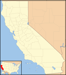 Midas  Midas Location in California | |
| Coordinates: 39°13′00″N 120°45′28″W / 39.21667°N 120.75778°WCoordinates: 39°13′00″N 120°45′28″W / 39.21667°N 120.75778°W | |
| Country |
|
| State |
|
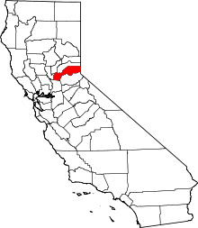
| County | Placer County |
| Elevation[1] | 4,153 ft (1,266 m) |
Midas (formerly, Shady Run) is an unincorporated community in Placer County, California.[1] Midas is located on the Southern Pacific Railroad, 4.5 miles (7.2 km) east of Dutch Flat.[2] It lies at an elevation of 4153 feet (1266 m).[1]
The Shady Run post office operated from 1872 to 1879 and from 1903 to 1904.[2]
References
This article is issued from Wikipedia - version of the 7/5/2016. The text is available under the Creative Commons Attribution/Share Alike but additional terms may apply for the media files.