Turner, Kansas
| Turner, Kansas | |
|---|---|
| Neighborhood | |
 Turner | |
| Coordinates: 39°05′00″N 94°42′16″W / 39.08333°N 94.70444°WCoordinates: 39°05′00″N 94°42′16″W / 39.08333°N 94.70444°W[1] | |
| Country | United States |
| State | Kansas |
| County | Wyandotte |
| Elevation[1] | 830 ft (253 m) |
| Time zone | CST (UTC-6) |
| • Summer (DST) | CDT (UTC-5) |
| Area code | 913 |
| FIPS code | 20-71775 [1] |
| GNIS feature ID | 0478951 [1] |
Turner is a neighborhood within Kansas City, Kansas, United States.[1] It was formerly an unincorporated community of Wyandotte County, similar to Piper, Kansas. Turner has its own school district, Turner USD #202.
History
The Prophet (Tenskwatawa; literally, "the door opener"), brother of Tecumseh, created Shawneetown in the area (near what today is Woodend and Shawnee Drive at 35th street). He made his final home near Turner in Argentine, Kansas (the property is today owned by Jack Beemont). Blue Jacket (Weyapiersenwah), who was Tecumseh's adoptive brother, was known to the early European settlers in this area. According to legend, one of the Shawnee chiefs, Fish, died and was buried in the Shawnee Township Cemetery (which is located in the heart of modern day Turner).
19th century

In 1828, Cyprian Chouteau established the first trading post in this locale. It was the American Fur Company trading house (located near 55th and Speaker Road). The original Shawnee Methodist Mission was built in 1830 near Chouteau's old trading post (near the heart of the Turner community). Reverend Thomas Johnson built the mission for the Shawnee. It was located at what would be 5100 block of Edgehill Drive. This mission was open till until 1839, when the Mission School was built at the current location in Johnson County. Around 1837, Charles Lovelace established a saw mill (today it would be located at 55th and Speaker Road, but has been long ago torn down). There was also a grist mill in close proximity. In 1838, the mighty steamboat, "The Antelope" docked in the area. It had several scientist and pioneers heading west. They stayed over in the area on their journey to Fort Pierre in South Dakota.[2]
The Delaware Crossing (or "Military Crossing"; sometimes "the Secondine") was where the old Indian trail met the water's of the Kaw River. Around 1831, Moses Grinter (one of the earliest permanent white settler in the area) set up the Grinter Ferry on the Kansas River here. His house, the Grinter Place, still stands at 1420 South 78th Street. The ferry was used by individuals (such as traders, freighters, and soldiers) traveling between Fort Leavenworth and Fort Scott on the military road. Other would cross this area on their way to Santa Fe.[2]
Various farmers took up residence around Turner by the fall of 1854. Turner as a community was known as early as 1856 (and no later than 1859). The community, then named "Farmer, Kansas", tried to incorporate itself on October 8, 1859. The attempt failed because the community never had enough population to achieve the statute requirements.[2]
Members of the old Quantrill's Raiders sacked a few homes and killed some of the inhabitants of the area around July 1863. Various families (living in the area that today is between Swartz Road from 51st to 53rd Street) suffered in the attacks. They were fended off from but a few homes.[2]
In 1859, the community had been referred to as the "Farmer" community (when the first post office was established). Twenty years later, the community took the name "Turner". Farmer post office name was switched to the "Turner" post office on September 23, 1879; by Robert M. Hester.[2][3][4]
20th century
The Flood of 1903 hit Turner. The 1910 population was around 200 people. In 1912, Turner had a few general stores, a school, money order post office, telegraph and express facilities.[2]
Historically, the Atchison, Topeka and Santa Fe Railway went through Argentine, Turner, and Kaw Valley. From the railroad yard in the Argentine, the railroad cars would be turned around at the Farmer train platform. The Farmer train station's circular platform stood at 55th street (which is Turner’s main downtown area).[2]
Parts of Turner were hit in the Great Flood of 1951 and the flood resulted in the "Highland" community being built (for displaced individuals from Argentine and Armourdale). Between late 1965 and early 1966, Kansas City, Kansas annexed the community of Turner. Although now a part of Kansas City, Kansas,the community still retains its own distinct flavor and personality.[2]
The Turner post office was discontinued in 1958.[5]
Education
Primary and secondary education

The Golden Bear mascot was adopted for the school and community in 1886. Two members of the community, Warren Hewitt and Jule Gaignet, submitted the icon and it won the majority of support in a contest. Reportedly, the two youths had heard of the bear from stories told by their grandparents. This icon is based on legends of a golden bear that live in the area.[2]
According to John Gardiner in 1831, the great golden bear that lived in the area was feared and admired by the local native population. The bear lived south of the river in the hills west of the Methodist Mission. According to legend, it was the largest bear that any of the natives had ever seen. It would raid the settlements of the area folks and feasted on the animals owned by the local population (the Shawnee tribe). Many of the Indians wanted to kill the bear for the pride of such a feat and the capture of its hide (the fur was most sought after). The golden bear was seen several times by the ferry crew on the Old Grinter Ferry during the 1830s and 1840s. Both the Shawnee and the Wyandot gathered a hunting party, but were unsuccessful in tracking the bear down.[2]
Turner USD 202 consolidated the five old school districts of Turner, Junction, Oak Grove, Morris, and Muncie in 1961 and currently consists of:
- Turner High School (Home of the Golden Bear)
- Turner Middle School
- Turner Primary
- Junction Primary
- Oak Grove Primary
- Midland Trail Primary
- Sixth Grade Academy
Infrastructure
Roads
Street names
The road overseers were Peter Partonnar, John Gibbs, and H. L. Swinggley. Peter Partonnar (sometimes misspelled as Parturner) has been rumored to be the origin of the name for Turner (but this is doubtful as the Partonnar family lived in Shawnee for many years and did not come to live in Turner till the name was already acquired).[2]
- New and old
- 55th Street (Portion) was known as "Lovelace Mill Road" and later it was named "Ambrose Key Road" after the saw mill was closed down. Still later it was renamed "Turner Avenue" until annexation. (55th leads Douglas and then into Key lane which goes to Gibbs Road)
- 56th Street was "Central Avenue"
- 57th Street was "Ore Avenue"
- Gibbs Road was named in honor of John Gibbs, Jr.
- Metropolitan Avenue was "Hester Road" ; Albert Hester had a farm, Hester Farm, on this route (it also crossed the road from Fort Scott and Fort Leavenworth).
- Swartz Road was "Silver Avenue"
- Miami was "Smelter Avenue"
- Osage was "Cable Avenue"
- Key Lane was for a time called "Ridgeview Road"
Further reading
- Wyandotte County and Kansas City, Kansas - Historical and Biographical; Goodspeed Publishing Co; 932 pages; 1890.[6]
- Cutler, William G. "History of the State of Kansas" TURNER. 1883.
- J. C. McConnell (of Turner), Kansas City Star. May 12, 1935.
- Wyandot Herald, May 22, 1879
References
- 1 2 3 4 5 Geographic Names Information System (GNIS) details for Turner, Kansas; United States Geological Survey (USGS); October 13, 1978.
- 1 2 3 4 5 6 7 8 9 10 11 Betty S. Gibson, "Pride of the Golden Bear". Kendall Hunt Pub Co., June 1981. ISBN 0-8403-2397-2
- ↑ Jeanie Turner, states that her father was an engineer who laid out the roads of the newly formed town and it was named in his honor.
- ↑ Annotation: Farmer was a post office until September 23, 1879, when Robert M. Hester changed the name to Turner.
- ↑ "Kansas Post Offices, 1828-1961". Kansas Historical Society. Archived from the original on April 10, 2013. Retrieved 29 June 2014.
- ↑ Wyandotte County and Kansas City, Kansas - Historical and Biographical; Goodspeed Publishing Co; 932 pages; 1890.
External links
- History of the Public Schools of Wyandotte County, Kansas
- Wyandotte County, Kansas Cemeteries; Includes the Shawnee Township / Turner burial grounds (Located at South 55th & Edgehill Street almost across from the old Turner High School; It contains about 30 gravesites)
- Hydrograph of Kansas River at Turner Bridge, NOAA
- "Centennial History of Argentine", Kansas City, Kansas 1880-1980. Information on John Gibbs, Jr.
- Charles Lovelace, skyways.lib.ks.us.
- Old Wyandotte map. skyways.lib.ks.us
- Wyandotte County Maps: Current, 1950
Municipalities and communities of Wyandotte County, Kansas, United States | ||
|---|---|---|
| Cities | 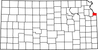 | |
| Neighborhoods in Kansas City |
| |
| Footnotes | ‡This populated place also has portions in an adjacent county or counties | |
Kansas City metropolitan area's cities and counties | ||
|---|---|---|
| Central city | 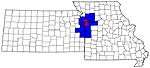 | |
| Largest cities (over 100,000 in 2000) | ||
| Medium-sized cities (10,000 to 100,000 in 2000) | ||
| Smaller Cities (between 5,000 and 9,900 in 2010) | ||
| Counties | ||