Clay County, Missouri
| Clay County, Missouri | |
|---|---|
 South side of the Clay County Courthouse (designed by Wight and Wight) in Liberty | |
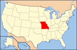
 Location in the U.S. state of Missouri | |
 Missouri's location in the U.S. | |
| Founded | January 2, 1822 |
| Seat | Liberty |
| Largest city | Kansas City |
| Area | |
| • Total | 409 sq mi (1,059 km2) |
| • Land | 397 sq mi (1,028 km2) |
| • Water | 11 sq mi (28 km2), 2.8% |
| Population (est.) | |
| • (2015) | 235,637 |
| • Density | 559/sq mi (216/km²) |
| Congressional districts | 5th, 6th |
| Time zone | Central: UTC-6/-5 |
| Website |
www |
Clay County is a county located in the U.S. state of Missouri. As of the 2010 census, the county had a population of 221,939,[1] making it the fifth-most populous county in Missouri. Its county seat is Liberty.[2] The county was organized January 2, 1822, and named in honor of U.S. Representative Henry Clay from Kentucky, later member of the United States Senate and United States Secretary of State.[3][4]
Clay County is part of the Kansas City, MO-KS Metropolitan Statistical Area and contains many of the city's northern suburbs, along with a substantial portion of the City of Kansas City.
Clay County owns and operates the Midwest National Air Center in Excelsior Springs.
History
Clay County was settled primarily from migrants from the Upper Southern states of Kentucky, Tennessee, and Virginia. They brought slaves and slaveholding traditions with them, and quickly started cultivating crops similar to those in Middle Tennessee and Kentucky: hemp and tobacco. Clay was one of several counties settled mostly by Southerners to the north and south of the Missouri River. Given their culture and traditions, this area became known as Little Dixie. In 1860, slaves made up 25% or more of the county's population.[5] Residents generally supported the Confederacy during the Civil War, as the Confederate flag flew over the county courthouse for many years following the end of the Civil War.
Many members of the Latter Day Saint movement found refuge in Clay County in November 1833. In 1836, mobs drove the members of the church from the county.[6] Leaders of this church, most notably Joseph Smith, were imprisoned for some months in Clay County in the jail at Liberty. In May 2012, the LDS Church opened a Kansas City Missouri Temple six miles southwest of the Liberty Jail site at 7001 Searcy Creek Parkway in Kansas City, Missouri.[7]
Geography
According to the U.S. Census Bureau, the county has a total area of 409 square miles (1,060 km2), of which 397 square miles (1,030 km2) is land and 11 square miles (28 km2) (2.8%) is covered by water.[8] It is the fourth-smallest county in Missouri by area.
Adjacent counties
- Clinton County (north)
- Ray County (east)
- Jackson County (south)
- Wyandotte County, Kansas (southwest)
- Platte County (west)
Major highways
Demographics
| Historical population | |||
|---|---|---|---|
| Census | Pop. | %± | |
| 1830 | 5,338 | — | |
| 1840 | 8,283 | 55.2% | |
| 1850 | 10,382 | 25.3% | |
| 1860 | 13,023 | 25.4% | |
| 1870 | 15,564 | 19.5% | |
| 1880 | 15,571 | 0.0% | |
| 1890 | 19,856 | 27.5% | |
| 1900 | 18,903 | −4.8% | |
| 1910 | 20,302 | 7.4% | |
| 1920 | 20,455 | 0.8% | |
| 1930 | 26,811 | 31.1% | |
| 1940 | 30,417 | 13.4% | |
| 1950 | 45,221 | 48.7% | |
| 1960 | 87,474 | 93.4% | |
| 1970 | 123,322 | 41.0% | |
| 1980 | 136,488 | 10.7% | |
| 1990 | 153,411 | 12.4% | |
| 2000 | 184,006 | 19.9% | |
| 2010 | 221,939 | 20.6% | |
| Est. 2015 | 235,637 | [9] | 6.2% |
| U.S. Decennial Census[10] 1790-1960[11] 1900-1990[12] 1990-2000[13] 2010-2015[1] | |||
As of the census[14] of 2010, 221,939 people, 72,558 households, and 50,137 families resided in the county. The population density was 558 people per square mile (216/km²). The 93,918 housing units averaged 236 per square mile (91/km2). The racial makeup of the county was 87.46% White, 5.18% Black or African American, 0.53% Native American, 2.05% Asian, 0.26% Pacific Islander, 1.77% from other races, and 2.75% from two or more races. About 5.90% of the population were Hispanic or Latino of any race. As of the census[15] of 2000, 23.3% were of German, 14.5% American, 11.0% English, 10.8% Irish, and 5.6% Italian ancestry.
Of the 72,558 households, 33.80% had children under the age of 18 living with them, 55.40% were married couples living together, 10.20% had a female householder with no husband present, and 30.90% were not families. About 25.20% of all households were made up of individuals, and 7.40% had someone living alone who was 65 years of age or older. The average household size was 2.50 and the average family size was 3.00.
In the county, the population was distributed as 25.80% under the age of 18, 8.70% from 18 to 24, 32.30% from 25 to 44, 22.30% from 45 to 64, and 10.80% who were 65 years of age or older. The median age was 35 years. For every 100 females, there were 94.60 males. For every 100 females age 18 and over, there were 91.80 males.
The median income for a household in the county was $48,347, and for a family was $56,772. Males had a median income of $40,148 versus $27,681 for females. The per capita income for the county was $23,144. About 3.80% of families and 5.50% of the population were below the poverty line, including 6.40% of those under age 18 and 5.50% of those age 65 or over.
Registered voters number 151,042.[16]
Education
Public schools
- Excelsior Springs School District No. 40 – Excelsior Springs
- Elkhorn Elementary School (K–5)
- Lewis Elementary School (PK–5)
- Westview Elementary School (K–5)
- Excelsior Springs Middle School (6–8)
- Excelsior Springs High School (9–12)
- Excelsior Springs Technical High School (12) – Alternative/Technical School
- Kearney R-I School District – Kearney
- Dogwood Elementary School (PreK–5)
- Hawthorne Elementary School (K–5)
- Holt Elementary School (K–5)
- Kearney Elementary School (K–5)
- Southview Elementary School (K–5)
- Kearney Middle School (6–7)
- Kearney Junior High School (8–9)
- Kearney High School (10–12)
- Liberty School District No. 53 – Liberty
- Liberty Early Childhood Education Center (PreK)
- Alexander Doniphan Elementary School (K–5)
- Franklin Elementary School (K–5)
- Kellybrook Elementary School (K–5) – Kansas City
- Lewis & Clark Elementary School (K–5)
- Liberty Oaks Elementary School (K–5) – Kansas City
- Lillian Schumacher Elementary School (K–5)
- Manor Hill Elementary School (K–5)
- Ridgeview Elementary School (K–5)
- Shoal Creek Elementary School (K–5)
- Warren Hills Elementary School (K–5)
- Liberty Middle School (6–8)
- South Valley Middle School (6–8)
- Heritage Middle School (6–8)
- Discovery Middle School (6–8)
- Liberty High School (9–12)
- Liberty North High School (9–12)
- Missouri City School District No. 56 – Missouri City
- Missouri City Elementary School (K–8)
- North Kansas City School District No. 74 – North Kansas City
- Bell Prairie Elementary School (K–5)
- Briarcliff Elementary School (K–5)
- Chapel Hill Elementary School (K–5)
- Chouteu Elementary School (Pre-K–5)
- Clardy Elementary School (2–5)
- Crestview Elementary School (K–5)
- Davidson Elementary School (Pre-K–5)
- Fox Hill Elementary School (K–5)
- Gashland Elementary School (K–1)
- Gracemor Elementary School (Pre-K–5)
- Lakewood Elementary School (Pre-K–5)
- Linden West Elementary School (K–5) – Gladstone
- Maplewood Elementary School (K–5)
- Meadowbrook Elementary School (K–5)
- Nashua Elementary School (K–5)
- Northview Elementary School (K–5)
- Oakwood Manor Elementary School (K–5)
- Ravenwood Elementary School (K–5)
- Topping Elementary School (K–5)
- West Englewood Elementary School (Pre-K–5)
- Winnwood Elementary School (Pre-K–5)
- Antioch Middle School (6–8)
- Eastgate Middle School (6–8)
- Maple Park Middle School (6–8)
- New Mark Middle School (6–8)
- Northgate Middle School (6–8)
- North Kansas City High School (9–12)
- Oak Park High School (9–12)
- Staley High School (9–12)
- Winnetonka High School (9–12)
- Smithville R-II School District – Smithville
- Smithville Elementary School (Pre-K–2)
- Smithville Upper Elementary School (3–5)
- Smithville Middle School (6–8)
- Smithville High School (9–12)
Private schools
- Outreach Christian Early Education Center – Avondale (Pre-K–12) – Nondenominational Christian
- Gladstone KinderCare – Gladstone (NS–Pre-K) – Nonsectarian
- Oakhill Day School – Gladstone (Pre-K–7) – Nonsectarian – (Special Programs Emphasis)
- St. Andrew the Apostle Parish School – Gladstone (K–9) – Roman Catholic
- Northern Hills Christian Academy – Holt (K–9) – Baptist
- Prairie Church School – Holt (K–6) – Nondenominational Christian
- Chouteau and Parvin KinderCare – Kansas City (NS–Pre-K) – Nonsectarian
- Covenant Memorial Baptist Day School – Kansas City (K) – Baptist
- Eagle Heights Christian School – Kansas City (Pre-K–12) – Baptist
- Faith Academy – Kansas City (Pre-K–12) – Nondenominational Christian
- St. Charles Borromeo School – Kansas City (K–9) – Roman Catholic
- St. Gabriel Catholic School –Kansas City (K–9) – Roman Catholic
- St. Patrick School – Kansas City (NS/Pre-K–8) – Roman Catholic
- St. Pius X High School – Kansas City (9–12) – Roman Catholic
- Liberty Montessori Center – Liberty (K–1) – Montessori
- St. James School – Liberty (K–9) – Roman Catholic
Postsecondary
- Maple Woods :: Metropolitan Community College—Kansas City—A public, two-year Liberal Arts college
- William Jewell College – Liberty – A private, four-year Liberal Arts college.
Politics
Local
The three-person Clay County Commission oversees the issues of Clay County. The current makeup of the commissioners is two Republicans and one Democrat.
| Clay County, Missouri | ||||
|---|---|---|---|---|
| Elected countywide officials | ||||
| Assessor | Cathy Rinehart | Democratic | ||
| Circuit Clerk | Stephen Haymes | Democratic | ||
| County Clerk | Sheri Chapman | Republican | ||
| Collector | Lydia McEvoy | Republican | ||
| Commissioner (Presiding) |
Pamela Mason | Republican | ||
| Commissioner (District 1) |
Luann Ridgeway | Republican | ||
| Commissioner (District 2) |
Gene Owen | Democratic | ||
| Prosecuting Attorney | Dan White | Democratic | ||
| Public Administrator | Debra L. Gwin | Democratic | ||
| Recorder | Jay Lawson | Republican | ||
| Sheriff | Paul Vescovo | Republican | ||
| Treasurer | Ted Graves | Republican | ||
State
| Year | Republican | Democratic | Third Parties |
|---|---|---|---|
| 2008 | 38.64% 41,518 | 58.95% 63,341 | 2.40% 2,583 |
| 2004 | 46.70% 44,763 | 51.72% 49,573 | 1.58% 1,520 |
| 2000 | 46.57% 36,983 | 51.31% 40,747 | 2.12% 1,689 |
| 1996 | 34.29% 23,524 | 63.54% 43,593 | 2.18% 1,493 |
Clay County is divided into six legislative districts in the Missouri House of Representatives, five of which are held by Republicans and one by a Democrat.
- District 31 – Jay Swearingin (D-North Kansas City) - consists of the communities of Avondale and North Kansas City, and under a tenth of the city of Kansas City.
| Party | Candidate | Votes | % | ± | |
|---|---|---|---|---|---|
| Democratic | Jay Swearingin | 4,669 | 51.27 | ||
| Republican | Matthew K. Thompson | 4,437 | 48.73 | ||
- District 33 – Jerry Nolte (R-Gladstone) - consists of the communities of Claycomo, Gladstone, Oaks, Oakview, Oakwood, Oakwood Park, and Pleasant Valley, and a small part of the city of Kansas City.
| Party | Candidate | Votes | % | ± | |
|---|---|---|---|---|---|
| Republican | Jerry Nolte | 7,853 | 65.13 | ||
| Democratic | Jim Stoufer | 4,204 | 34.87 | ||
- District 34 – Myron Neth (R-Liberty) - consists of the communities of Birmingham, Glenaire, Liberty, Randolph, and a small portion of the city of Kansas City.
| Party | Candidate | Votes | % | ± | |
|---|---|---|---|---|---|
| Republican | Myron Neth | 6,551 | 54.56 | ||
| Democratic | Mark Ellebracht | 5,457 | 45.44 | ||
- District 35 – T.J. Berry (R-Kearney) - consists of the communities of Holt, Kearney, Missouri City, Mosby, Pleasant Valley, Smithville, and a small portion of the city of Kansas City.
| Party | Candidate | Votes | % | ± | |
|---|---|---|---|---|---|
| Republican | T.J. Berry | 13,656 | 69.49 | ||
| Democratic | Jim Baldwin | 5,997 | 30.51 | ||
- District 36 – Bob Nance (R-Excelsior Springs) - consists of the communities of Excelsior Estates, Excelsior Springs, Lawson, and Prathersville.
| Party | Candidate | Votes | % | ± | |
|---|---|---|---|---|---|
| Republican | Bob Nance | 2,272 | 69.65 | ||
| Democratic | Barbara Lanning | 990 | 30.35 | ||
- District 38 – Ryan Silvey (R-Kansas City) - consists of a portion of Gladstone and less than a tenth of the city of Kansas City.
| Party | Candidate | Votes | % | ± | |
|---|---|---|---|---|---|
| Republican | Ryan Silvey | 9,133 | 69.65 | ||
| Democratic | Debbie Colozza | 3,979 | 30.35 | ||
Clay County is divided into two districts in the Missouri Senate, both of which are held by Republicans.
- District 17 – Luann Ridgeway (R-Smithville) - consists of the communities of Avondale, Birmingham, Claycomo, Gladstone, Glenaire, Holt, Liberty, Missouri City, Mosby, North Kansas City, Oaks, Oakview, Oakwood, Oakwood Park, Pleasant Valley, Prathersville, Randolph, Smithville, Sugar Creek, and a fifth of the city of Kansas City.
| Party | Candidate | Votes | % | ± | |
|---|---|---|---|---|---|
| Republican | Luann Ridgeway | 50,451 | 53.09 | ||
| Democratic | Sandra Aust | 44,578 | 46.91 | ||
- District 21 – Bill Stouffer (R-Napton) - consists of the communities of Excelsior Estates, Excelsior Springs, Kearney, and Lawson.
| Party | Candidate | Votes | % | ± | |
|---|---|---|---|---|---|
| Republican | Bill Stouffer | 6,035 | 59.72 | ||
| Democratic | Joe Sadeghi | 4,071 | 40.28 | ||
Federal
All of Clay County is included in Missouri’s 6th Congressional District and is currently represented by Sam Graves (R-Tarkio) in the U.S. House of Representatives.
| Party | Candidate | Votes | % | ± | |
|---|---|---|---|---|---|
| Republican | Sam Graves | 45,210 | 65.17 | ||
| Democratic | Clint Hylton | 24,142 | 34.80 | ||
| Year | Republican | Democratic | Third Parties |
|---|---|---|---|
| 2016 | 52.48% 57,328 | 41.36% 45,182 | 6.16% 6,727 |
| 2012 | 52.99% 56,191 | 46.31% 47,310 | 2.40% 2,542 |
| 2008 | 49.55% 54,516 | 48.86% 53,761 | 1.59% 1,748 |
| 2004 | 53.07% 51,193 | 46.31% 44,670 | 0.62% 597 |
| 2000 | 48.75% 39,083 | 48.75% 39,084 | 2.50% 2,006 |
| 1996 | 41.85% 28,935 | 47.15% 32,603 | 11.00% 7,609 |
Communities
Notable natives
- Frank James, born in Clay County in 1843
- Jesse James, born in Clay County in 1847
- John Ellis Martineau, Governor of Arkansas (1927–1928), born in Clay County in 1873
- Noah Beery, Sr., actor
- Wallace Beery, actor
See also
- List of counties in Missouri
- Mormon War (1838)
- National Register of Historic Places listings in Clay County, Missouri
References
- 1 2 "State & County QuickFacts". United States Census Bureau. Retrieved September 7, 2013.
- ↑ "Find a County". National Association of Counties. Archived from the original on 2011-05-31. Retrieved 2011-06-07.
- ↑ Eaton, David Wolfe (1916). How Missouri Counties, Towns and Streams Were Named. The State Historical Society of Missouri. p. 277.
- ↑ Gannett, Henry (1905). The Origin of Certain Place Names in the United States. Govt. Print. Off. p. 83.
- ↑ T. J. Stiles, Jesse James: The Last Rebel of the Civil War, New York: Vintage Books, 2003, pp.10-11
- ↑ Jenson, Andrew. Encyclopedic History of the Church of Jesus-Christ of Latter-day Saints (Salt Lake City: Deseret News Press, 1941) p. 144-145
- ↑ "Kansas City Missouri LDS (Mormon) Temple". Ldschurchtemples.com. Retrieved 2013-07-10.
- ↑ "2010 Census Gazetteer Files". United States Census Bureau. August 22, 2012. Retrieved November 14, 2014.
- ↑ "County Totals Dataset: Population, Population Change and Estimated Components of Population Change: April 1, 2010 to July 1, 2015". Retrieved July 2, 2016.
- ↑ "U.S. Decennial Census". United States Census Bureau. Archived from the original on May 11, 2015. Retrieved November 14, 2014.
- ↑ "Historical Census Browser". University of Virginia Library. Retrieved November 14, 2014.
- ↑ "Population of Counties by Decennial Census: 1900 to 1990". United States Census Bureau. Retrieved November 14, 2014.
- ↑ "Census 2000 PHC-T-4. Ranking Tables for Counties: 1990 and 2000" (PDF). United States Census Bureau. Retrieved November 14, 2014.
- ↑ "American FactFinder". United States Census Bureau. Archived from the original on 2013-09-11. Retrieved 2011-05-14.
- ↑ "American FactFinder". United States Census Bureau. Archived from the original on 2013-09-11. Retrieved 2008-01-31.
- ↑ Registered Voters in Missouri 2008
Further reading
- Woodson, W.H. History of Clay County, Missouri (1920) online
External links
Coordinates: 39°19′N 94°25′W / 39.31°N 94.42°W
- Clay County government's website
- Clay County Economic Development Council website
- Digitized 1930 Plat Book of Clay County from University of Missouri Division of Special Collections, Archives, and Rare Books
 |
Clinton County | | ||
| Platte County | |
Ray County | ||
| ||||
| | ||||
| Wyandotte County, Kansas | Jackson County |
Kansas City metropolitan area's cities and counties | ||
|---|---|---|
| Central city | 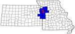 | |
| Largest cities (over 100,000 in 2000) | ||
| Medium-sized cities (10,000 to 100,000 in 2000) | ||
| Smaller Cities (between 5,000 and 9,900 in 2010) | ||
| Counties | ||
Municipalities and communities of Clay County, Missouri, United States | ||
|---|---|---|
| Cities | | |
| Villages | ||
| Townships |
| |
| Unincorporated communities | ||
| Footnotes | ‡This populated place also has portions in an adjacent county or counties | |