Stockbridge, Vermont
| Stockbridge, Vermont | |
|---|---|
| Town | |
 Location in Windsor County and the state of Vermont. | |
 Stockbridge, Vermont Location in the United States | |
| Coordinates: 43°45′42″N 72°44′13″W / 43.76167°N 72.73694°WCoordinates: 43°45′42″N 72°44′13″W / 43.76167°N 72.73694°W | |
| Country | United States |
| State | Vermont |
| County | Windsor |
| Area | |
| • Total | 46.2 sq mi (119.6 km2) |
| • Land | 45.9 sq mi (118.9 km2) |
| • Water | 0.3 sq mi (0.7 km2) |
| Elevation | 846 ft (258 m) |
| Population (2010) | |
| • Total | 736 |
| • Density | 16/sq mi (6.2/km2) |
| Time zone | Eastern (EST) (UTC-5) |
| • Summer (DST) | EDT (UTC-4) |
| ZIP code | 05772 |
| Area code(s) | 802 |
| FIPS code | 50-70375[1] |
| GNIS feature ID | 1462218[2] |
| Website | http://www.stockbridgevt.org/ |
Stockbridge is a town in Windsor County, Vermont, United States. The population was 736 at the 2010 census.[3]
Stockbridge was one of thirteen Vermont towns isolated by flooding caused by Hurricane Irene in 2011.[4]
Stockbridge contains the village of Gaysville, Vermont, which includes the Cobble House Inn Bed and Breakfast.
Geography
According to the United States Census Bureau, the town has a total area of 46.2 square miles (119.6 km2), of which 45.9 square miles (118.9 km2) are land and 0.27 square miles (0.7 km2), or 0.60%, is water.[5]
Demographics
| Historical population | |||
|---|---|---|---|
| Census | Pop. | %± | |
| 1790 | 100 | — | |
| 1800 | 432 | 332.0% | |
| 1810 | 700 | 62.0% | |
| 1820 | 964 | 37.7% | |
| 1830 | 1,333 | 38.3% | |
| 1840 | 1,499 | 12.5% | |
| 1850 | 1,327 | −11.5% | |
| 1860 | 1,264 | −4.7% | |
| 1870 | 1,269 | 0.4% | |
| 1880 | 1,124 | −11.4% | |
| 1890 | 894 | −20.5% | |
| 1900 | 822 | −8.1% | |
| 1910 | 737 | −10.3% | |
| 1920 | 618 | −16.1% | |
| 1930 | 460 | −25.6% | |
| 1940 | 490 | 6.5% | |
| 1950 | 427 | −12.9% | |
| 1960 | 392 | −8.2% | |
| 1970 | 389 | −0.8% | |
| 1980 | 508 | 30.6% | |
| 1990 | 618 | 21.7% | |
| 2000 | 674 | 9.1% | |
| 2010 | 736 | 9.2% | |
| Est. 2014 | 731 | [6] | −0.7% |
| U.S. Decennial Census[7] | |||
As of the census[1] of 2000, there were 674 people, 281 households, and 193 families residing in the town. The population density was 14.6 people per square mile (5.6/km2). There were 528 housing units at an average density of 11.4 per square mile (4.4/km2). The racial makeup of the town was 98.37% White, 0.59% African American, 0.45% Native American, 0.45% Asian and 0.15% Pacific Islander. Hispanic or Latino of any race were 0.45% of the population.
There were 281 households out of which 29.9% had children under the age of 18 living with them, 58.0% were married couples living together, 6.8% had a female householder with no husband present, and 31.3% were non-families. 22.8% of all households were made up of individuals and 9.3% had someone living alone who was 65 years of age or older. The average household size was 2.40 and the average family size was 2.81.
In the town the population was spread out with 22.7% under the age of 18, 5.0% from 18 to 24, 29.2% from 25 to 44, 27.4% from 45 to 64, and 15.6% who were 65 years of age or older. The median age was 41 years. For every 100 females there were 104.2 males. For every 100 females age 18 and over, there were 100.4 males.
The median income for a household in the town was $37,292, and the median income for a family was $44,821. Males had a median income of $30,417 versus $25,000 for females. The per capita income for the town was $21,379. About 2.0% of families and 5.3% of the population were below the poverty line, including 3.2% of those under age 18 and 8.0% of those age 65 or over.
Notable people
- Orestes Brownson, intellectual, preacher and labor organizer
References
- 1 2 "American FactFinder". United States Census Bureau. Archived from the original on September 11, 2013. Retrieved 2008-01-31.
- ↑ "US Board on Geographic Names". United States Geological Survey. 2007-10-25. Retrieved 2008-01-31.
- ↑ "Profile of General Population and Housing Characteristics: 2010 Demographic Profile Data (DP-1): Stockbridge town, Windsor County, Vermont". U.S. Census Bureau, American Factfinder. Archived from the original on September 11, 2013. Retrieved August 1, 2012.
- ↑ Floodwaters From Storm Isolate 13 Vermont Towns, The New York Times
- ↑ "Geographic Identifiers: 2010 Demographic Profile Data (G001): Stockbridge town, Windsor County, Vermont". U.S. Census Bureau, American Factfinder. Archived from the original on September 11, 2013. Retrieved August 1, 2012.
- ↑ "Annual Estimates of the Resident Population for Incorporated Places: April 1, 2010 to July 1, 2014". Retrieved June 4, 2015.
- ↑ "U.S. Decennial Census". United States Census Bureau. Archived from the original on May 11, 2015. Retrieved May 16, 2015.
Municipalities and communities of Windsor County, Vermont, United States | ||
|---|---|---|
| Towns | 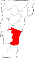 | |
| Villages | ||
| CDPs | ||
| Other communities | ||
