Spenceville, California
| Spenceville | |
|---|---|
| Former settlement | |
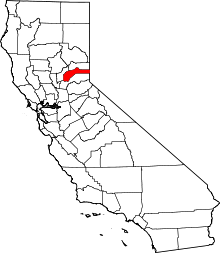
 Spenceville Location in California | |
| Coordinates: 39°06′53″N 121°16′06″W / 39.11472°N 121.26833°WCoordinates: 39°06′53″N 121°16′06″W / 39.11472°N 121.26833°W | |
| Country | United States |
| State | California |
| County | Nevada County |
| Time zone | Pacific (PST) (UTC-8) |
| • Summer (DST) | PDT (UTC-7) |
Spenceville is a former settlement in Nevada County, California.[1] Along with Hacketville and Wilsonville, Spenceville was established southwest of Rough and Ready during the 1865-1866 copper mining boom.[2]
Demographics
In 1880, its population was 350.[3] By the 1920s, the population had dropped to approximately 150.
History
The Spenceville post office operated during the period of 1872 through 1932.
During World War II, Spenceville was used as a military training area by Camp Beale.[2]
See also
References
- ↑ "NEVADA COUNTY, CALIFORNIA". calsign.com. Retrieved 2009-05-28.
- 1 2 Hoover, Mildred Brooke; Douglas E. Kyle; Hero Rensch (2002). Historic spots in California (5 ed.). Stanford University Press. p. 255. ISBN 0-8047-4482-3.
- ↑ "Nevada County GenWeb Nevada County History". cagenweb.com. Retrieved 2009-05-31.
External links
- Spenceville Wildlife Refuge & Shingle Falls: 11,213-acre (45.38 km2) Wildlife Preserve
- Photos, undated, Gold Rush Towns of Nevada County, p. 86
This article is issued from Wikipedia - version of the 10/16/2016. The text is available under the Creative Commons Attribution/Share Alike but additional terms may apply for the media files.