Lake of the Pines, California
- For the lake in Texas, see Lake O’ the Pines.
| Lake of the Pines | |
|---|---|
| census-designated place | |
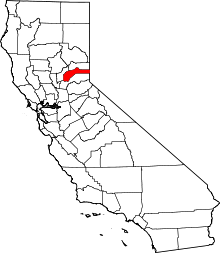
 Location in Nevada County and the state of California | |
 Lake of the Pines Location in the United States | |
| Coordinates: 39°2′19″N 121°3′41″W / 39.03861°N 121.06139°WCoordinates: 39°2′19″N 121°3′41″W / 39.03861°N 121.06139°W | |
| Country |
|
| State |
|
| County | Nevada |
| Area[1] | |
| • Total | 1.846 sq mi (4.781 km2) |
| • Land | 1.495 sq mi (3.872 km2) |
| • Water | 0.351 sq mi (0.908 km2) 19.00% |
| Elevation | 1,516 ft (462 m) |
| Population (2010) | |
| • Total | 3,917 |
| • Density | 2,100/sq mi (820/km2) |
| Time zone | Pacific (PST) (UTC-8) |
| • Summer (DST) | PDT (UTC-7) |
| ZIP code | 95602 |
| Area code(s) | 530 |
| FIPS code | 06-39690 |
| GNIS feature ID | 1682905 |
Lake of the Pines is a census-designated place (CDP) and a gated residential community in Nevada County, California, United States. The population was 3,917 at the 2010 census.
History
Lake of the Pines was laid out by property developers in the 1960s.[2]
Geography
Lake of the Pines is located in the foothills of the Sierra Nevada mountain range in California, at 39°02′19″N 121°03′41″W / 39.038571°N 121.061354°W.[3]
According to the United States Census Bureau, the CDP has a total area of 1.8 square miles (4.7 km2), of which, 1.5 square miles (3.9 km2) of it is land and 0.4 square miles (1.0 km2) of it (19.00%) is water.
Lake of the Pines is commonly associated with a gated residential community which surrounds a reservoir, also named Lake of the Pines. The reservoir was created by damming Magnolia Creek, in the Bear River watershed, and it has a maximum elevation of 459 m (1507 ft).[4] The gated community contains a golf course looping around the reservoir. The community is normally accessed only through the main entrance from Magnolia Road, just northeast of Combie Road.[5]
The boundaries of the census-designated place differ slightly from the boundaries of the gated community. As the CDP boundaries tend to follow streets, the CDP excludes many parcels in the periphery of the gated community and includes a shopping center in Combie Road.[6] In postal addresses, the area is considered a part of Auburn, though the city of Auburn is in Placer County.[7]
Demographics
2010
The 2010 United States Census[8] reported that Lake of the Pines had a population of 3,917. The population density was 2,122.1 people per square mile (819.3/km²). The racial makeup of Lake of the Pines was 3,669 (93.7%) White, 5 (0.1%) African American, 20 (0.5%) Native American, 65 (1.7%) Asian, 7 (0.2%) Pacific Islander, 24 (0.6%) from other races, and 127 (3.2%) from two or more races. Hispanic or Latino of any race were 246 persons (6.3%).
The Census reported that 3,917 people lived in households, 0 (0%) lived in non-institutionalized group quarters, and 0 (0%) were institutionalized.
There were 1,567 households, out of which 478 (30.5%) had children under the age of 18 living in them, 977 (62.3%) were opposite-sex married couples living together, 157 (10.0%) had a female householder with no husband present, 62 (4.0%) had a male householder with no wife present. There were 54 (3.4%) unmarried opposite-sex partnerships, and 15 (1.0%) same-sex married couples or partnerships. 314 households (20.0%) were made up of individuals and 197 (12.6%) had someone living alone who was 65 years of age or older. The average household size was 2.50. There were 1,196 families (76.3% of all households); the average family size was 2.84.
The population was spread out with 871 people (22.2%) under the age of 18, 221 people (5.6%) aged 18 to 24, 594 people (15.2%) aged 25 to 44, 1,276 people (32.6%) aged 45 to 64, and 955 people (24.4%) who were 65 years of age or older. The median age was 49.5 years. For every 100 females there were 90.4 males. For every 100 females age 18 and over, there were 87.2 males.
There were 1,768 housing units at an average density of 957.8 per square mile (369.8/km²), of which 1,234 (78.7%) were owner-occupied, and 333 (21.3%) were occupied by renters. The homeowner vacancy rate was 3.2%; the rental vacancy rate was 2.3%. 2,932 people (74.9% of the population) lived in owner-occupied housing units and 985 people (25.1%) lived in rental housing units.
2000
As of the census[9] of 2000, there were 3,956 people, 1,554 households, and 1,252 families residing in the CDP. The population density was 2,634.1 people per square mile (1,018.3/km²). There were 1,652 housing units at an average density of 1,100.0 per square mile (425.2/km²). The racial makeup of the CDP was 96.46% White, 0.15% African American, 0.61% Native American, 0.83% Asian, 0.08% Pacific Islander, 0.73% from other races, and 1.14% from two or more races. Hispanic or Latino of any race were 3.19% of the population.
There were 1,554 households out of which 28.3% had children under the age of 18 living with them, 72.0% were married couples living together, 6.4% had a female householder with no husband present, and 19.4% were non-families. 16.6% of all households were made up of individuals and 11.8% had someone living alone who was 65 years of age or older. The average household size was 2.55 and the average family size was 2.83.
In the CDP the population was spread out with 22.9% under the age of 18, 4.5% from 18 to 24, 18.6% from 25 to 44, 26.7% from 45 to 64, and 27.3% who were 65 years of age or older. The median age was 47 years. For every 100 females there were 97.1 males. For every 100 females age 18 and over, there were 91.3 males.
The median income for a household in the CDP was $52,105, and the median income for a family was $55,861. Males had a median income of $46,500 versus $32,155 for females. The per capita income for the CDP was $23,357. About 4.7% of families and 5.8% of the population were below the poverty line, including 6.1% of those under age 18 and 4.5% of those age 65 or over.
Politics
In the state legislature, Lake of the Pines is in the 1st Senate District, represented by Republican Ted Gaines,[10] and the 1st Assembly District, represented by Republican Brian Dahle.[11]
Federally, Lake of the Pines is in California's 1st congressional district, represented by Republican Doug LaMalfa.[12]
References
- ↑ U.S. Census
- ↑ "Urban refugees, country-seekers flock to Nevada County developments for 'good life'". The Union. July 26, 2014. Retrieved 13 October 2015.
- ↑ "US Gazetteer files: 2010, 2000, and 1990". United States Census Bureau. 2011-02-12. Retrieved 2011-04-23.
- ↑ "Lake Combie Quadrangle, California, 7.5 minute series (topographic), Provisional edition 1995". United States Geological Survey. Retrieved 2011-01-31.
- ↑ "Map of Lake of the Pines". Lake Of The Pines Association. Retrieved 2011-09-10.
- ↑ "2010 CENSUS - CENSUS BLOCK MAP: Lake of the Pines CDP, CA" (PDF). U.S. Census Bureau. Retrieved 2011-09-02.
- ↑ "ZIP Code Lookup". United States Postal Service. Retrieved 2011-09-10.
- ↑ "2010 Census Interactive Population Search: CA - Lake of the Pines CDP". U.S. Census Bureau. Retrieved July 12, 2014.
- ↑ "American FactFinder". United States Census Bureau. Retrieved 2008-01-31.
- ↑ "Senators". State of California. Retrieved March 10, 2013.
- ↑ "Members Assembly". State of California. Retrieved March 2, 2013.
- ↑ "California's 1st Congressional District - Representatives & District Map". Civic Impulse, LLC. Retrieved March 2, 2013.
External links
 |
Beale Air Force Base | Alta Sierra | Colfax | |
| Wheatland | |
Foresthill | ||
| ||||
| | ||||
| Lincoln | North Auburn | Meadow Vista |