Spencer, West Virginia
| Spencer, West Virginia | |
|---|---|
| City | |
|
Skyline of Spencer from a nearby park | |
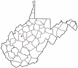 Location of Spencer, West Virginia | |
| Coordinates: 38°48′6″N 81°21′6″W / 38.80167°N 81.35167°WCoordinates: 38°48′6″N 81°21′6″W / 38.80167°N 81.35167°W | |
| Country | United States |
| State | West Virginia |
| County | Roane |
| Area[1] | |
| • Total | 1.28 sq mi (3.32 km2) |
| • Land | 1.26 sq mi (3.26 km2) |
| • Water | 0.02 sq mi (0.05 km2) |
| Elevation | 748 ft (228 m) |
| Population (2010)[2] | |
| • Total | 2,322 |
| • Estimate (2012[3]) | 2,252 |
| • Density | 1,842.9/sq mi (711.5/km2) |
| Time zone | Eastern (EST) (UTC-5) |
| • Summer (DST) | EDT (UTC-4) |
| ZIP code | 25276 |
| Area code(s) | 304 |
| FIPS code | 54-75820[4] |
| GNIS feature ID | 1547124[5] |

Spencer is a city in Roane County, West Virginia, USA. Originally known as "California," Spencer was chartered in 1858, and named after Spencer Roane (1762–1822), a distinguished jurist from Virginia, who served on the Virginia Supreme Court of Appeals, and for whom Roane county was named.[6][7] The population was 2,322 at the 2010 census. It is the county seat of Roane County.[8] Spencer is the home of the annual West Virginia Black Walnut Festival.[9] Points of interest include Charles Fork Lake, Chrystal Water and Power Company-Spencer Water and Ice Company, the McIntosh Mansion, and the Robey Theatre.
Geography
Spencer is located at 38°48′6″N 81°21′6″W / 38.80167°N 81.35167°W (38.801690, -81.351689).[10] Spring Creek flows through the city.[11]
According to the United States Census Bureau, the city has a total area of 1.28 square miles (3.32 km2), of which, 1.26 square miles (3.26 km2) is land and 0.02 square miles (0.05 km2) is water.[1]
Climate
The climate in this area is characterized by hot, humid summers and generally mild to cool winters. According to the Köppen Climate Classification system, Spencer has a humid subtropical climate, abbreviated "Cfa" on climate maps.[12]
Demographics
| Historical population | |||
|---|---|---|---|
| Census | Pop. | %± | |
| 1860 | 196 | — | |
| 1870 | 143 | −27.0% | |
| 1880 | 226 | 58.0% | |
| 1890 | 431 | 90.7% | |
| 1900 | 737 | 71.0% | |
| 1910 | 1,224 | 66.1% | |
| 1920 | 1,765 | 44.2% | |
| 1930 | 2,493 | 41.2% | |
| 1940 | 2,497 | 0.2% | |
| 1950 | 2,587 | 3.6% | |
| 1960 | 2,660 | 2.8% | |
| 1970 | 2,271 | −14.6% | |
| 1980 | 2,799 | 23.2% | |
| 1990 | 2,279 | −18.6% | |
| 2000 | 2,352 | 3.2% | |
| 2010 | 2,322 | −1.3% | |
| Est. 2015 | 2,195 | [13] | −5.5% |
2010 census
As of the census[2] of 2010, there were 2,322 people, 1,005 households, and 578 families residing in the city. The population density was 1,842.9 inhabitants per square mile (711.5/km2). There were 1,180 housing units at an average density of 936.5 per square mile (361.6/km2). The racial makeup of the city was 97.5% White, 0.1% Native American, 0.3% Asian, 0.6% from other races, and 1.5% from two or more races. Hispanic or Latino of any race were 1.7% of the population.
There were 1,005 households of which 28.3% had children under the age of 18 living with them, 38.5% were married couples living together, 13.6% had a female householder with no husband present, 5.4% had a male householder with no wife present, and 42.5% were non-families. 37.6% of all households were made up of individuals and 17.7% had someone living alone who was 65 years of age or older. The average household size was 2.25 and the average family size was 2.94.
The median age in the city was 40.2 years. 23.2% of residents were under the age of 18; 8.5% were between the ages of 18 and 24; 23.5% were from 25 to 44; 26.3% were from 45 to 64; and 18.5% were 65 years of age or older. The gender makeup of the city was 46.7% male and 53.3% female.
2000 census
As of the census[4] of 2000, there were 2,352 people, 1,005 households, and 614 families residing in the city. The population density was 1,984.3 people per square mile (763.1/km²). There were 1,154 housing units at an average density of 973.6 per square mile (374.4/km²). The racial makeup of the city was 97.62% White, 0.13% African American, 0.21% Native American, 0.68% Asian, 0.04% from other races, and 1.32% from two or more races. Hispanic or Latino of any race were 0.77% of the population.
There were 1,005 households out of which 27.6% had children under the age of 18 living with them, 44.2% were married couples living together, 12.9% had a female householder with no husband present, and 38.9% were non-families. 35.0% of all households were made up of individuals and 19.8% had someone living alone who was 65 years of age or older. The average household size was 2.25 and the average family size was 2.89.
In the city the population was spread out with 23.9% under the age of 18, 8.3% from 18 to 24, 23.6% from 25 to 44, 22.1% from 45 to 64, and 22.2% who were 65 years of age or older. The median age was 41 years. For every 100 females there were 86.1 males. For every 100 females age 18 and over, there were 80.6 males.
The median income for a household in the city was $19,773, and the median income for a family was $28,500. Males had a median income of $28,000 versus $16,452 for females. The per capita income for the city was $12,976. About 24.9% of families and 31.0% of the population were below the poverty line, including 42.8% of those under age 18 and 21.4% of those age 65 or over.
Notable natives and residents
- Ruby Bradley, Colonel, US Army, 1907–2002
- Derek Hardman, Offensive tackle for the National Football League's Detroit Lions
- Debbie Hersman, Chairperson, National Transportation Safety Board, 2009-[15]
References
- 1 2 "US Gazetteer files 2010". United States Census Bureau. Retrieved 2013-01-24.
- 1 2 "American FactFinder". United States Census Bureau. Retrieved 2013-01-24.
- ↑ "Population Estimates". United States Census Bureau. Retrieved 2013-06-26.
- 1 2 "American FactFinder". United States Census Bureau. Retrieved 2008-01-31.
- ↑ "US Board on Geographic Names". United States Geological Survey. 2007-10-25. Retrieved 2008-01-31.
- ↑ "Spencer" in The West Virginia Encyclopedia, Ken Sullivan (Ed.), West Virginia Humanities Council (2006), p. 669.
- ↑ Capace, Nancy (1999). Encyclopedia of West Virginia. North American Book Dist LLC. p. 192. ISBN 978-0-403-09843-9.
- ↑ "Find a County". National Association of Counties. Retrieved 2011-06-07.
- ↑ West Virginia Black Walnut Festival
- ↑ "US Gazetteer files: 2010, 2000, and 1990". United States Census Bureau. 2011-02-12. Retrieved 2011-04-23.
- ↑ West Virginia Atlas & Gazetteer. Yarmouth, Me.: DeLorme. 1997. p. 34. ISBN 0-89933-246-3.
- ↑ Climate Summary for Spencer, West Virginia
- ↑ "Annual Estimates of the Resident Population for Incorporated Places: April 1, 2010 to July 1, 2015". Retrieved July 2, 2016.
- ↑ "Census of Population and Housing". Census.gov. Retrieved June 4, 2015.
- ↑ Stump, Jake. "Obama taps Spencer native to head agency", Charleston Daily Mail, Friday July 10, 2009
External links
Municipalities and communities of Roane County, West Virginia, United States | ||
|---|---|---|
| City | 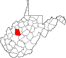 | |
| Town | ||
| Unincorporated communities |
| |
| Ghost towns | ||
| Footnotes | ‡This populated place also has portions in an adjacent county or counties | |