Oakvale, West Virginia
| Oakvale, West Virginia | |
|---|---|
| Town | |
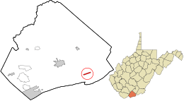 Location in Mercer County and the state of West Virginia. | |
| Coordinates: 37°19′56″N 80°58′8″W / 37.33222°N 80.96889°WCoordinates: 37°19′56″N 80°58′8″W / 37.33222°N 80.96889°W | |
| Country | United States |
| State | West Virginia |
| County | Mercer |
| Area[1] | |
| • Total | 0.42 sq mi (1.09 km2) |
| • Land | 0.42 sq mi (1.09 km2) |
| • Water | 0 sq mi (0 km2) |
| Elevation | 1,722 ft (525 m) |
| Population (2010)[2] | |
| • Total | 121 |
| • Estimate (2012[3]) | 118 |
| • Density | 288.1/sq mi (111.2/km2) |
| Time zone | Eastern (EST) (UTC-5) |
| • Summer (DST) | EDT (UTC-4) |
| ZIP code | 24739 |
| Area code(s) | 304 |
| FIPS code | 54-60196[4] |
| GNIS feature ID | 1552361[5] |
Oakvale is a town in Mercer County, West Virginia, along the East River. The population was 121 at the 2010 census. It is part of the Bluefield, WV-VA micropolitan area which has a population of 107,578.
Geography
Oakvale is located at 37°19′56″N 80°58′8″W / 37.33222°N 80.96889°W (37.332163, -80.968802).[6]
According to the United States Census Bureau, the town has a total area of 0.42 square miles (1.09 km2), all land.[1]
Demographics
| Historical population | |||
|---|---|---|---|
| Census | Pop. | %± | |
| 1910 | 278 | — | |
| 1920 | 281 | 1.1% | |
| 1930 | 261 | −7.1% | |
| 1940 | 273 | 4.6% | |
| 1950 | 239 | −12.5% | |
| 1960 | 267 | 11.7% | |
| 1970 | 292 | 9.4% | |
| 1980 | 208 | −28.8% | |
| 1990 | 165 | −20.7% | |
| 2000 | 142 | −13.9% | |
| 2010 | 121 | −14.8% | |
| Est. 2015 | 120 | [7] | −0.8% |
2010 census
As of the census[2] of 2010, there were 121 people, 49 households, and 31 families residing in the town. The population density was 288.1 inhabitants per square mile (111.2/km2). There were 55 housing units at an average density of 131.0 per square mile (50.6/km2). The racial makeup of the town was 100.0% White.
There were 49 households of which 28.6% had children under the age of 18 living with them, 42.9% were married couples living together, 12.2% had a female householder with no husband present, 8.2% had a male householder with no wife present, and 36.7% were non-families. 22.4% of all households were made up of individuals and 10.2% had someone living alone who was 65 years of age or older. The average household size was 2.47 and the average family size was 2.94.
The median age in the town was 41.9 years. 24% of residents were under the age of 18; 4.9% were between the ages of 18 and 24; 27.3% were from 25 to 44; 27.3% were from 45 to 64; and 16.5% were 65 years of age or older. The gender makeup of the town was 52.1% male and 47.9% female.
2000 census
As of the census[4] of 2000, there were 142 people, 58 households, and 45 families residing in the town. The population density was 332.2 inhabitants per square mile (127.5/km²). There were 65 housing units at an average density of 152.0 per square mile (58.4/km²). The racial makeup of the town was 97.89% White, 1.41% African American, and 0.70% from two or more races.
There were 58 households out of which 29.3% had children under the age of 18 living with them, 48.3% were married couples living together, 20.7% had a female householder with no husband present, and 22.4% were non-families. 20.7% of all households were made up of individuals and 12.1% had someone living alone who was 65 years of age or older. The average household size was 2.45 and the average family size was 2.73.
In the town the population was spread out with 23.2% under the age of 18, 10.6% from 18 to 24, 28.9% from 25 to 44, 25.4% from 45 to 64, and 12.0% who were 65 years of age or older. The median age was 37 years. For every 100 females there were 91.9 males. For every 100 females age 18 and over, there were 91.2 males.
The median income for a household in the town was $22,500, and the median income for a family was $23,750. Males had a median income of $24,375 versus $22,500 for females. The per capita income for the town was $9,593. There were 9.5% of families and 19.0% of the population living below the poverty line, including 16.0% of under eighteens and 25.0% of those over 64.
See also
References
- 1 2 "US Gazetteer files 2010". United States Census Bureau. Archived from the original on January 24, 2012. Retrieved 2013-01-24.
- 1 2 "American FactFinder". United States Census Bureau. Retrieved 2013-01-24.
- ↑ "Population Estimates". United States Census Bureau. Archived from the original on June 17, 2013. Retrieved 2013-06-26.
- 1 2 "American FactFinder". United States Census Bureau. Archived from the original on September 11, 2013. Retrieved 2008-01-31.
- ↑ "US Board on Geographic Names". United States Geological Survey. 2007-10-25. Retrieved 2008-01-31.
- ↑ "US Gazetteer files: 2010, 2000, and 1990". United States Census Bureau. 2011-02-12. Retrieved 2011-04-23.
- ↑ "Annual Estimates of the Resident Population for Incorporated Places: April 1, 2010 to July 1, 2015". Retrieved July 2, 2016.
- ↑ "Census of Population and Housing". Census.gov. Archived from the original on May 11, 2015. Retrieved June 4, 2015.
Municipalities and communities of Mercer County, West Virginia, United States | ||
|---|---|---|
| Cities |  | |
| Towns | ||
| CDPs | ||
| Other communities |
| |
| Ghost town | ||
| Footnotes | ‡This populated place also has portions in an adjacent county or counties | |