Windsor Heights, West Virginia
| Windsor Heights, West Virginia | |
|---|---|
| Village | |
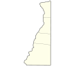
 Location of Windsor Heights, West Virginia | |
| Coordinates: 40°11′30″N 80°39′56″W / 40.19167°N 80.66556°WCoordinates: 40°11′30″N 80°39′56″W / 40.19167°N 80.66556°W | |
| Country | United States |
| State | West Virginia |
| County | Brooke |
| Area[1] | |
| • Total | 0.14 sq mi (0.36 km2) |
| • Land | 0.14 sq mi (0.36 km2) |
| • Water | 0 sq mi (0 km2) |
| Elevation | 1,004 ft (306 m) |
| Population (2010)[2] | |
| • Total | 423 |
| • Estimate (2012[3]) | 416 |
| • Density | 3,021.4/sq mi (1,166.6/km2) |
| Time zone | Eastern (EST) (UTC-5) |
| • Summer (DST) | EDT (UTC-4) |
| ZIP code | 26075 |
| Area code(s) | 304 |
| FIPS code | 54-87892[4] |
| GNIS feature ID | 1560604[5] |
Windsor Heights is a village in Brooke County, West Virginia, United States. It is part of the Wheeling, West Virginia Metropolitan Statistical Area. The population was 423 at the 2010 census. James Smith was mayor as of July 1st, 2013.
Geography
Windsor Heights is located at 40°11′30″N 80°39′56″W / 40.19167°N 80.66556°W (40.191658, -80.665594).[6]
According to the United States Census Bureau, the village has a total area of 0.14 square miles (0.36 km2), all of it land.[1]
Demographics
| Historical population | |||
|---|---|---|---|
| Census | Pop. | %± | |
| 2000 | 431 | — | |
| 2010 | 423 | −1.9% | |
| Est. 2015 | 402 | [7] | −5.0% |
2010 census
As of the census[2] of 2010, there were 423 people, 170 households, and 121 families residing in the village. The population density was 3,021.4 inhabitants per square mile (1,166.6/km2). There were 185 housing units at an average density of 1,321.4 per square mile (510.2/km2). The racial makeup of the village was 99.5% White and 0.5% African American.
There were 170 households of which 32.9% had children under the age of 18 living with them, 54.7% were married couples living together, 10.6% had a female householder with no husband present, 5.9% had a male householder with no wife present, and 28.8% were non-families. 25.3% of all households were made up of individuals and 14.7% had someone living alone who was 65 years of age or older. The average household size was 2.48 and the average family size was 2.94.
The median age in the village was 40.6 years. 22.2% of residents were under the age of 18; 5.3% were between the ages of 18 and 24; 26.7% were from 25 to 44; 30.5% were from 45 to 64; and 15.4% were 65 years of age or older. The gender makeup of the village was 50.4% male and 49.6% female.
2000 census
As of the census[4] of 2000, there were 431 people, 180 households, and 124 families residing in the village. The population density was 3,053.2 people per square mile (1,188.6/km²). There were 197 housing units at an average density of 1,395.6 per square mile (543.3/km²). The racial makeup of the village was 99.07% White, 0.46% Native American, and 0.46% from two or more races.
There were 180 households out of which 26.1% had children under the age of 18 living with them, 55.0% were married couples living together, 9.4% had a female householder with no husband present, and 31.1% were non-families. 26.7% of all households were made up of individuals and 17.2% had someone living alone who was 65 years of age or older. The average household size was 2.39 and the average family size was 2.91.
The age distribution is 20.9% under the age of 18, 7.9% from 18 to 24, 26.7% from 25 to 44, 25.5% from 45 to 64, and 19.0% who were 65 years of age or older. The median age was 40 years. For every 100 females there were 93.3 males. For every 100 females age 18 and over, there were 98.3 males.
The median income for a household in the village was $28,523, and the median income for a family was $37,794. Males had a median income of $30,833 versus $20,000 for females. The per capita income for the village was $17,315. About 5.6% of families and 8.4% of the population were below the poverty line, including 10.5% of those under age 18 and 3.3% of those age 65 or over.
References
- 1 2 "US Gazetteer files 2010". United States Census Bureau. Retrieved 2013-01-24.
- 1 2 "American FactFinder". United States Census Bureau. Retrieved 2013-01-24.
- ↑ "Population Estimates". United States Census Bureau. Retrieved 2013-06-26.
- 1 2 "American FactFinder". United States Census Bureau. Retrieved 2008-01-31.
- ↑ "US Board on Geographic Names". United States Geological Survey. 2007-10-25. Retrieved 2008-01-31.
- ↑ "US Gazetteer files: 2010, 2000, and 1990". United States Census Bureau. 2011-02-12. Retrieved 2011-04-23.
- ↑ "Annual Estimates of the Resident Population for Incorporated Places: April 1, 2010 to July 1, 2015". Retrieved July 2, 2016.
- ↑ "Census of Population and Housing". Census.gov. Retrieved June 4, 2015.
See also
Municipalities and communities of Brooke County, West Virginia, United States | ||
|---|---|---|
| Cities |  | |
| Town | ||
| Villages | ||
| CDP | ||
| Unincorporated communities | ||
| Footnotes | ‡This populated place also has portions in an adjacent county or counties | |
| Counties | 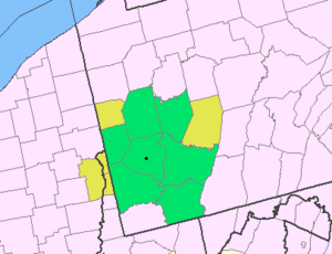 Map of the Pittsburgh Tri-State with green counties in the metropolitan area and yellow counties in the combined area. | |
|---|---|---|
| Major cities | ||
| Cities and towns 15k-50k (in 2010) | ||
| Airports | ||
| Topics | ||
| ||