Murray River National Park
| Murray River National Park South Australia | |
|---|---|
|
IUCN category VI (protected area with sustainable use of natural resources) | |
 Murray River National Park | |
| Nearest town or city | Berri |
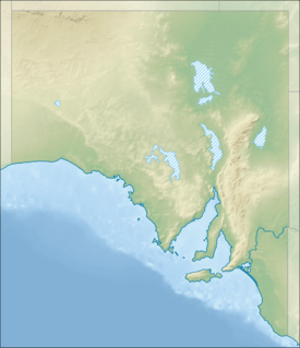
| Coordinates | 34°23′13″S 140°32′23″E / 34.38694°S 140.53972°ECoordinates: 34°23′13″S 140°32′23″E / 34.38694°S 140.53972°E |
| Established | 27 April 1972[1] |
| Area | 135.92 km2 (52.5 sq mi)[1] |
| Managing authorities | Department of Environment, Water and Natural Resources |
| Website | Murray River National Park |
| See also | Protected areas of South Australia |
Murray River National Park is a protected area in South Australia located between 180 kilometres (110 mi) and 240 kilometres (150 mi) north east of the Adelaide city centre. The national park was proclaimed in 1972 "to conserve a significant proportion of South Australia’s floodplain environments which are not represented widely in other reserve systems." The national park consists of three sections adjoining the Murray River and extending from near Loxton in the south west to near Renmark in the north-east. The first which is known as the ‘Katarapko’ section is located on the north side of the river between Loxton in the south and Berri in the north. The second section which is known as the ‘Lyrup Flats’ section is located on the north side of the river midway between Berri and Loxton. The third section is known as the ‘Bulyong’ section is located on the west side of the river upstream from Renmark. The national park is classified as an IUCN Category VI protected area.[2][3][4]
See also
- Protected areas of South Australia
- Riverland Biosphere Reserve
- List of islands within the Murray River in South Australia
- Riverland Mallee Important Bird Area
References
- 1 2 "Protected Areas Information System - reserve list (as of 25 November 2014)" (PDF). Department of Environment Water and Natural Resources. Retrieved 8 January 2015.
- ↑ "Murray River National Park (Including Rilli Island, Media Island and Kapunda Island) Management Plan Amendment 2010" (PDF). Department for Environment and Natural Resources. 2010. p. 1. Retrieved 16 January 2015.
- ↑ "Murray River National Park Management Plan (including Rilli Island, Media Island and Kapunda Island Conservation Park)" (PDF). Department for Environment and Natural Resources. 1994. pp. vi–vii. Retrieved 16 January 2015.
- ↑ "Terrestrial Protected Areas of South Australia (see 'DETAIL' tab)". CAPAD 2012. Australian Government - Department of the Environment. 6 February 2014. Retrieved 6 February 2014.