Chowilla Regional Reserve
| Chowilla Regional Reserve South Australia | |
|---|---|
|
IUCN category VI (protected area with sustainable use of natural resources) | |
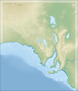 Chowilla Regional Reserve | |
| Nearest town or city | Berri[1] |
| Coordinates | 33°41′47.7″S 140°51′48.9″E / 33.696583°S 140.863583°ECoordinates: 33°41′47.7″S 140°51′48.9″E / 33.696583°S 140.863583°E |
| Established | 8 April 1993[1] |
| Area | 752.21 km2 (290.4 sq mi)[1] |
| Managing authorities |
Department of Environment, Water and Natural Resources Robertson Chowilla Pty Ltd[2] |
| Website | Chowilla Regional Reserve |
| Footnotes | Coordinates[3] |
| See also | Protected areas of South Australia |
Chowilla Regional Reserve is a type of protected area known as a regional reserve. It is located in the Australian state of South Australia approximately 250 kilometres (160 mi) north-east of Adelaide. It was proclaimed 8 April 1993 in conjunction with the Chowilla Game Reserve and has an area of 75,221 hectares (185,880 acres). ‘It protects and conserves a semi-arid environment adjacent to the Murray River. The dominant land uses of the reserve are pastoral production, conservation of natural and historic features and tourism/recreation.’[4] The regional reserve is classified as an IUCN Category VI protected area.[3]
Name
Chowilla is an Aboriginal name for this district. There were various early spellings by pioneers for the Chowilla Creek anabranch and floodplain. These include Cawilli by Sturt and Kawelle by Browne. Tindale noted Tjowilla, as well as the accepted modern spelling Chowilla. Tindale attributes the meaning to a 'place of spirits or ghosts'.
History
The Aboriginal inhabitants of the Chowilla region were the Maraura people. The first European exploration was the expedition of Capt Charles Sturt in 1830. There were no further European incursions until 1838, when Hawdon and Bonney were the first to overland livestock between NSW and South Australia. Theirs was the harbinger of numerous such overlanding expeditions over the following years, the increasing pace and scale of which climaxed in conflict known as the Rufus River massacre at nearby Lake Victoria. Hostilities between Aboriginals and Europeans abated following that, such that by 1846 the first pastoralist settlers arrived in the district, led by Fred Handcock, Henry Jones, James Fisher, and Ned Bagot.
See also
- Protected areas of South Australia
- Regional reserves of South Australia
- Regional Reserve (Australia)
- Riverland Biosphere Reserve
- Chowilla, South Australia
References
- 1 2 3 "Protected Areas Information System - reserve list (as of 17 Feb 2014)" (PDF). Department of Environment Water and Natural Resources. Retrieved 27 March 2014.
- ↑ "Fire Management Plan, Bookmark Mallee 2009-2019" (PDF). Department for Environment and Heritage. p. 54. Retrieved 28 September 2015.
- 1 2 "Terrestrial Protected Areas of South Australia (see 'DETAIL' tab)". CAPAD 2014. Australian Government - Department of the Environment. 2014. Retrieved 13 March 2015.
- ↑ "Regional reserves". Department of Environment Water and Natural Resources. Retrieved 31 March 2014.