Riverland Biosphere Reserve
| Riverland Biosphere Reserve South Australia | |
|---|---|
 Mallee woodland at Gluepot Reserve, South Australia | |
 Riverland Biosphere Reserve | |
| Nearest town or city |
Berri Renmark Paringa |
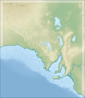
| Coordinates | 33°19′0″S 140°30′0″E / 33.31667°S 140.50000°ECoordinates: 33°19′0″S 140°30′0″E / 33.31667°S 140.50000°E |
| Established | 1977[1] |
| Area | 9,000 km2 (3,474.9 sq mi)[1] |
| Footnotes | Coordinates [1] |
The Riverland Biosphere Reserve, formerly the Bookmark Biosphere Reserve, is a 9,000 square kilometres (3,500 sq mi) area of land in eastern South Australia, adjoining the states of New South Wales and Victoria. It is one of 14 biosphere reserves in Australia and is part of the World Network of Biosphere Reserves, being officially recognized and listed by UNESCO in 1977.[1][2]
Description
The reserve is composed of several mainly contiguous properties that, although having different ownerships and different management purposes, have the joint aim of identifying approaches to ecologically sustainable development in a low-productivity landscape with many shared land-management problems. It lies in the Murray Mallee and the Riverland with the native vegetation predominantly mallee woodland and shrubland, but also including wetlands and riverine communities along the Murray River. The flood plains of the reserve are recognised as internationally significant wetlands for migratory birds under the Ramsar Convention. The reserve is involved in Australia’s national recovery plan for the endangered black-eared miner[3][4]
The reserve's many component properties include protected areas, pastoral leases and privately owned land such as the following:
- Calperum Station[5]
- Chowilla Regional Reserve[6]
- Chowilla Game Reserve[6]
- Cooltong Conservation Park[6]
- Danggali Conservation Park[6]
- Danggali Wilderness Protection Area[6]
- Gluepot Reserve[6]
- Loch Luna Game Reserve[6]
- Moorook Game Reserve[6]
- Murray River National Park[6][7]
- Taylorville Station[5]
The reserve is also overlapped by the Riverland Mallee Important Bird Area, an area identified by BirdLife International as being "important" for the conservation of mallee birds and their habitats.[8]
See also
References
- 1 2 3 4 "Biosphere Reserve Information, RIVERLAND". UNESCO. Retrieved 3 November 2014.
- ↑ "Australia's Biosphere Reserves". Parks Australia. Retrieved 3 November 2014.
- ↑ Lindenmayer, David; & Burgman, Mark A. (2005). Practical Conservation Biology. CSIRO Publishing: Melbourne. ISBN 0-643-09089-4
- ↑ Brunckhorst, David J. (2000). Bioregional Planning: Resource Management Beyond the New Millennium. Routledge. ISBN 90-5823-046-5
- 1 2 "Calperum and Taylorville Stations". Australian government, Department of the Environment. Retrieved 2 November 2014.
- 1 2 3 4 5 6 7 8 9 "Danggali Wilderness Protection Area and Conservation Park Management Plan 2011" (PDF). Department of Environment and Natural Resources. p. 2. Retrieved 3 November 2014.
- ↑ "Murray River National Park Management Plan (including Rilli Island, Media Island and Kapunda Island Conservation Park)" (PDF). Department for Environment and Natural Resources. 1994. pp. xii. Retrieved 16 January 2015.
- ↑ "Important Bird Areas factsheet: Riverland Mallee". BirdLife International. 2014. Retrieved 2 November 2014.
External links
- UNESCO - Biosphere reserves
- Australian biosphere reserves - location map
- Entry for Riverland Biosphere Reserve on protected planet