Port Noarlunga Reef Aquatic Reserve
| Port Noarlunga Reef Aquatic Reserve South Australia | |
|---|---|
|
IUCN category VI (protected area with sustainable use of natural resources) | |
.jpg) Port Noarlunga Jetty and the submerged Port Noarlunga Reef | |
 Port Noarlunga Reef Aquatic Reserve | |
| Nearest town or city |
Christies Beach Port Noarlunga Port Noarlunga South Noarlunga Downs Seaford Meadows Seaford |
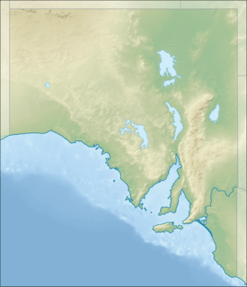
| Coordinates | 35°16′13″S 138°27′43″E / 35.2702°S 138.4619°ECoordinates: 35°16′13″S 138°27′43″E / 35.2702°S 138.4619°E |
| Established | 1 December 1971[1] |
| Area | 5.79 km2 (2.2 sq mi)[2] |
| Visitation | 170,000 (in 1987)[3] |
| Managing authorities | Primary Industries and Resources South Australia (PIRSA) |
| Footnotes |
Coordinates[2] Nearest towns/cities[4] Managing authority[5] |
| See also | Protected areas of South Australia |
Port Noarlunga Reef Aquatic Reserve is a marine protected area in the Australian state of South Australia located in waters in Gulf St Vincent adjoining the Adelaide metropolitan area and including part of the Onkaparinga River about 28 kilometres (17 mi) south-west of the state capital of Adelaide.[4][5][6]
As of 2016, the aquatic reserve extents seaward for a distance of about 1.75 kilometres (1.09 mi) from Gulfview Road in the suburb of Christies Beach in the north with its seaward boundary finishing in the south at the shoreline near the west end of Helmsman Terrace in the suburb of Seaford and includes the full extent of the Onkaparinga River from its mouth to the bridge on the South Road in the suburbs of Noarlunga Downs and Seaford Meadows.[4][6]
The portion of the aquatic reserve located within Gulf St Vincent includes two reef systems that are exposed at low tide - the Horseshoe Reef located off the coast at Christies Beach and the Port Noarlunga Reef located off the coast at Port Noarlunga. The Port Noarlunga Reef is connected to the shore by a jetty.[5][7]
The aquatic reserve was declared on 30 November 1971 to protect “reef organisms from exploitation and for the conservation of the estuary and swamps of the lower Onkaparinga River, for the purposes of recreation and education.”[1][5]
Fishing activity is limited to the use of rod and handline except for the waters within 25 metres (82 ft) of Horseshoe Reef and can only be carried out at Port Noarlunga from the beach and the jetty to within 50 metres (160 ft) of the Port Noarlunga Reef. The use of ‘hand nets for the taking of shrimps for bait only’ is permitted in estuary and the Onkaparinga River.[5]
In 1994, the South Australian Research and Development Institute installed an “underwater interpretation trail” in order to “raise community awareness of temperate reef environments and marine life.” The trail which covers a distance of 800 metres (2,600 ft) consists of 12 concrete plinths installed on the seabed and each fitted with a plaque providing information about the reef’s sub-tidal flora and fauna. The trail which starts at the jetty heads south on the east side of the reef and passes through a passage in the reef known as The Gap and then heads north on the west side of the reef to a point opposite the end of the jetty.[3][7]
Since 2012, its full extent has been located within the boundaries of the protected area known as the Encounter Marine Park and is fully occupied by four ‘habitat protection zones’ and two ‘sanctuary zones’ including one extending along the coastline from Witton Bluff in the north and Onkaparinga Head in the south.[8]
The aquatic reserve is classified as an IUCN Category VI protected area.[2]
See also
- Protected areas of South Australia
- List of protected areas in Adelaide
- Onkaparinga River Recreation Park
References
- 1 2 "Aquatic Reserves (as part of the proclamation of the Fisheries Act 1971)" (PDF). South Australian Government Gazette. Government of South Australia. 30 November 1971. pp. 2263 – 2264. Retrieved 12 November 2016.
- 1 2 3 "Collaborative Australian Protected Area Database (CAPAD) - Marine Protected Areas in coastal waters of South Australia (refer "DETAIL' tab)". Australian Government, Department of the Environment (DoE). Retrieved 11 April 2016.
- 1 2 Edyvane, K.S. (May 1999). Conserving Marine Biodiversity in South Australia - Part 2 - Identification of areas of high conservation value in South Australia. South Australian Research and Development Institute. p. 187. ISBN 0730852385.
- 1 2 3 "Search result for "Port Noarlunga, sub" with the following databases selected - "Suburbs and Localities", "Aquatic Reserves" and "State Marine Park Network "". Location SA Viewer. Government of South Australia. Retrieved 12 November 2016.
- 1 2 3 4 5 Primary Industries and Regions South Australia (PIRSA) (2007), Aquatic Reserve: Port Noarlunga (PDF), Primary Industries and Regions South Australia, archived from the original (PDF) on 15 October 2014
- 1 2 Boating Industry Association of South Australia (BIA); South Australia. Department for Environment and Heritage (2005), South Australia's waters an atlas & guide, Boating Industry Association of South Australia, p. 199, ISBN 978-1-86254-680-6
- 1 2 "Port Noarlunga Reef Underwater Trail" (PDF). Department of Primary Industries and Regions SA (PIRSA). Retrieved 12 November 2016.
- ↑ "Encounter Marine Park Management Plan 2012" (PDF). Department of Environment, Water and Natural Resources. pp. 10, 25, 26, 36, 37 and 38. Retrieved 10 October 2016.