Shire of Miriam Vale
| Shire of Miriam Vale Queensland | |||||||||||||
|---|---|---|---|---|---|---|---|---|---|---|---|---|---|
 Location within Queensland | |||||||||||||
| Population | 4,813 (2001 census) | ||||||||||||
| • Density | 1.267/km2 (3.28/sq mi) | ||||||||||||
| Area | 3,800 km2 (1,467.2 sq mi) | ||||||||||||
| Council seat | Miriam Vale | ||||||||||||
|
| |||||||||||||
| Website | Shire of Miriam Vale | ||||||||||||
| |||||||||||||
The Shire of Miriam Vale was a local government area near Gladstone in Queensland, Australia. The administrative centre was the town of Miriam Vale.
History
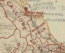
Calliope Division was created on 11 November 1879 as one of 74 divisions around Queensland under the Divisional Boards Act 1879.[1] On 7 January 1902 the Miriam Vale Division was separated from Calliope Division.[2][3]
With the passage of the Local Authorities Act 1902, Miriam Vale Division became the Shire of Miriam Vale on 31 March 1903.
Following the report of the Local Government Reform Commission released in July 2007, three former local government areas:
- City of Gladstone
- Shire of Calliope
- Shire of Miriam Vale
were amalgamated to form Gladstone Region on 15 March 2008.[4][5]
Towns and localities
The Shire of Miriam Vale included the following settlements:
Towns:
- 1770
- Agnes Water
- Miriam Vale (administrative centre)
Villages:
Other communities:
- Baffle Creek
- Deepwater
Economy
The Shire of Miriam Vale was a sheep growing area, and also supported timber, beef and dairy cattle. Tourism was an emerging industry within the Shire.
Chairmen
- 1927: G. G. Hales [6]
References
- ↑ "Proclamation [Calliope Division]". Queensland Government Gazette. 11 November 1879. p. 25:1004.
- ↑ "OFFICIAL ITEMS.". The Queenslander (Brisbane, Qld. : 1866 - 1939). Brisbane, Qld.: National Library of Australia. 11 January 1902. p. 52. Retrieved 27 December 2013.
- ↑ "Miriam Vale and Miriam Vale Shire". Queensland Places. Centre for the Government of Queensland, University of Queensland. Retrieved 27 December 2013.
- ↑ "Gladstone Region". Queensland Places. Centre for the Government of Queensland, University of Queensland. Retrieved 8 September 2013.
- ↑ "Gladstone Regional Council",Centre for the Government of Queensland, Retrieved January 14, 2012.
- ↑ Pugh, Theophilus Parsons (1927). Pugh's Almanac for 1927. Retrieved 13 June 2014.
External links
- "Miriam Vale and Miriam Vale Shire". Queensland Places. Centre for the Government of Queensland, University of Queensland.
Coordinates: 24°19′43″S 151°33′43.4″E / 24.32861°S 151.562056°E