Town of Roma
| Town of Roma Queensland | |
|---|---|
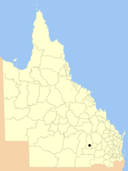 Location within Queensland | |
| Population | 6,906 (2011 census)[1] |
| Established | 1867 |
| Council seat | Roma |
| Region | Darling Downs |
|
| |
| Website | Town of Roma |
The Town of Roma was a local government area in the western Downs region of Queensland, Australia. The Town of Roma covered the urban area of Roma and was completely surrounded by the neighbouring Shire of Bungil. Today it is part of the Maranoa Region. At the 2011 census the Town had a population of 6,906[1]
History
The Borough of Roma was established in 1867.[2]
On 31 March 1903, under the Local Authorities Act (1902), the Borough of Roma became the Town of Roma.[2]
In July 2007, the Local Government Reform Commission released a report recommending a number of amalgamations of local government areas in Queensland. As a result, under the Local Government (Reform Implementation) Act 2007, on 15 March 2008, the new local government area of Roma Region was created, as an amalgamation of five previous local government areas:[2][3]
- the Town of Roma;
- the Shire of Bendemere;
- the Shire of Booringa;
- the Shire of Bungil;
- and the Shire of Warroo.
On 26 July 2009, Roma Region was renamed Maranoa Region.[3]
Mayors
- 1867: T. McEwen[4]

- 1902: T.A. Spencer[5]
- 1906: R. Conlan [6]
- James Lalor, also Member of the Queensland Legislative Assembly and the Queensland Legislative Council[7]
- 1927: George Power Williams [8]
- Richard James Cottell (twice) [9]
- 2000 - 2008: Bruce Garvie[10]
References
- 1 2 Australian Bureau of Statistics (31 October 2012). "2011 Community Profiles: Roma (T) (Local Government Area)". 2011 Census of Population and Housing. Retrieved 2016-10-04.
- 1 2 3 "Agency ID2460, Roma Town Council". Queensland State Archives. Retrieved 22 January 2014.
- 1 2 "Agency ID11033, Maranoa Regional Council". Queensland State Archives. Retrieved 5 September 2013.
- ↑ Spencer, Hope (22 April 1948). "Roma: Its Growth and Development" (PDF). Historical Society of Queensland, Inc. Retrieved 22 January 2014.
- ↑ Consolidated Index to Queensland Government Gazette 1859-1919. Queensland Family History Society. 2004. ISBN 1 876613 79 3.
- ↑ "Queensland Mayors and Shire Chairmen.". The Queenslander (Brisbane, Qld. : 1866 - 1939). Brisbane, Qld.: National Library of Australia. 24 February 1906. p. 22. Retrieved 1 October 2015.
- ↑ "Lalor, James". Re-Member Database. Queensland Parliament. Retrieved 18 June 2014.
- ↑ Pugh, Theophilus Parsons (1927). Pugh's Almanac for 1927. Retrieved 13 June 2014.
- ↑ Welch, Melva A, (compiler.); Toowong and District Historical Society (issuing body) (2013), Cradle to grave - Toowong Council, Toowong, [Queensland] Toowong and District Historical Society, ISBN 978-0-9872487-0-1
- ↑ "The Councillors". Roma Town Council. Archived from the original on 30 August 2007. Retrieved 22 January 2014.
External links
- Queensland Department of Local Government & Planning - Local Government Directory.
- "Roma". Queensland Places. Centre for the Government of Queensland, University of Queensland.
Coordinates: 26°34′18″S 148°47′26″E / 26.57167°S 148.79056°E