Shire of Herberton
| Shire of Herberton Queensland | |||||||||||||
|---|---|---|---|---|---|---|---|---|---|---|---|---|---|
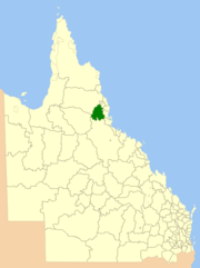 Location within Queensland | |||||||||||||
| Population | 5,423 (2006 census)[1] | ||||||||||||
| • Density | 0.56448/km2 (1.46201/sq mi) | ||||||||||||
| Established | 1895 | ||||||||||||
| Area | 9,607.0 km2 (3,709.3 sq mi) | ||||||||||||
| Council seat | Herberton | ||||||||||||
| Region | Far North Queensland | ||||||||||||
|
| |||||||||||||
| Website | Shire of Herberton | ||||||||||||
| |||||||||||||
The Shire of Herberton was a local government area of Queensland. It was located on the Atherton Tableland, a plateau forming part of the Great Dividing Range west of the city of Cairns. The shire, administered from the town of Herberton, covered an area of 9,607.0 square kilometres (3,709.3 sq mi), and existed as a local government entity from 1895 until 2008, when it amalgamated with several other councils in the Tableland area to become the Tablelands Region.
History

Tinaroo Division was created on 3 September 1881 under the Divisional Boards Act 1879, and was responsible for a large area which included Herberton. On 15 September 1888, the Borough of Herberton was established to manage the affairs of the town of Herberton. On 11 May 1895, the borough was abolished and the entire Herberton region separated from Tinaroo to become the Herberton Division. With the passage of the Local Authorities Act 1902, Herberton Division became the Shire of Herberton on 31 March 1903.
On 15 March 2008, under the Local Government (Reform Implementation) Act 2007 passed by the Parliament of Queensland on 10 August 2007, the Shire of Herberton merged with the Shires of Atherton, Eacham and Mareeba to form the Tablelands Region.
Towns and localities
The Shire of Herberton included the following settlements:
- Herberton
- Evelyn
- Innot Hot Springs
- Kalunga
- Millstream
- Moomin
- Mount Garnet
- Ravenshoe
- Tumoulin
- Wairuna
- Wondecla
Chairmen
Population
| Year | Population |
|---|---|
| 1933 | 2,852 |
| 1947 | 3,198 |
| 1954 | 4,150 |
| 1961 | 3,815 |
| 1966 | 3,634 |
| 1971 | 3,726 |
| 1976 | 3,679 |
| 1981 | 3,688 |
| 1986 | 4,210 |
| 1991 | 4,560 |
| 1996 | 5,113 |
| 2001 | 5,083 |
| 2006 | 5,423 |
References
- ↑ Australian Bureau of Statistics (25 October 2007). "Herberton (S) (Local Government Area)". 2006 Census QuickStats. Retrieved 2009-04-16.
- ↑ "LICENSING AUTHORITIES.". Townsville Daily Bulletin. Qld.: National Library of Australia. 4 April 1908. p. 3. Retrieved 19 May 2014.
- ↑ Pugh, Theophilus Parsons (1927). Pugh's Almanac for 1927. Retrieved 13 June 2014.
Coordinates: 17°22′52″S 145°23′03″E / 17.3811°S 145.3841°E