Le Pègue
| Le Pègue | |
|---|---|
 | |
 Le Pègue | |
|
Location within Auvergne-Rhône-Alpes region  Le Pègue | |
| Coordinates: 44°25′49″N 5°03′02″E / 44.4303°N 5.0506°ECoordinates: 44°25′49″N 5°03′02″E / 44.4303°N 5.0506°E | |
| Country | France |
| Region | Auvergne-Rhône-Alpes |
| Department | Drôme |
| Arrondissement | Nyons |
| Canton | Grigan |
| Government | |
| • Mayor (2008–2014) | Roland Bogart |
| Area1 | 11.12 km2 (4.29 sq mi) |
| Population (2008)2 | 386 |
| • Density | 35/km2 (90/sq mi) |
| Time zone | CET (UTC+1) |
| • Summer (DST) | CEST (UTC+2) |
| INSEE/Postal code | 26226 / 26770 |
| Elevation | 348–1,323 m (1,142–4,341 ft) |
|
1 French Land Register data, which excludes lakes, ponds, glaciers > 1 km² (0.386 sq mi or 247 acres) and river estuaries. 2 Population without double counting: residents of multiple communes (e.g., students and military personnel) only counted once. | |
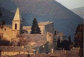
Le Pègue is a commune in the Drôme department in southeastern France.
Population
| Historical population | ||
|---|---|---|
| Year | Pop. | ±% |
| 1911 | 232 | — |
| 1962 | 165 | −28.9% |
| 1968 | 198 | +20.0% |
| 1975 | 214 | +8.1% |
| 1982 | 305 | +42.5% |
| 1990 | 369 | +21.0% |
| 1999 | 372 | +0.8% |
| 2008 | 386 | +3.8% |
See also
References
| Wikimedia Commons has media related to Le Pègue. |
This article is issued from Wikipedia - version of the 3/15/2016. The text is available under the Creative Commons Attribution/Share Alike but additional terms may apply for the media files.