Upie
| Upie | ||
|---|---|---|
|
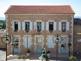
Town hall | ||
| ||
 Upie | ||
|
Location within Auvergne-Rhône-Alpes region  Upie | ||
| Coordinates: 44°48′18″N 4°58′44″E / 44.805°N 4.979°ECoordinates: 44°48′18″N 4°58′44″E / 44.805°N 4.979°E | ||
| Country | France | |
| Region | Auvergne-Rhône-Alpes | |
| Department | Drôme | |
| Arrondissement | Valence | |
| Canton | Chabeuil | |
| Government | ||
| • Mayor (2008–2014) | Martine Vincenot | |
| Area1 | 19.53 km2 (7.54 sq mi) | |
| Population (2008)2 | 1,389 | |
| • Density | 71/km2 (180/sq mi) | |
| Time zone | CET (UTC+1) | |
| • Summer (DST) | CEST (UTC+2) | |
| INSEE/Postal code | 26358 / 26120 | |
| Elevation |
158–415 m (518–1,362 ft) (avg. 221 m or 725 ft) | |
|
1 French Land Register data, which excludes lakes, ponds, glaciers > 1 km² (0.386 sq mi or 247 acres) and river estuaries. 2 Population without double counting: residents of multiple communes (e.g., students and military personnel) only counted once. | ||
.svg.png)
Upie is a commune in the Drôme department in southeastern France.
Population
| Historical population | ||
|---|---|---|
| Year | Pop. | ±% |
| 1911 | 1,034 | — |
| 1962 | 656 | −36.6% |
| 1968 | 718 | +9.5% |
| 1975 | 742 | +3.3% |
| 1982 | 938 | +26.4% |
| 1990 | 956 | +1.9% |
| 1999 | 1,096 | +14.6% |
| 2008 | 1,389 | +26.7% |
See also
References
| Wikimedia Commons has media related to Upie. |
This article is issued from Wikipedia - version of the 10/28/2016. The text is available under the Creative Commons Attribution/Share Alike but additional terms may apply for the media files.