Andancette
| Andancette | ||
|---|---|---|
 | ||
| ||
 Andancette | ||
|
Location within Auvergne-Rhône-Alpes region  Andancette | ||
| Coordinates: 45°14′34″N 4°48′27″E / 45.2427°N 4.8075°ECoordinates: 45°14′34″N 4°48′27″E / 45.2427°N 4.8075°E | ||
| Country | France | |
| Region | Auvergne-Rhône-Alpes | |
| Department | Drôme | |
| Arrondissement | Valence | |
| Canton | Saint-Vallier | |
| Intercommunality | Rhône-Valloire | |
| Government | ||
| • Mayor (2008–2014) | André Roussellet | |
| Area1 | 5.98 km2 (2.31 sq mi) | |
| Population (2008)2 | 1,249 | |
| • Density | 210/km2 (540/sq mi) | |
| Time zone | CET (UTC+1) | |
| • Summer (DST) | CEST (UTC+2) | |
| INSEE/Postal code | 26009 / 26140 | |
| Elevation |
129–168 m (423–551 ft) (avg. 138 m or 453 ft) | |
|
1 French Land Register data, which excludes lakes, ponds, glaciers > 1 km² (0.386 sq mi or 247 acres) and river estuaries. 2 Population without double counting: residents of multiple communes (e.g., students and military personnel) only counted once. | ||
.svg.png)
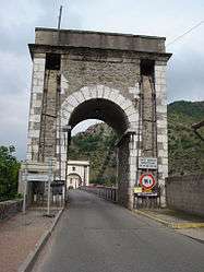
Andancette is a commune in the Drôme department in southeastern France.
Geography
Andancette is located:
- 6 km (3.7 mi) from Saint-Rambert-d'Albon
- 6 km (3.7 mi) from Saint-Vallier
- 30 km (19 mi) from Valence
Population
| Historical population | ||
|---|---|---|
| Year | Pop. | ±% |
| 1872 | 636 | — |
| 1876 | 717 | +12.7% |
| 1881 | 679 | −5.3% |
| 1886 | 646 | −4.9% |
| 1891 | 635 | −1.7% |
| 1896 | 640 | +0.8% |
| 1901 | 614 | −4.1% |
| 1906 | 630 | +2.6% |
| 1911 | 663 | +5.2% |
| 1921 | 618 | −6.8% |
| 1926 | 637 | +3.1% |
| 1931 | 628 | −1.4% |
| 1936 | 642 | +2.2% |
| 1946 | 668 | +4.0% |
| 1954 | 685 | +2.5% |
| 1962 | 781 | +14.0% |
| 1968 | 976 | +25.0% |
| 1975 | 1,099 | +12.6% |
| 1982 | 1,020 | −7.2% |
| 1990 | 1,157 | +13.4% |
| 1999 | 1,156 | −0.1% |
| 2008 | 1,249 | +8.0% |
See also
References
| Wikimedia Commons has media related to Andancette. |
This article is issued from Wikipedia - version of the 10/28/2016. The text is available under the Creative Commons Attribution/Share Alike but additional terms may apply for the media files.