Kewaunee Power Station
| Kewaunee Power Station | |
|---|---|
|
Kewaunee Power Station | |
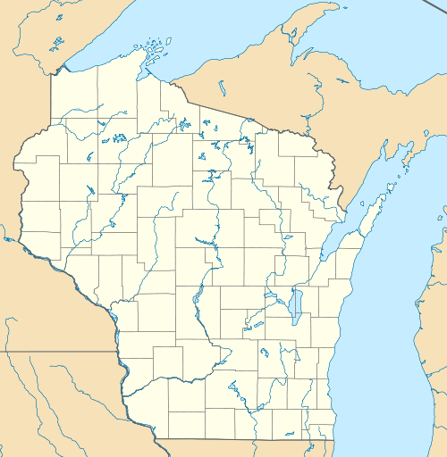 Location of Kewaunee Power Station in Wisconsin | |
| Country | United States |
| Location | Town of Carlton, Kewaunee County, near Kewaunee, Wisconsin |
| Coordinates | 44°20′32″N 87°32′10″W / 44.34222°N 87.53611°WCoordinates: 44°20′32″N 87°32′10″W / 44.34222°N 87.53611°W |
| Status | Closed |
| Commission date | June 16, 1974 |
| Decommission date | May 7, 2013 |
| Construction cost | US$776.15M (2007 prices) |
| Operator(s) | Dominion Generation |
| Nuclear power station | |
| Reactor type | pressurized water reactor |
| Reactor supplier | Westinghouse |
| Power generation | |
| Nameplate capacity | 556 MW |
|
Website www.dom.com/about/stations/nuclear/kewaunee/ | |
The Kewaunee Power Station, now closed, occupies a 900-acre site in Carlton, Wisconsin, 27 miles southeast of Green Bay, Wisconsin, Kewaunee was the fourth nuclear power plant built in Wisconsin, and the 44th built in the United States. Due to falling electricity prices resulting from the falling price of natural gas, the plant ceased operation May 7, 2013.[1]
History
The plant's original operator was Wisconsin Public Service and it was owned by Wisconsin Public Service (59%) and Alliant Energy (41%).[2] From 2000 to July 2005, the plant was operated by Nuclear Management Company, of Hudson, Wisconsin. The plant is now owned by Dominion Resources of Richmond, Virginia. In 2008, Dominion applied to the Nuclear Regulatory Commission for an extension of its operating license for an additional 20 years.[2] The license was extended until 2033.
On April 27, 2006, there was a small water leak at the plant, though no radioactive material was released.[3]
On October 22, 2012, Dominion Resources announced they would shut down and decommission the plant in Mid-2013. Dominion's chairman and CEO said "the decision was based purely on economics. Dominion was not able to move forward with our plan to grow our nuclear fleet in the Midwest to take advantage of economies of scale". Lower natural gas costs and resultant lower electricity prices created an electricity market in which the plant could not compete. The plant came offline permanently on May 7, 2013.[1][4] Plans for decommissioning are uncertain: as a private owner rather than a public utility, Dominion cannot rely on charges imposed on utility customers by state regulators; however, the firm has a substantial reserve fund earmarked for this purpose and a cause of action against the Department of Energy for failure to remove spent fuel. There is also the chance that the energy market might improve due to economic or political changes.[1]
The SAFSTOR (SAFe STORage) nuclear decommissioning option was selected. During SAFSTOR, the de-fuelled plant is monitored for up to sixty years before complete decontamination and dismantling of the site, to a condition where nuclear licensing is no longer required. During the storage interval, some of the radioactive contaminants of the reactor and power plant will decay, which will reduce the quantity of radioactive material to be removed during the final decontamination phase. A reduced workforce will move fuel assemblies from the reactor into the spent fuel pool.[5]
Description
This plant has one Westinghouse pressurized water reactor. The plant has two 345 kV lines interconnecting it to the grid with one going to We Energies North Appleton Substation located 15 miles (24 km) north of Appleton, Wisconsin and the other one interconnecting with the Point Beach Nuclear Generating Station located just a short distance away. Two 138 kV lines exit the plant which go to the Green Bay area 30 miles (48 km) away.
Surrounding population
The Nuclear Regulatory Commission defines two emergency planning zones around nuclear power plants: a plume exposure pathway zone with a radius of 10 miles (16 km), concerned primarily with exposure to, and inhalation of, airborne radioactive contamination, and an ingestion pathway zone of about 50 miles (80 km), concerned primarily with ingestion of food and liquid contaminated by radioactivity.[6]
The 2010 U.S. population within 10 miles (16 km) of Kewaunee was 10,292, a decrease of 0.9 percent in a decade, according to an analysis of U.S. Census data for msnbc.com. The 2010 U.S. population within 50 miles (80 km) was 776,954, an increase of 10.1 percent since 2000. Cities within 50 miles include Green Bay (26 miles to city center).[7]
Seismic risk
The Nuclear Regulatory Commission's estimate of the risk each year of an earthquake intense enough to cause core damage to the reactor at Kewaunee was 1 in 83,333, according to an NRC study published in August 2010.[8] [9]
Images
 Kewaunee Power Station, Kewaunee, Wisconsin
 Kewaunee Power Station, 2007
 Kewaunee Power Station, 2009
Notes
- 1 2 3 Matthew L. Wald (May 7, 2013). "As Price of Nuclear Energy Drops, a Wisconsin Plant Is Shut". The New York Times. Retrieved May 8, 2013.
- 1 2 "568 MW nuclear power plant up for sale". PowerGen Worldwid. PennWell Corporation. 2011-04-29. Retrieved 2011-05-01.
- ↑ http://www.greenbaypressgazette.com/apps/pbcs.dll/article?AID=/20060427/GPG0101/604270583/1207/GPGnews
- ↑ "Dominion To Close, Decommission Kewaunee Power Station". Dominion. 22 October 2012. Retrieved 28 February 2013.
- ↑ "Kewaunee Nuclear Plant Powers Down for the Last Time". Nuclear Street News. May 8, 2013. Retrieved May 8, 2013.
- ↑ http://www.nrc.gov/reading-rm/doc-collections/fact-sheets/emerg-plan-prep-nuc-power-bg.html
- ↑ Bill Dedman, Nuclear neighbors: Population rises near US reactors, msnbc.com, April 14, 2011 http://www.msnbc.msn.com/id/42555888/ns/us_news-life/ Accessed May 1, 2011.
- ↑ Bill Dedman, "What are the odds? US nuke plants ranked by quake risk," msnbc.com, March 17, 2011 http://www.msnbc.msn.com/id/42103936/ Accessed April 19, 2011.
- ↑ http://msnbcmedia.msn.com/i/msnbc/Sections/NEWS/quake%20nrc%20risk%20estimates.pdf
External links
| Wikimedia Commons has media related to Kewaunee Nuclear Generating Station. |
- "Wisconsin Nuclear Plants#Kewaunee". Energy Information Administration, U.S. Department of Energy (DOE). September 1, 2010. Retrieved 2011-03-17.
- "Kewaunee Pressurized Water Reactor". Operating Nuclear Power Reactors. U.S. Nuclear Regulatory Commission (NRC). February 14, 2008. Retrieved 2008-11-20.
