Kampong Siem District
| Kampong Siem ស្រុកកំពង់សៀម | |
|---|---|
| District (srok) | |
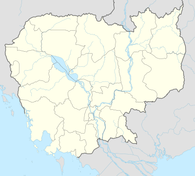 Kampong Siem Location in Cambodia | |
| Coordinates: 12°0′52″N 105°25′3″E / 12.01444°N 105.41750°E | |
| Country |
|
| Province | Kampong Cham |
| Communes | 15 |
| Villages | 112 |
| Population (1998)[1] | |
| • Total | 99,056 |
| Time zone | +7 |
| Geocode | 0306 |
Kampong Siem District (Khmer: ស្រុកកំពង់សៀម "Port of Siam") is a district (srok) located in Kampong Cham Province, Cambodia. The district surrounds the provincial capital Kampong Cham City. The administrative center of the district locates not far from the Provincial capital of Kampong Cham in Ampil Leu Village, Ampil Commune about 3 km west from the center of Kampong Cham city on National Highway 7 and is 120 kilometres by road from Phnom Penh. The district borders on the western bank of the Mekong for most of its length.[2]
In February 2007 the United States Peace Corps sent 29 volunteers to live in Kampong Siem District.[3] This marked the beginning of the first ever Peace Corps mission in Cambodia.[4] During a nine-week stay in the district the group of volunteers from San Francisco studied the Khmer language, acclimatised themselves to the local way of life, tried eating deep fried tarantulas and began teaching English.[3]
Location
Kampong Siem district is in central Kampong Cham Province and is surrounded by other Kampong Cham districts. Reading from the north clockwise, Kampong Cham shares a border with Stueng Trang District while Krouch Chhmar and Tbong Khmom districts form the eastern boundary. To the south of Kampong Siem is Koh Soutin District. The three districts of Kang Meas, Prey Chor and Chamkar Leu make up the western border of the district. Kampong Siem also surrounds the tiny Kampong Cham City which is the provincial capital.[5]
Administration
The Kampong Siem district governor reports to His Excellency Hun Neng, the Governor of Kampong Cham. The following table shows the villages of Kampong Siem district by commune.
| Khum (Communes) | Phum (Villages) |
|---|---|
| Ampil | Andoung Chraoh, Ampil Leu, Ampil Kraom, Cheung Kouk, Roliek, Romeas, Banteay Thmei, Sralau, Krala, Chonghuk, Veal Sbov, Sya |
| Han Chey | Hanchey, Krouch Saeuch, Lvea Ter, Moan Haeur |
| Kien Chrey | Preaek Yuon, Enteak Nel, Spean Thmei, Boeng Babos, Kien Chrey Krau, Kien Chrey Knong |
| Kokor | Kokor Muoy, Kokor Pir, Chamkar Samseb, Kampong Krabei |
| Kaoh Mitt | Kaoh Paen Ka, Kaoh Paen Kha, Kaoh Paen Kho, Kaoh Kol, Kaoh Dach, Kaoh Prolung, Svay Chrum, Kaoh Chas, Kampong Trom Kraom, Kampong Trom Leu |
| Koh Roka | Kaoh Roka Krau, Kaoh Roka Knong, Dambang Daek, Ou Chhleung, Ta Meang, Thmei |
| Koh Samraong | Phum Muoy, Phum Pir, Phum Bei, Phum Buon, Phum Pram, Phum Prammuoy, Phum Prampir, Phum Prambei |
| Koh Tontuem | Kaoh Kok Ka, Kaoh Kok Kha, Kaoh Prak Kraom, Kaoh Prak Knong, Kaoh Prak Leu |
| Krala | Sdach Non, Tuol Beng, Andoung Pou, Tuol Popel, Trapeang Chrey, Trapeang Tras, Trapeang Ruessei, Angkuonh Dei, Ampil Chrum, Thmei, Trapeang Thma, Trapeang Char, Trakuon |
| Ou Svay | Prey Chakkrei, Anlong Snouk, Ampil Kranhanh, Ou Svay, Trapeang Kak, Ou Thnong, Khael Chey |
| Ro'aing | Thma Koul, Veal Khsach, Prasam, Pongro, Romul, Tuol Roka, Ro'ang Leu, Ro'ang Kraom |
| Rumchek | Chheu Teal Srot Leu, Chheu Teal Srot Kraom, Rumlech, Thmei |
| Srak | Lpeak, Prey Kuy, Srak, Tamouv |
| Trean | Chrak Sdau, Veal Kriel, Trean, Trapeang Ta Sokh, Prathang, Paen, Tuol Chambak, Chranieng, Trapeang Ampil, Ta Khong, Tuol Trach, Poun |
| Vihear Thom | Prey Phdau, Andoung Svay, Kouk Kream, Kdei Boeng, Pongro, Prasat, Kouk Totea, Vihear, Kong Moha |
Demographics
The district is subdivided into 15 communes (khum) and 112 villages (phum).[6] According to the 1998 Census, the population of the district was 99,056 persons in 18,884 households in 1998. With a population of over 99,000 people, Kampong Siem is one of the more populated districts in Kampong Cham province. The average household size in Kampong Siem is 5.2 persons per household, slightly higher than the rural average for Cambodia (5.1). The sex ratio in the district is 92.0%, with more females than males.[7]
References
- ↑ General Population Census of Cambodia, 1998: Village Gazetteer. National Institute of Statistics. February 2000. pp. 40–42.
- ↑ Total Road Atlas of Cambodia 2006 (3rd ed.). Total Cambodge. 2006. p. 44.
- 1 2 "U.S. Peace Corps starts first Cambodian mission". Reuters. Feb 5, 2007. Retrieved 2009-01-31.
- ↑ "Decades Later, a Peaceful Invasion of Cambodia; Volunteers With U.S. Corps Adjust to a New Life Before Deployment to Countryside as Teachers". Washington Post. May 6, 2007. Retrieved 2009-01-31.
- ↑ "Kampong Cham Provincial Resources". Ministry of Commerce. Archived from the original on January 5, 2009. Retrieved 2009-01-25.
- ↑ "Kampong Cham Administration". Royal Government of Cambodia. Retrieved 2009-01-20.
- ↑ General Population Census of Cambodia, 1998: Village Gazetteer. National Institute of Statistics. February 2000. pp. 32–73.
External links
| Capital city |  | |
|---|---|---|
| Districts | ||
Coordinates: 12°0′52″N 105°25′3″E / 12.01444°N 105.41750°E
