Chamkar Leu District
| Chamkar Leu ស្រុកចំការលើ | |
|---|---|
| District (srok) | |
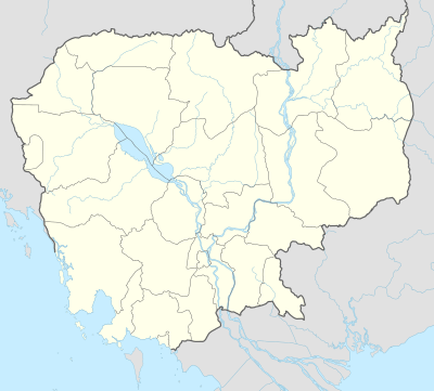 Chamkar Leu Location in Cambodia | |
| Coordinates: 12°18′51″N 105°16′39″E / 12.31417°N 105.27750°E | |
| Country |
|
| Province | Kampong Cham |
| Communes | 8 |
| Villages | 85 |
| Government | |
| • Governor | H.E. Kim Nuth Nittia |
| Population (1998)[1] | |
| • Total | 125,862 |
| Time zone | +7 |
| Geocode | 0302 |
Chamkar Leu District (Khmer: ស្រុកចំការលើ "Upper Farm") is a district (srok) of Kampong Cham Province, Cambodia. The district capital is Chamkar Leu town. The town is located at the junction of National Roads 71 and 222 around 48 kilometres (30 mi) north east of the provincial capital at Kampong Cham city. The district is significant producer of rubber, both for domestic consumption and for export. Two large rubber co-operatives, Chamkar Andong Plantation and Chamkar Leu Plantation are located in the district.[2] At 6,000 hectares (15,000 acres), the state-owned Chamkar Andong plantation is one of the largest in the country.[3]
Location
Reading from the north clockwise, Chamkar Leu shares a border with Kampong Thom Province to the north and the district of Stueng Trang to the east. To the south of Chamkar Leu are Kampong Siem (south east) and Prey Chhor (south west) districts. Chamkar Leu shares its western border with Baray District of Kampong Thom province.[4]
Administration
His Excellency Kim Nuth Nittia is the district governor and reports to H.E. Hun Neng the Governor of Kampong Cham.[5] The following table shows the villages of Chamkar Leu district by commune.
| Khum (Communes) | Phum (Villages) |
|---|---|
| Bos Khnaor | Saray, Doun Thi, Thlok Kravan, Veal Thnong, Bos Khnor, Chranaom, Prasaeur, Dab Meakkakra, Sameakki, kasithan, Samsebbram |
| Chamkar Andoung | Chamkar Andoung, Souchey, Svay Chuor, Ou Kravan, Doun Bos, Choam Chrey, Praeus Meas, lex BI, lex dobmuy, sam sibbi, mopeypi, Tamum, lekmoy, sahakkreas, sahakkran, Srongchan, Rongchak, Kromhun |
| Cheyyou | Spueu Ka, Cheyyou, Ou Pes, Trapeang Ruessei, Trapeang Lpov |
| Lvea Leu | Kbal Hong Thmei, Kbal Hong Chas, Kralaeng Kaeut, Kralaeng Lech, Lvea Cheung, Lvea Tboung, Phum Bei |
| Spueu | Banteay Chey, Popreng, Ou Veay, Peaeng Meas Cheung, Peaeng Meas Tboung, Spueu Lech, Spueu Kaeut, Veal |
| Svay Teab | Trapeang Beng, Pramat Dei, Veal Ri Lech, Svay Teab, Proeks, Thnal Baek Lech, Tang Krang, Mouha, Bos Thlan, Srae Preal, Ou Dar, Thnal Baek Kaeut, Veal Ri Kaeut, Proeks |
| Ta Ong | Ta Ong, Sampoar, Tuol Prak, Tuol Meas, Tuol Paen, Chamraeun Phal, Trapeang Chhuk, Tuol Srov, Phum Samseb, Phum Sammuoy, Phum Sampir, Phum Sambei, Phum Sambuon |
| Ta Prok | Srae Prang, Rumchek, Neang Laeung, Svay Teab, Ou Ta Saeng, Chhuk, Phlak |
Demographics
The district is subdivided into 8 communes (khum) and 85 villages (phum).[6] According to the 1998 Census, the population of the district was 125,862 persons in 24,338 households in 1998. With a population of well over 100,000 people, Chamkar Leu is the third most populous district in Kampong Cham province, after Tbong Khmum and Prey Chhor. The average household size in Chamkar Leu is 5.2 persons per household, slightly larger than the rural average for Cambodia (5.1 persons). The sex ratio in the district is 95.5%, with more females than males.[7]
Recent history
Located in eastern Cambodia, not far from the border with Vietnam, Chamkar Leu was the site of significant fighting during the Cambodian Civil War. During the Second Indochina War the district was heavily bombed by both B-52 and smaller aircraft. One of the senior leaders of the Khmer Rouge, Ke Pauk was born in nearby Baray District. According to his auto-biography, Pauk joined the nascent Cambodian Communist movement in Svay Teab, Chamkar Leu District, Kampong Cham.[8]
References
- ↑ General Population Census of Cambodia, 1998: Village Gazetteer. National Institute of Statistics. February 2000. pp. 34–35.
- ↑ Total Road Atlas of Cambodia 2006 (3rd ed.). Total Cambodge. 2006. pp. 44–45.
- ↑ "Cambodian gov't plans to sell off 3 rubber plantations". People's Daily. May 09, 2006. Retrieved 2009-01-25. Check date values in:
|date=(help) - ↑ "Kampong Cham Provincial Resources". Ministry of Commerce. Archived from the original on January 5, 2009. Retrieved 2009-01-25.
- ↑ "Grand Opening of ACLEDA Bank Chamkar Leu Branch". ACLEDA Bank Plc. August 15, 2008. Retrieved 2009-01-25.
- ↑ "Kampong Cham Administration". Royal Government of Cambodia. Retrieved 2009-01-25.
- ↑ General Population Census of Cambodia, 1998: Village Gazetteer. National Institute of Statistics. February 2000. pp. 32–73.
- ↑ Pauk, Ke. "Ke Pauk's Autobiography from 1949–1985". Documentation Centre of Cambodia. Retrieved 2009-01-25.
External links
| Capital city |  | |
|---|---|---|
| Districts | ||
Coordinates: 12°18′51″N 105°16′39″E / 12.31417°N 105.27750°E
